- Denali Borough, Alaska
-
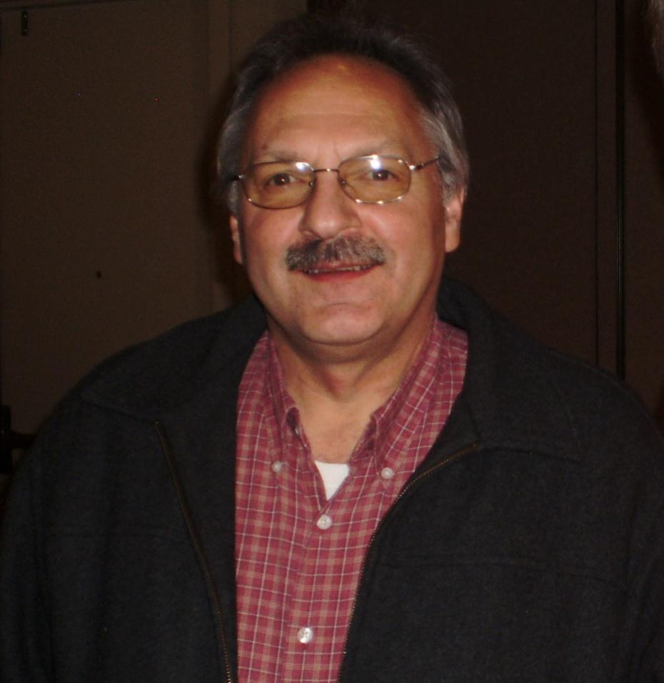
Denali Borough, Alaska  David M. Talerico, mayor of the Denali Borough since 2002
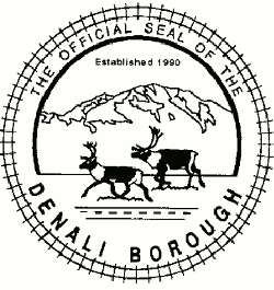
Seal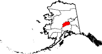
Location in the state of Alaska
Alaska's location in the U.S.Incorporated December 7, 1990 Seat Healy Area
- Total
- Land
- Water
12,775 sq mi (33,087 km²)
12,750 sq mi (33,022 km²)
25 sq mi (65 km²), 0.19%Population
- (2000)
- Density
1,893Website www.denaliborough.com The Denali Borough is a borough located in the U.S. state of Alaska and was incorporated in 1990. The area was previously a part of the unorganized borough, with the Upper Railbelt School District serving as the region's rural education attendance area (which was replaced by a school district under the borough's umbrella upon incorporation). As of 2000 the population of the borough was 1,893. The borough seat is Healy. The only incorporated place is Anderson.
Contents
Geography
The borough has a total area of 12,775 square miles (33,087.1 km2), of which 12,750 square miles (33,022.3 km2) is land and 25 square miles (64.7 km2) (0.19%) is water.
The borough contains North America's highest point: Denali (Mount McKinley), from which it derives its name, at 6,194 m (20,320 ft).
National protected area
- Denali National Park and Preserve (part)
- Denali Wilderness (part)
Adjacent boroughs and census areas
- Yukon-Koyukuk Census Area, Alaska - west/north
- Fairbanks North Star Borough, Alaska - northeast
- Southeast Fairbanks Census Area, Alaska - east
- Matanuska-Susitna Borough, Alaska - south

Yukon-Koyukuk Census Area Fairbanks North Star Borough Yukon-Koyukuk Census Area 
Southeast Fairbanks Census Area  Denali Borough, Alaska

Matanuska-Susitna Borough Demographics
As of the census[1] of 2000, there were 1,893 people, 785 households, and 452 families residing in the borough. The population density was 0 people per square mile (0/km²). There were 1,351 housing units at an average density of 0 per square mile (0/km²). The racial makeup of the borough was 85.74% White, 1.43% Black or African American, 4.75% Native American, 1.53% Asian, 0.37% Pacific Islander, 0.95% from other races, and 5.23% from two or more races. 2.48% of the population were Hispanic or Latino of any race.
Historical populations Census Pop. %± 2000 1,893 — 2010 1,826 −3.5% source:[2] There were 785 households out of which 31.00% had children under the age of 18 living with them, 48.40% were married couples living together, 4.50% had a female householder with no husband present, and 42.30% were non-families. 35.00% of all households were made up of individuals and 1.40% had someone living alone who was 65 years of age or older. The average household size was 2.28 and the average family size was 3.03.
In the borough the population was spread out with 23.80% under the age of 18, 6.70% from 18 to 24, 36.80% from 25 to 44, 29.70% from 45 to 64, and 3.10% who were 65 years of age or older. The median age was 38 years. For every 100 females there were 139.00 males. For every 100 females age 18 and over, there were 147.10 males.
Denali Borough is the 49th highest-income county in the United States, by personal per capita income as of 2005.[3]
Cities and towns
Denali Borough in fiction
In the Twilight Saga by Stephenie Meyer, the Denali vampire coven (consisiting of Tanya, Kate, Irina, Eleazar and Carmen and later Garrett) lives in Denali because of the lack of sunlight.
See also
- List of airports in the Denali Borough
- National Register of Historic Places listings in Denali Borough, Alaska
References
- ^ "American FactFinder". United States Census Bureau. http://factfinder.census.gov. Retrieved 2008-01-31.
- ^ "Census Of Population And Housing". U.S. Census Bureau. http://www.census.gov/prod/www/abs/decennial/index.htm. Retrieved 2011-04-21.
- ^ Per capita personal income, 2005
External links
Municipalities and communities of Denali Borough, Alaska Borough seat: Healy City 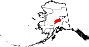
CDPs Cantwell | Ferry | Healy | McKinley Park
Unincorporated
communities State of Alaska
Juneau (capital) Topics Index · Geography · Climate · Wildlife · History · People · Transportation · Government · Delegations · Music · Visitor attractions
Society Culture · Crime · Demographics · Economy · Education · Health (Rural dentistry) · Politics
Regions Aleutian Islands · Arctic Alaska · Bush Alaska · Inside Passage · Interior · Kenai Peninsula · Mat‑Su Valley · North Slope · Southeast · Seward Peninsula · Southcentral · Southwest · Tanana Valley · Yukon–Kuskokwim Delta
Largest cities Boroughs Aleutians East · Anchorage · Bristol Bay · Denali · Fairbanks North Star · Haines · Juneau · Kenai Peninsula · Ketchikan Gateway · Kodiak Island · Lake and Peninsula · Matanuska‑Susitna · North Slope · Northwest Arctic · Sitka · Skagway · Wrangell · Yakutat · Unorganized
Census Areas Aleutians West · Bethel · Dillingham · Hoonah‑Angoon · Nome · Petersburg · Prince of Wales‑Hyder · Southeast Fairbanks · Valdez‑Cordova · Wade Hampton · Yukon‑Koyukuk
Coordinates: 63°47′20″N 150°11′30″W / 63.78889°N 150.19167°W
Categories:- Alaska boroughs
- Denali Borough, Alaska
- Denali National Park and Preserve (part)

Wikimedia Foundation. 2010.