- Anderson, Alaska
Infobox Settlement
official_name = Anderson, Alaska
settlement_type =City
nickname =
motto =
imagesize =
image_caption =
image_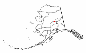
map_caption = Location of Anderson, Alaska
mapsize = 250x200px
mapsize1 =
map_caption1 =subdivision_type = Country
subdivision_name =United States
subdivision_type1 = State
subdivision_name1 =Alaska
subdivision_type2 = Borough
subdivision_name2 = Denali
government_footnotes =
government_type =
leader_title =
leader_name =
leader_title1 =
leader_name1 =
established_title =
established_date =area_magnitude =
area_footnotes =
area_total_km2 = 122.4
area_land_km2 = 121
area_water_km2 = 1.4
area_total_sq_mi = 47.3
area_land_sq_mi = 46.7
area_water_sq_mi = 0.5population_as_of = 2007
population_footnotes =cite web|url=http://www.census.gov/popest/cities/tables/SUB-EST2007-04-02.csv|title=Annual Estimates of the Population for Incorporated Places in Alaska|publisher=United States Census Bureau |date=2008-07-10|accessdate=2008-07-14]
population_total = 274timezone = Alaska (AKST)
utc_offset = -9
timezone_DST = AKDT
utc_offset_DST = -8
elevation_footnotes =
elevation_m = 157
elevation_ft = 515
latd = 64 |latm = 20 |lats = 43 |latNS = N
longd = 149 |longm = 11 |longs = 43 |longEW = Wpostal_code_type =
postal_code =
area_code = 907
GNIS_id = 1398245
blank_name = FIPS code
blank_info = 02-03220
blank1_name =
blank1_info =
website =
footnotes =Anderson is a city in Denali Borough,
Alaska ,United States . At the 2000 census the population was 367. The city is named after one of the original homesteaders.Anderson is immediately north of the Clear Air Force Station and is seventy-five miles southwest of Fairbanks.
Geography
Anderson is located at coor dms|64|20|43|N|149|11|43|W|city (64.345372, -149.195352)GR|1.
According to the
United States Census Bureau , the city has a total area of 47.3square mile s (122.4km² ), of which, 46.7 square miles (121.0 km²) of it is land and 0.5 square miles (1.4 km²) of it (1.14%) is water.Anderson lies 9 km (6 miles) west of the
George Parks Highway , south of Nenana. 9 km (6 miles) south of Anderson is Clear Air Force Station, home of the 13th Space Warning Squadron (13SWS). Clear Air Force Station is located within the city boundaries.Demographics
As of the
census GR|2 of 2000, there were 367 people, 101 households, and 74 families residing in the city. Thepopulation density was 7.9 people per square mile (3.0/km²). There were 148 housing units at an average density of 3.2/sq mi (1.2/km²). The racial makeup of the city was 86.38% White, 4.36% Black or African American, 1.36% Native American, 0.27% Asian, 0.82% from other races, and 6.81% from two or more races. 5.18% of the population were Hispanic or Latino of any race.There were 101 households out of which 40.6% had children under the age of 18 living with them, 56.4% were married couples living together, 10.9% had a female householder with no husband present, and 26.7% were non-families. 20.8% of all households were made up of individuals and none had someone living alone who was 65 years of age or older. The average household size was 2.60 and the average family size was 3.05.
In the city the population was spread out with 21.0% under the age of 18, 12.0% from 18 to 24, 42.0% from 25 to 44, 22.6% from 45 to 64, and 2.5% who were 65 years of age or older. The median age was 33 years. For every 100 females there were 175.9 males. For every 100 females age 18 and over, there were 187.1 males.
The median income for a household in the city was $58,750, and the median income for a family was $62,188. Males had a median income of $31,641 versus $23,750 for females. The
per capita income for the city was $23,837. About 15.6% of families and 17.6% of the population were below thepoverty line , including 25.8% of those under age 18 and 10.0% of those age 65 or over.History
Anderson is named after Arthur Anderson, one of several homesteaders who settled in the area in the late 1950s. In 1959, Mr. Anderson subdivided his homestead into house lots and sold most of the lots to civilian workers from
Clear Air Force Station , aBallistic Missile Early Warning System completed in 1961. An elementary school was built in the community in 1961, and Anderson incorporated as a city in 1962.In the 1960s, a road was completed between Anderson and Nenana, which gave access to Fairbanks. Vehicles were ferried across the
Tanana River at Nenana until 1968, when a steel bridge was built there. In 1971 theGeorge Parks Highway was constructed, which facilitated road access to Anchorage.On the last weekend of every July, the town hosts the Anderson Bluegrass Festival, which lasts from Friday through Sunday.
Homesteading
In March 2007, the city announced a plan to attract more residents: the awarding of free land to interested applicants. [http://www.cnn.com/2007/US/03/16/alaska.land.ap/index.html] This concept has been compared to that of the
Homestead Act .References
External links
* [http://www.anderson.govoffice.com/ Anderson government site]
Wikimedia Foundation. 2010.