- Dooen, Victoria
-
Dooen
Victoria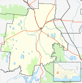
 Dooen
DooenPopulation: 544[1] Postcode: 3401 Location: LGA: Rural City of Horsham State District: Lowan Federal Division: Mallee Dooen is a small town situated in the Wimmera region, Western Victoria, Australia. The Henty Highway between Mildura and Portland passes through the tiny town. At the 2006 census, Dooen and the surrounding area had a population of 544.[1]
Dooen Post Office opened on 1 September 1877 and closed in 1982. [2] The Old Dooen pub is one of the few remaining occupied buildings and is popular amongst the agricultural students of Longerenong College. The Dooen School closed in 1994, the Dooen Hall is all that remains on the site.[citation needed]
The ABC Western Victoria transmitter at Dooen, named 594 3WV, was built in the mid-30s. The mast is nearly 190 metres tall and the transmitter generates 50 kilowatts of energy, with only 13 other more powerful broadcast towers in Australia. The lattice work at the top of the mast is 20 metres in diameter.[citation needed]
References
- ^ a b Australian Bureau of Statistics (25 October 2007). "Dooen (State Suburb)". 2006 Census QuickStats. http://www.censusdata.abs.gov.au/ABSNavigation/prenav/LocationSearch?collection=Census&period=2006&areacode=SSC25495&producttype=QuickStats&breadcrumb=PL&action=401. Retrieved 2007-08-15.
- ^ Premier Postal History, Post Office List, https://www.premierpostal.com/cgi-bin/wsProd.sh/Viewpocdwrapper.p?SortBy=VIC&country=, retrieved 2008-04-11
Coordinates: 36°40′S 142°17′E / 36.667°S 142.283°E
Towns in the Rural City of Horsham Cities and towns in the Wimmera region of Victoria Cities: Ararat · Horsham
Towns/Communities: Antwerp · Apsley · Armstrong · Balmoral · Beulah · Birchip · Brim · Callawadda · Dadswells Bridge · Dimboola · Donald · Douglas · Edenhope · Glenorchy · Goroke · Great Western · Halls Gap · Harrow · Haven · Jeparit · Joel Joel · Lawloit · Kaniva · Marnoo · Minimay · Minyip · Murtoa · Natimuk · Netherby · Nhill · Pimpinio · Pomonal · Rainbow · Rupanyup · Serviceton · St Arnaud · Stawell · Tarraginnie · Telopea Downs · Wallup · Warracknabeal · Wartook · Willenabrina · YaapeetCategories:- Towns in Victoria (Australia)
- Victoria (Australia) geography stubs

Wikimedia Foundation. 2010.