- Col d'Aspin
-
Col d'Aspin 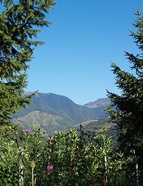
The east slope of the Col d'Aspin, viewed from the tiny hamlet of Pailhac, at the opposite side of the Aure valley.Elevation 1,489 m (4,885 ft) Traversed by D918 Location Location of Col d'Aspin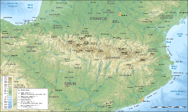
 Col d'Aspin
Location  France
Range Pyrenees Coordinates 42°56′32.3″N 0°19′38.6″E / 42.942306°N 0.327389°ECoordinates: 42°56′32.3″N 0°19′38.6″E / 42.942306°N 0.327389°E Col d'Aspin (Occitan: Còth d'Aspin; 1489 m) is a high mountain pass in the Pyrenees in the department of Hautes-Pyrénées in France.
It connects Sainte-Marie-de-Campan and Arreau.
Contents
Tour de France
The pass has been part of the Tour de France 66 times, largely because it is the middle link in a fearsome chain of three road climbs, that also includes the Col du Tourmalet (2115m) and Col de Peyresourde (1569m). The first time was in 1910, and the most recent in 2010. In the 1950 Tour, there was an altercation at the pass, and the Italian team with Gino Bartali and Fiorenzo Magni, the leaders at the time, withdrew from the Tour.
Bicycle Ascent of Col d'Aspin: Description
Col d'Aspin, rising next to its neighbor Tourmalet, is a shorter and easier climb that is often featured in the Tour. Along with its bigger brother, it is a classic of enduring fame. Cycling Col d'Aspin is possible from very early until late in the year because it is lower in elevation than most other climbs in the Hautes-Pyrénées. Gradual and without any long sections over 9%, Aspin is a good climb for moderately fit cyclists or to ride in combination with other climbs... Excerpt from "Best Cycling Routes of the Pyrenees"[1]
Appearances in Tour de France since 1947
See also
- List of highest paved roads in Europe
- List of mountain passes
References
- ^ Best Cycling Routes of the Pyrenees
External links
Categories:- Mountain passes of France
- Mountain passes of the Pyrenees
- Climbs in cycle racing
- 2006 Tour de France
- 2008 Tour de France


Wikimedia Foundation. 2010.