- Chapel Allerton
-
For village in southwest England, see Chapel Allerton, Somerset.
Coordinates: 53°50′09″N 1°32′24″W / 53.835888°N 1.540071°W
Chapel Allerton 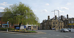
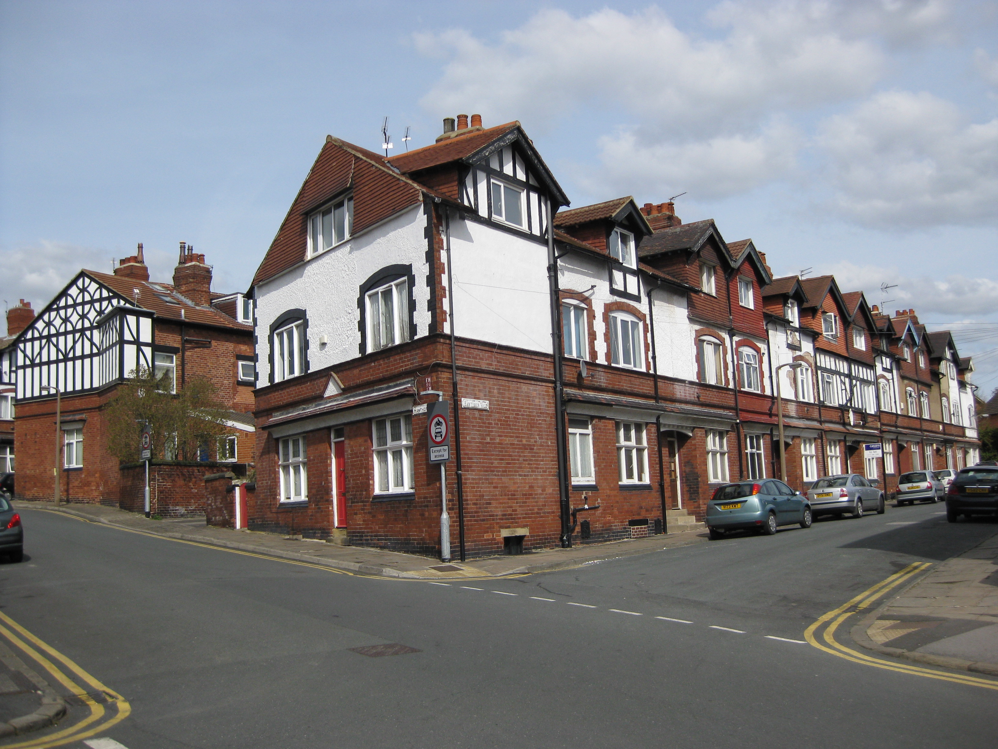
Stainbeck Corner, the effective centre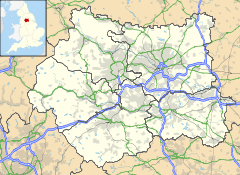
 Chapel Allerton
Chapel Allerton shown within West YorkshirePopulation 18,206 OS grid reference SE303378 Metropolitan borough City of Leeds Metropolitan county West Yorkshire Region Yorkshire and the Humber Country England Sovereign state United Kingdom Post town LEEDS Postcode district LS7 Dialling code 0113 Police West Yorkshire Fire West Yorkshire Ambulance Yorkshire EU Parliament Yorkshire and the Humber UK Parliament Leeds North East List of places: UK • England • Yorkshire Chapel Allerton is an inner suburb of north-east Leeds, 2 miles (3.2 km) from the city centre, West Yorkshire, England. The Chapel Allerton electoral ward includes areas otherwise referred to as Chapeltown and Potternewton - the suburb is generally considered to be only the northern part of this. The ward population was estimated at 18,206 in the 2001 census.[1]
Contents
Location
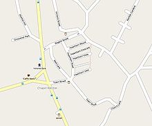 Central Chapel Allerton street map.
The region within the ward generally considered to be Chapel Allerton is bounded by Potternewton Lane to the south, Scott Hall Road to the west, and Gledhow Valley Road to the north-west.[2]
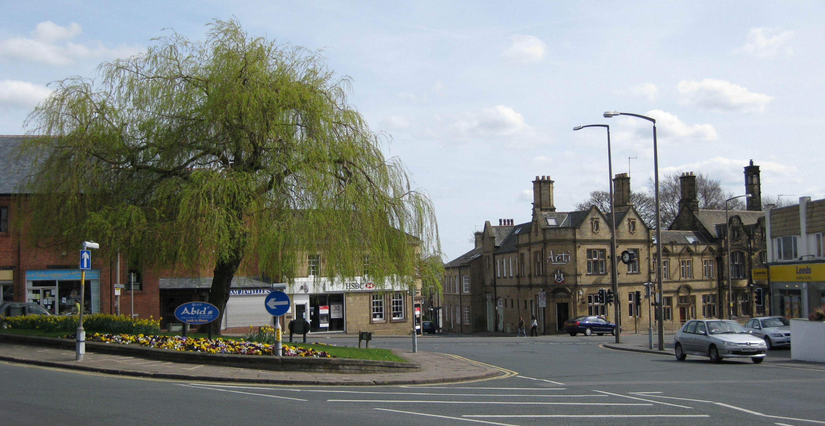
Surrounding districts include Moortown, Meanwood, Roundhay, Gledhow and Chapeltown. Chapel Allerton is situated on Harrogate Road, which prior to the building of the A61 Scott Hall Road, was the main road from Leeds to Harrogate. The centre in terms of activity is Stainbeck Corner, at the junction of Stainbeck Lane, Harrogate Road and Town Street.[2]
History
There was a village referred to as Alreton (meaning Alder farm[2]) in the Domesday Book, then in 1240 a charter referred to land "which lies between the road which goes to the Chapel of Allerton and the bounds of Stainbeck".[3] The chapel was associated with Kirkstall Abbey and was demolished in the 18th century: however the site remains between Harrogate Road and Church Street.[2] From this time the terms "Chapel Allerton" and "Chapeltown" became essentially interchangeable.[4][5] Ralph Thoresby, writing in 1715, records Chapel-Town as a common name for the township of Chapel Allerton, describing it as "well situated in pure Air, upon a pleasant Ascent, which affords a Prospect of the Country ten or twelve miles". The open space to its east and north of Potter-Newton was "a delicate Green commonly call'd Chapel-Town Moor"."[6]
In mediaeval times the area was mostly small farms, but by the end of the 17th century it had become a resort or second home for wealthy people from Leeds[2] and in 1767 was described as the Montpellier of Yorkshire by one visitor.[4]
Chapel Allerton was incorporated into Leeds administrative area in 1869 as a civil parish
Historically, Chapel Allerton had a strong connection with the Irish. With many families in the area being Irish immigrants or of Irish descent.
Architecture
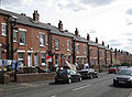
See also: Architecture in LeedsChapel Allerton is a conservation area for the character and historical interest of its buildings, noted not for grand edifices but rather a diversity of good quality domestic buildings from various periods.[2] The historic core is around Stainbeck Corner, particularly around Town Street and Well Lane, with 8 listed buildings. To the south and west of this is an area of grand detached houses with large gardens dating from the 18th and early 19th century.[2] The earlier buildings are of fine-grained sandstone derived from the quarries which were once on Stainbeck Lane. These include a number of small 19th century two-storey houses as well as grander buildings.[2] After 1890 brick terraced and back-to-back houses were built, but of better quality than workers' housing elsewhere in Leeds, as they were intended for artisans and the lower middle class.[2] The advent of the electric tram in 1901 made the area more accessible and further housing began to fill in empty spaces [4] though this was of varied types. It finally lost its village character in the 1920s and it joined the Leeds urban area.[2] Thus the area between King George Avenue and Montreal Avenue was filled in between 1920 and 1939 with bungalows and stucco-faced houses typical of Leeds of the time.[4] In Riveria Gardens were built white rendered houses in the Modernistic style.[4]
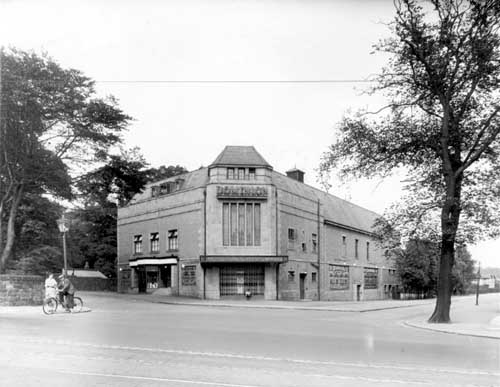
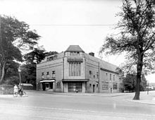 The Dominion Cinema
After the Second World War further building and rebuilding continued, mostly unremarkable, though with a few examples of good modern design.[4] The area was once home to an art deco cinema, the Dominion. Opened in 1934 and lasting only until 1967 when it operated as a bingo hall until the later part of the 1990, the cinema stood on Montreal Avenue. The residential street 'Dominion Close' is close to its former site.[7]
Houses
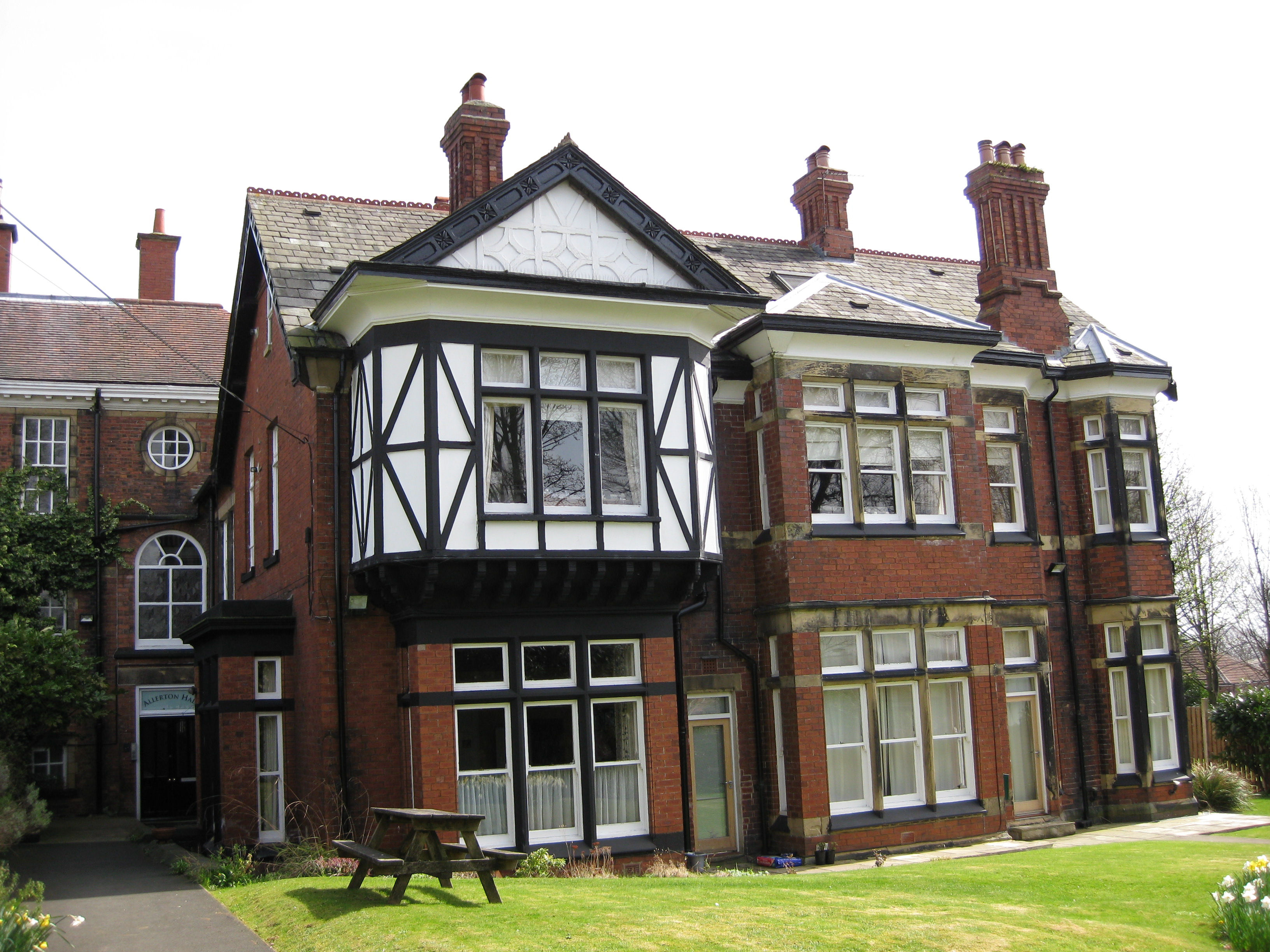
 Allerton Hall from Wensley Drive
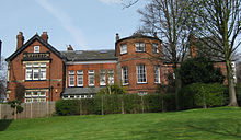 Allerton Hall from Stainbeck Lane
Allerton Hall was situated between Wensley Drive and Stainbeck Lane. In 1755 it was purchased by Josiah Oates, a merchant and an ancestor of Captain Laurence Edward Oates who perished in a blizzard at the age of 32 on the Terra Nova Expedition to the Antarctic led by Robert Falcon Scott in 1912.[8] A brass plaque commemorates him in Leeds Parish Church. Most of the 60 bed mansion has since been demolished. The remaining parts of Allerton Hall is a grade II listed building. In the 1950s, the building was used by Twentieth Century Fox for the distribution of films across the North of England.[9]
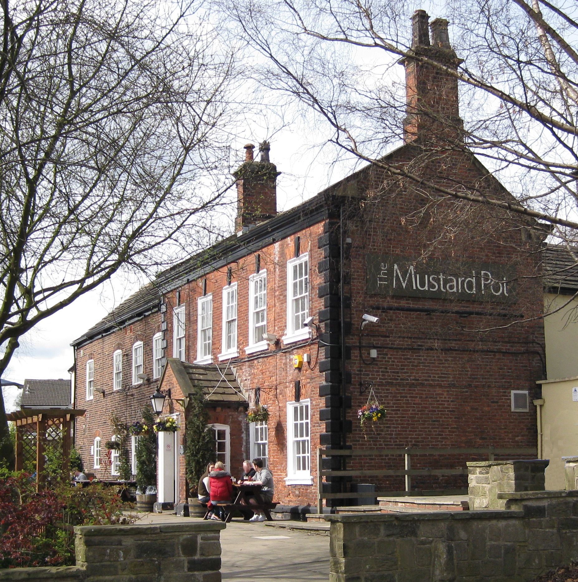
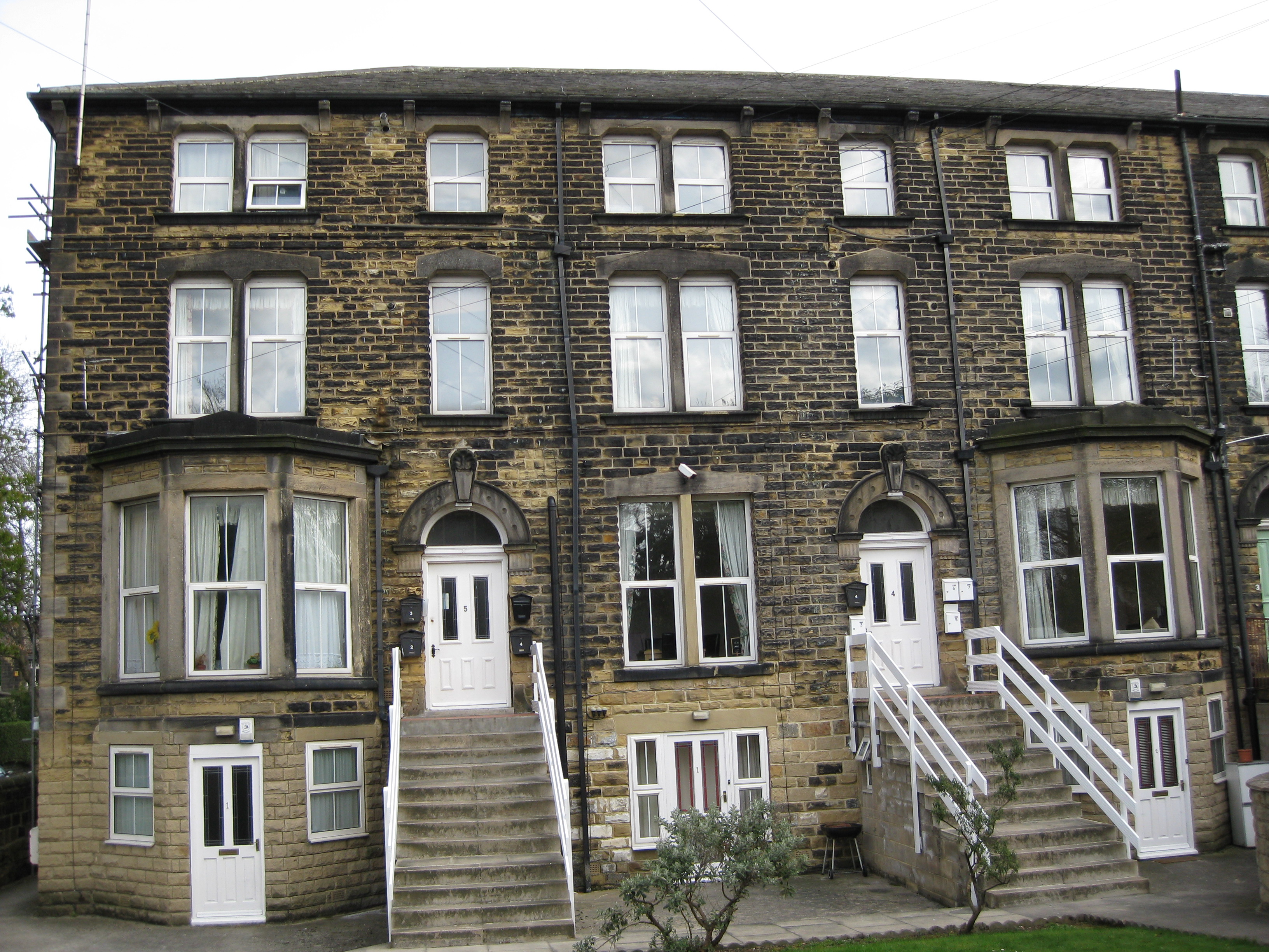
Clough House on Stainbeck Lane was converted to the Mustard Pot pub in 1979. It may date to 1653, and thus one of the oldest inhabited houses in Leeds, though most of the structure is from 1700 onwards.[10] On Wood Lane are Gothic style villas in sandstone dating from the second half of the 19th century for the middle classes.[10] Methley Place is an example of late 19th century terraces for the artisan class.[4] The Hawthorns are a set of terraces built in the early 1900s in an unusual Manorial style.[10]
-
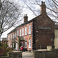
Clough House (The Mustard Pot)
-

Houses on Wood Lane
-
Methley Place
-
Hawthorn terraces
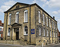
Public Buildings
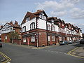
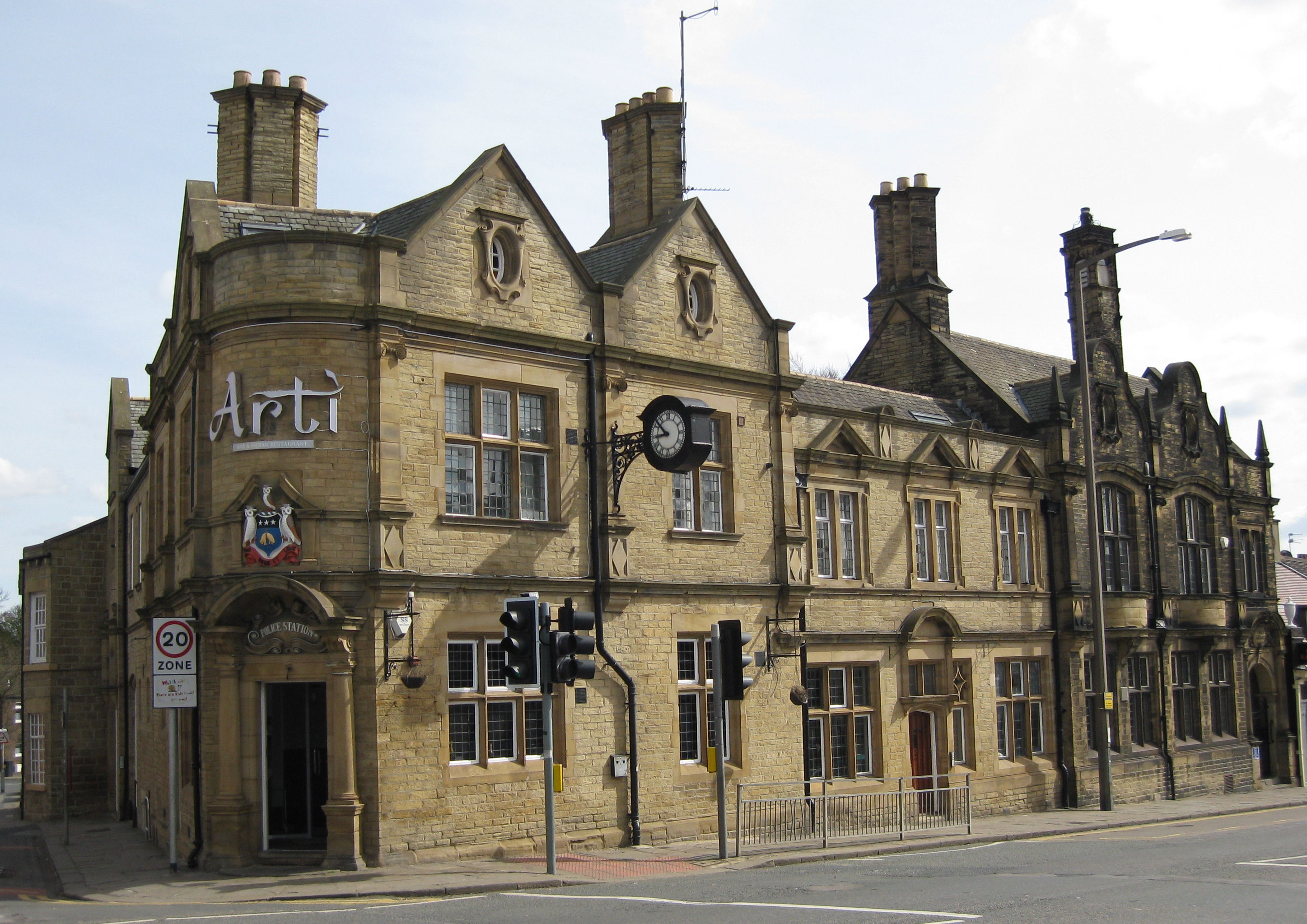
On Stainbeck Corner are a pair of linked buildings, originally constructed as a police station and a fire station in 1900. The style is dressed sandstone with ashlar details. The main corner doorway is flanked by Tuscan columns supporting a segmental pedimented hood containing a cartouche, and above this is a moulded and painted coat of arms of Leeds. The Harrogate road doorways are Tudor-arched with rectangular fanlights.[10] There is a bell turret and a clock. In 1904 the fire station was converted to a public library, with some amendments to the frontage style.[10] The former library is the darker building (i.e. not cleaned). Further down Harrogate Road in the direction of Leeds is a brick and sandstone building bearing the sign "Leeds Board School 1878". This is still a school, Chapel Allerton Primary School. It is on the site of the Chapeltown Moor gallows.[10]
-
Former police station (left) and library (right)
-

Leeds Board School
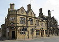
Inns
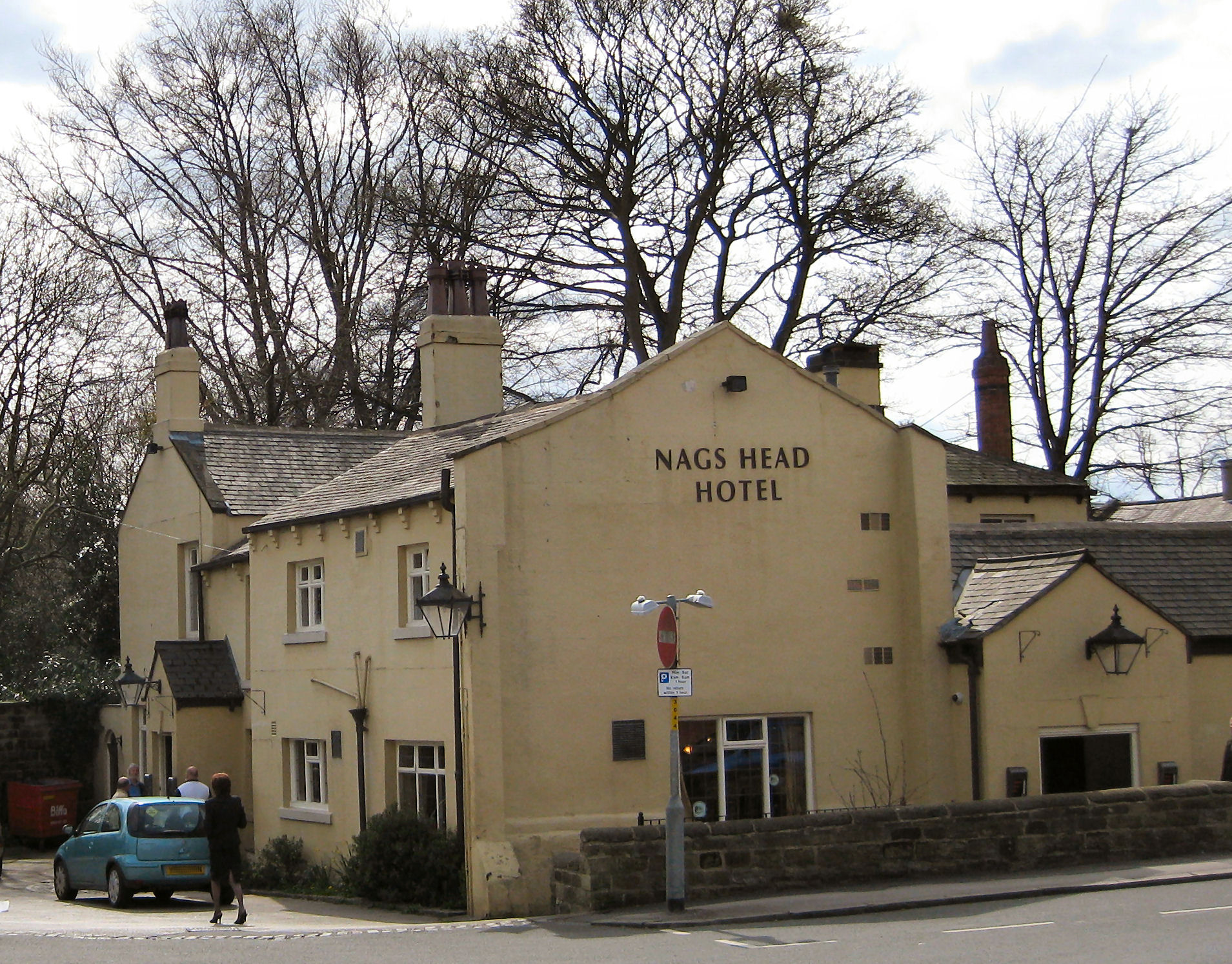
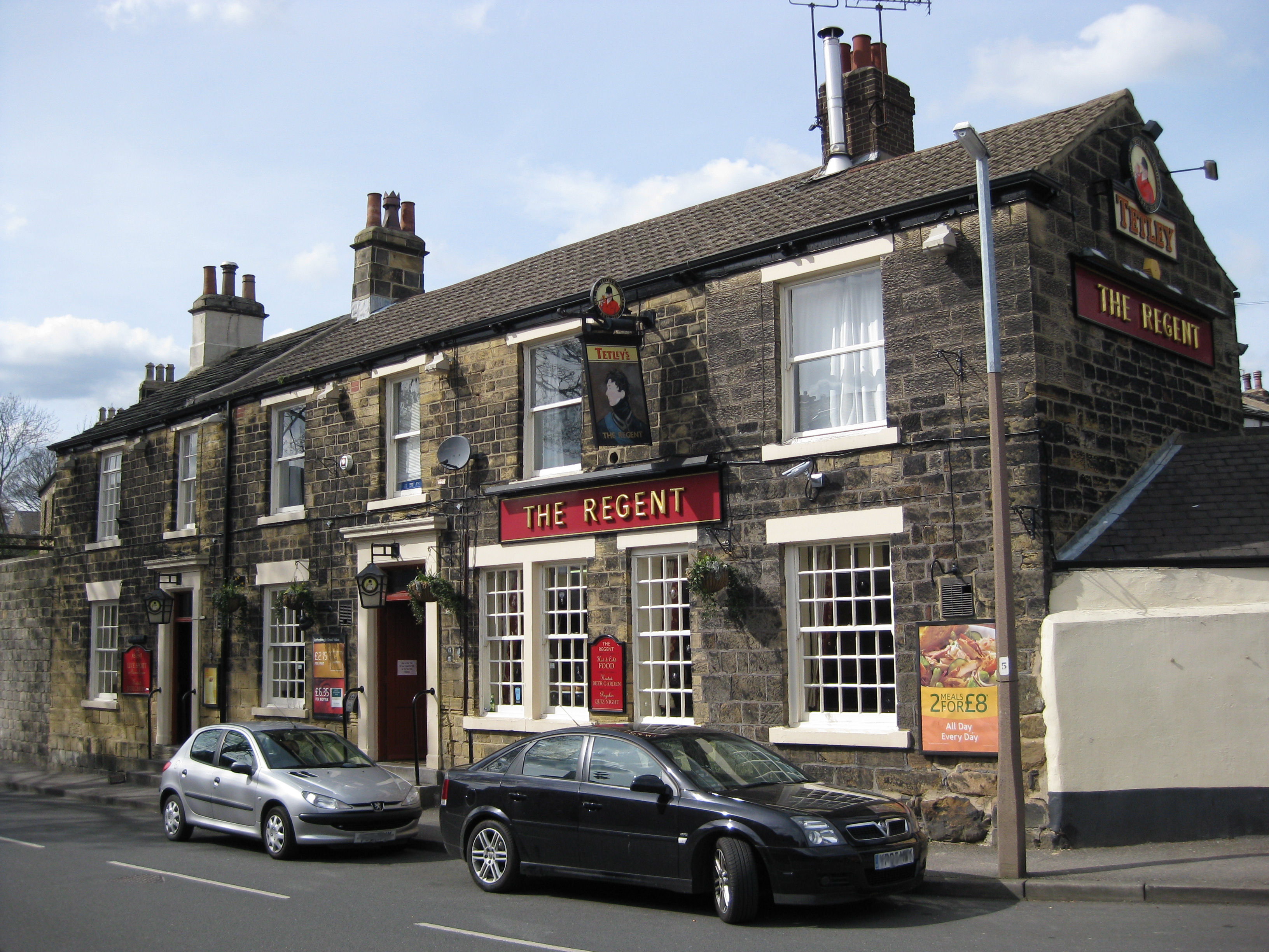
The public house The Nag's Head opened in 1772 as the Bay Horse Inn, a coaching inn, and according to local legend the original inkeepers were in league with 18th century Highwaymen.[10] The Regent was completed in the first half of the 19th Century, and its exterior is little changed from that time.[4] What is now called the Three Hulats was until recently the Mexborough Arms. (The hulats are owls, of which there are three on the arms of the Earl of Mexborough[11]) The present building dates from 1911, replacing a 19th century Mexborough Arms, a terminus for the horse tram service from Leeds, itself replacing the 17th century Bowling Green Tavern.[4]
-

Nag's Head
-
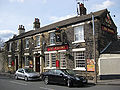
The Regent
-
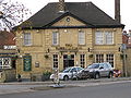
Former Mexborough Arms
Churches
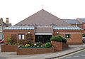
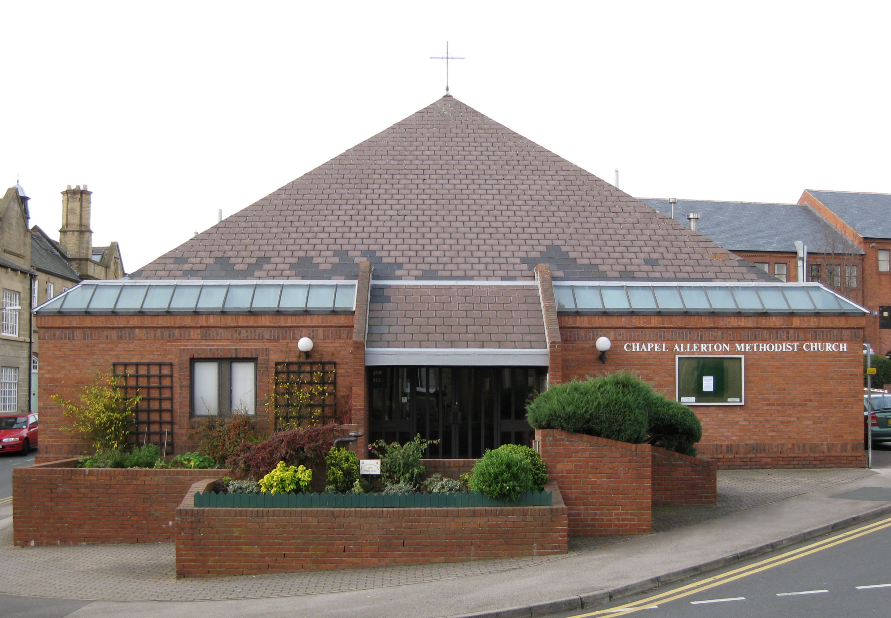
The area is home to a gothic stone church, St Matthew's Church, built in 1900, the architect being George Frederick Bodley. It replaced the old church set in the churchyard on Harrogate Road. By 1935 the old church had become so unsafe it was demolished.[12] A Methodist church was built in 1877 on Town Street. It has now been replaced by a smaller (1983) Methodist Church and shops facing onto Harrogate Road.[13] The Methodist Sunday School (1878) opposite survives as a community centre.
-
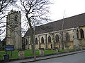
St Matthew's Church
-
Methodist Sunday School (now a community centre)
-
Current Methodist Church
Amenities
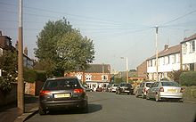
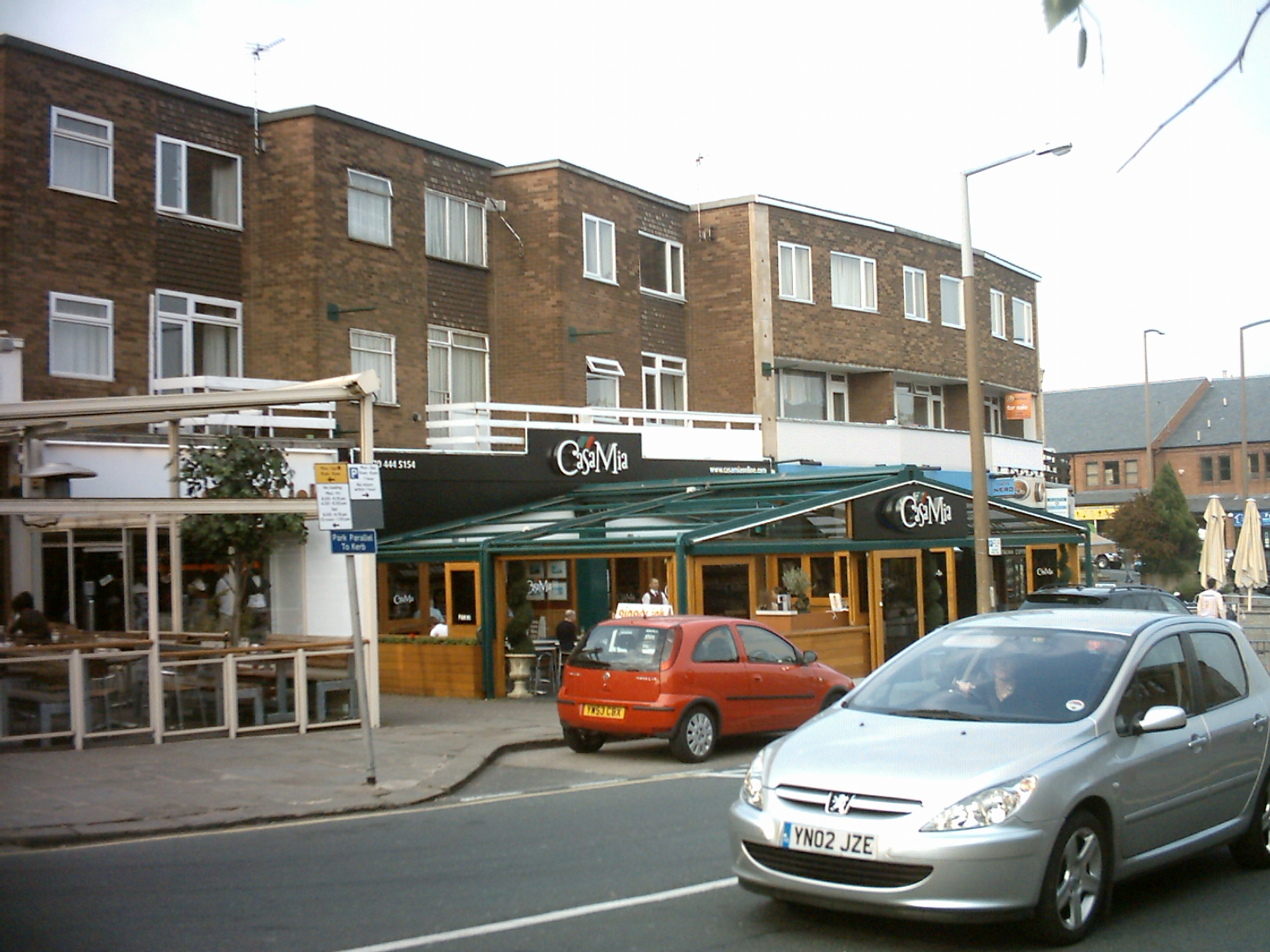
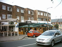 Restaurants in Chapel Allerton
The area has an established local centre, which is situated around the junction of Stainbeck Lane and Harrogate Road. This consists of a Co-op supermarket,[14][15] a post office, several banks, several restaurants as well as many pubs and bars. The Regent is one of the oldest pubs in Chapel Allerton and has been home to Leeds' longest running "semi-legendary music quiz" since 1994 every Tuesday evening. The Three Hulats Pub is a J.D Wetherspoons Freehouse and other pubs include The Queens Arms, The Mustard Pot and The Suburban Style Bar. There is also a large Caffe Nero.[16] There is a large Lidl store on Harrogate Road.
The former police station is now a bar and restaurant,[17] with the new police station further down Stainbeck Lane on the junction with Scott Hall Road. Originally called Chapeltown Police Station, it was renamed due to its misleading name to Stainbeck Police Station following the merger of two former divisions in 2006.[18] Officially opened on the 16th November 1998, Stainbeck Police Station is divisional headquarters for the large North East Leeds division, covering as far out as Wetherby.
There are also many takeaways, a library, petrol station and many other independent shops. The council have allowed many cafes, bars and restaurants to utilise pavement space creating a pavement cafe culture in the area. Many of the shops are chains, such as Greggs (formerly Thurstons), Pizza Hut and Caffe Nero.
Chapel Allerton Lawn Tennis and Squash Club is hidden away at the back of the square, behind the Mustard Pot pub. The Club is in fact 128 years old.[19]
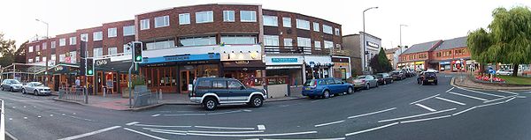 Bars and restaurants on Stainbeck Lane
Transport
The Leeds Tramway once ran through Chapel Allerton, but was dismantled in 1959.[20] Chapel Allerton was also once on the main road to Harrogate but the building of the A61 Scott Hall Road effectively bypassed Chapel Allerton, along with Chapeltown and Moortown. First Leeds provide the main bus service in Chapel Allerton, the 'Red Line', (No. 2, 3 and 3A), Another bus which is available is the 48 which started commencement of running in May 2010, you can catch the 91 bus either to Halton Moor or Bramley, and you can get 91a to St James Hospital which form part of the 'Leeds Overground' network of buses. The 'Red Line' links Chapel Allerton with Roundhay, Gledhow, Moortown, Chapeltown, Leeds city centre, Hunslet, Beeston, Middleton and the White Rose Centre.[21] Harrogate and District also run their 36 route through Chapel Allerton, linking it with Leeds city centre (central bus station), Moortown, Alwoodley, Harewood, Pannal, Harrogate, Killinghall, Ripley and Ripon. The nearest commuter railway station to Chapel Allerton is Headingley, from here services run to Leeds, Burley, Horsforth, , Starbeck, Knaresborough, Cattal, Kirk Hammerton, Poppleton and York.
Hospital
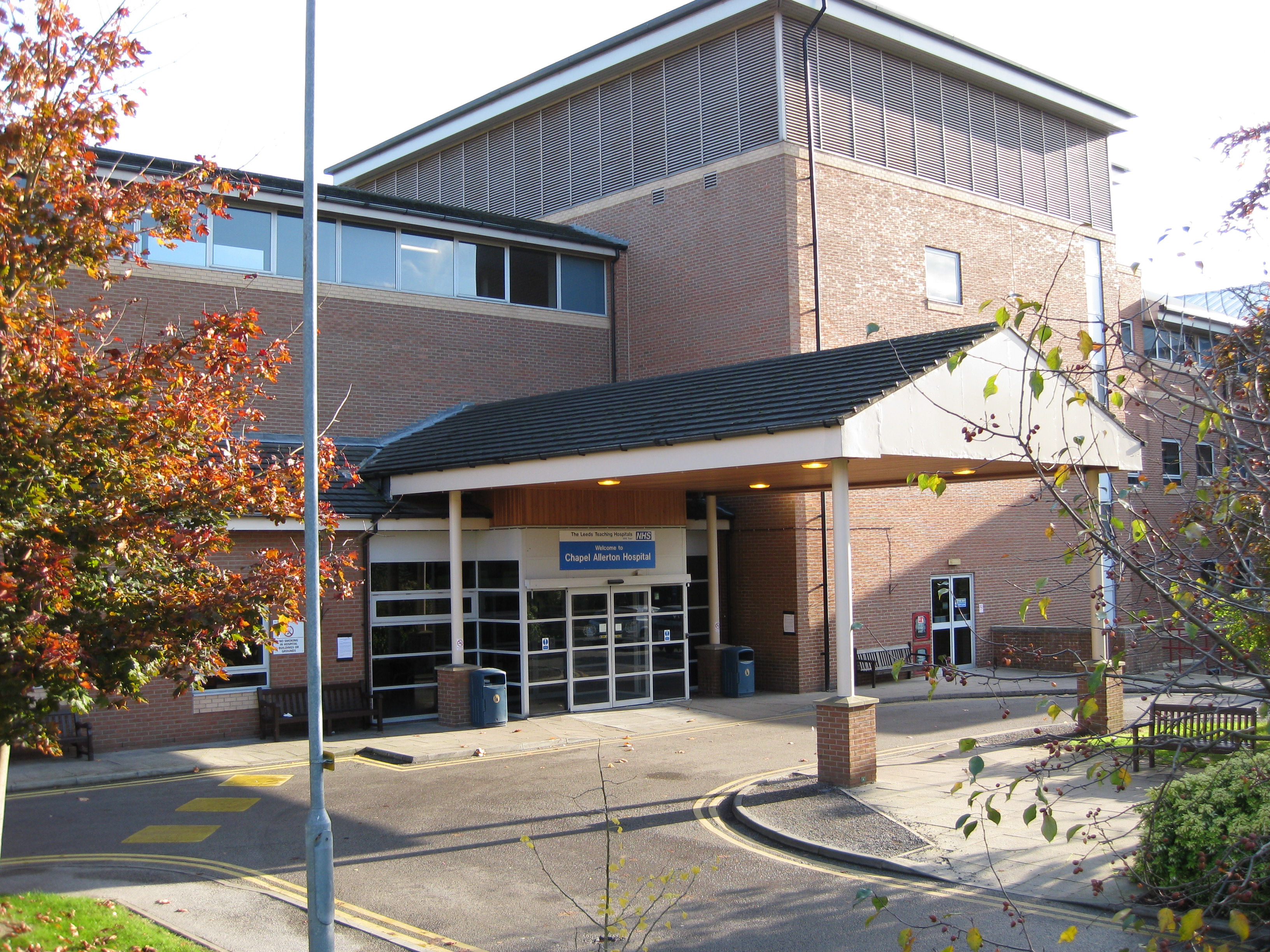
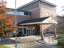 Chapel Allerton HospitalMain article: Chapel Allerton Hospital
Chapel Allerton Hospital is an NHS hospital which includes the Chapel Allerton Orthopaedic Centre. It was established in 1926[22] in the building and grounds of Gledhow Grove mansion, a Grade II listed building which has now been converted to housing. The hospital now occupies buildings which were opened in 1994, across Harehills Lane from its original site.[23] There is no Accident and Emergency department but the hospital does boast a leading orthopaedic centre.
Notable references in popular culture
 Norfolk Gardens
- Norfolk Green was used as the main setting in 1980s Yorkshire Television dramas The Beiderbecke Tapes and The Beiderbecke Connection. There were also several other scenes shot in the Chapel Allerton area. Using an end terrace house on Norfolk Green as the main setting, replacing a house that had been used on Abbeydale Oval in Kirkstall.[24]
- The Yorkshire Television series Fat Friends was in part filmed around Chapel Allerton as well as other nearby suburbs such as Kirkstall, Headingley and Moor Grange.
Location grid

Moortown Meanwood 
Roundhay  Chapel Allerton

Chapeltown References
- ^ Office for National Statistics
- ^ a b c d e f g h i j Chapel Allerton Conservation Area Appraisal & Management Plan Leeds City Council 22 October 2008
- ^ Holy Rosary Church Leeds Silver Jubilee 1937-1962
- ^ a b c d e f g h i R. Faulkner (1995) From Village to Suburb - A History of Chapel Allerton (Chapel Allerton Residents Association)
- ^ William White (1853) Directory and Gazetteer of Leeds, Bradford, Halifax, Huddersfield, Wakefield and the whole of the clothing districts of the West Riding of Yorkshire (reprinted 1969 Clarke Doble & Brendon Ltd)
- ^ Ralph Thoresby (1715) Ducatus Leodiensis: or, the topography of the ancient and populous town and parish of Leedes,and parts adjacent in the West Riding of York, pages 113, 124
- ^ Leodis - a photographic archive of Leeds - Display
- ^ http://www.leodis.net/display.aspx?resourceIdentifier=2004122_57326907
- ^ http://www.leodis.net/display.aspx?resourceIdentifier=8595&DISPLAY=FULL
- ^ a b c d e f g J. R. Tucker Chapel Allerton Historical and Architectural Trail (1987) Manpower Services Commission
- ^ Rotherham Web Genealogy Savile of Mexborough
- ^ Leodis - a photographic archive of Leeds - Display
- ^ Leodis - a photographic archive of Leeds - Display
- ^ http://www.yell.com/listings/DoFindListings/958844/Somerfield-Stores/Supermarkets
- ^ http://findarticles.com/p/articles/mi_hb5245/is_/ai_n29376404
- ^ http://www.jiwire.com/hotspot-detail.htm?location_id=1470365
- ^ http://www.leodis.net/display.aspx?resourceIdentifier=2002124_75066775&DISPLAY=FULL
- ^ http://www.westyorkshire.police.uk/wypuploads/yourpolice/your-police-issue6.pdf
- ^ http://www.chapel-a.co.uk/tennis.html
- ^ http://www.leodis.net/display.aspx?resourceIdentifier=2002913_66646975
- ^ http://www.firstgroup.com/ukbus/yorkhumber/leeds/map/Leedsoverground.pdf
- ^ http://www.secretleeds.com/forum/Messages.aspx?ThreadID=103
- ^ http://www.leodis.net/display.aspx?resourceIdentifier=2002815_7455080&DISPLAY=FULL
- ^ Internet Movie Database with link to Beiderbecke Tapes (1987) TV series.
External links
- lovechapelallerton.com CARA: Social community group and local discount scheme
- chapelallerton.org
- Chapel Allerton Conservation Area Appraisal and Management Plan
- Chapel Allerton: a short history BBC website
- chapel-a.com Community discussion forum, reviews and directory.
- YEP Chapel Allerton Community Website
- Wikitravel Leeds/Chapel Allerton
- The ancient parish of Leeds: historical and genealogical information at GENUKI (Chapel Allerton was in this parish)
Leeds Topics Culture Places List of towns, villages, areas and suburbsGovernment City of Leeds • Leeds City CouncilPeople Categories:- Places in Leeds
-


Wikimedia Foundation. 2010.