- Walgett Shire Council
Infobox Australian Place | type = lga
name = Walgett Shire
state = nsw
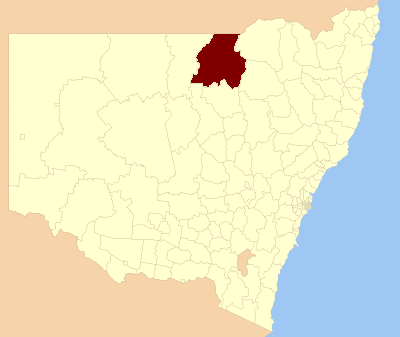
caption = Location inNew South Wales
pop = 8,279
density = 0.37
area = 22336
est =
seat = Walgett (77 Fox Street)
mayor =
region = Orana
url = http://www.walgett.nsw.gov.au
stategov = Barwon
fedgov = Gwydir
near-nw = Balonne (Qld)
near-n = Balonne (Qld)
near-ne = Balonne (Qld)
near-e = Moree Plains
near-w = Brewarrina
near-sw = Warren
near-s = Coonamble
near-se = NarrabriWalgett Council is a local government area in the Orana region of
New South Wales ,Australia , borderingQueensland on the north.Walgett, New South Wales is at the junction of the Barwon River and theNamoi River , and at the junction of theKamilaroi Highway and theCastlereagh Highway . The Shire is divided between the agricultural areas (producing wool, cattle, wheat and cotton), which are near the Barwon and Namoi or southeast of the Barwon, and theoutback country northwest of the Barwon, including theblack opal mining andfossicking town ofLightning Ridge, New South Wales . Prior to 1957, when Lightning Ridge was established (or re-established) as a significant settlement, the outback country was part of the Western Division.The Council is currently controlled by an Administrator, Vic Smith, [ cite web
publisher = New South Wales Department of Local Government
title=Local Government Directory
date= June 2004
url = http://www.dlg.nsw.gov.au/dlg/dlghome/dlg_LocalGovDirectory.asp?index=1&CN=T#209
accessdate = 2006-11-14 ] appointed by the New South Wales Minister for Local Government. The previous Walgett Council was split between factions representing Lightning Ridge and the rest of the Shire and apparently became unworkable as a result. This, among other things, was investigated by a Public Enquiry in 2004 [ cite web
last= Bulford
first=Robert
publisher = Department of Local Government
title=Walgett Shire Council Public Enquiry
date= June 2004
url = http://www.dlg.nsw.gov.au/dlg/dlghome/documents/Information/Walgett_Public_Inquiry_Report_31_May_2004.pdf
accessdate = 2006-11-14 (section 3.2) ] under the New South Wales Local Government Act 1993. [ cite web
title=Local Government Act 1993
work=New South Wales Consolidated Acts
publisher=Australasian Legal Information Institute
url=http://www.austlii.edu.au/au/legis/nsw/consol_act/lga1993182/
accessdate = 2006-11-14 ] Other matters investigated included poor administration, failure to properly inform councilors in relation to some matters, apparently illegal walkouts by some councilors to frustrate votes and, in particular, events surrounding a failed project to build a community centre in Lightning Ridge.Incomes
According to the [http://www.abs.gov.au Australian Bureau Statistics] [cite web
publisher =Australian Bureau of Statistics
title=Regional Wage and Salary Earner Statistics, Australia (catalogue no.: 5673.055.003)
url = http://abs.gov.au
accessdate = 2007-03-11 ] during 2003-04, there:- were 1,726 wage and salary earners (ranked 123rd in New South Wales and 393rd in Australia, less than 0.1% of both New South Wales's 2,558,415 and Australia's 7,831,856)
- was a total income of $55,197,025 (around $55 million) (ranked 121st in New South Wales and 391st in Australia, less than 0.1% of both New South Wales's $107,179,688,262 (around $107 billion) and Australia's $304,034,755,876 (around $304 billion))
- was an estimated
average income per wage and salary earner of $31,980 (ranked 112th in New South Wales and 376th in Australia, 77% of New South Wales's $41,407 and 82% of Australia's $38,820)- was an estimated
median income per wage and salary earner of $29,155 (ranked 119th in New South Wales and 406th in Australia, 82% of New South Wales's $35,479 and 85% of Australia's $34,149).Main towns/villages
Walgett Shire includes Walgett, Lightning Ridge, Collarenebri, Pokataroo, Rowena, Burren Junction, Cryon, Cumborah, Glengarry and Carinda.
References
Wikimedia Foundation. 2010.