- Moteng Pass
-
This article is about the mountain pass. For other uses, see Moteng (disambiguation).
Moteng Pass 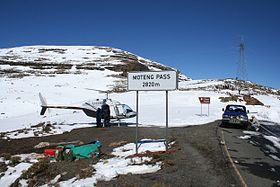
Top of Monteng PassElevation 2,820 m (9,252 ft) Location Location in Lesotho

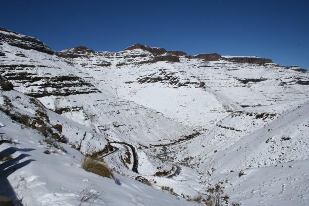
Range Maluti Mountains Coordinates 28°45′21″S 28°36′01″E / 28.75583°S 28.60028°ECoordinates: 28°45′21″S 28°36′01″E / 28.75583°S 28.60028°E The Moteng pass is a steep tarred pass in the Maluti mountains of Lesotho, reaching a height of 2820 meters.[1] It is one of two passes that links the town of Butha-Buthe with the diamond mining town of Mokhotlong, the other pass being the Mahlasela pass.[2] Heavy snowfalls frequently closes the pass in winter. The pass is 7.9 km long, with the last stage being extremely dangerous in winter due to frequent patches of ice.
References
- ^ Road Sign Elevation Photo, Jaco van Tonder, 2006
- ^ Map of Lesotho, South and North Sheet, Lesotho Government, 1978
Gallery
 Snow on the Moteng Pass
 Categories:
- Landforms of Lesotho
- Mountain passes of Lesotho
- Lesotho geography stubs


Wikimedia Foundation. 2010.