- Mahlasela Pass
-
This article is about the mountain pass. For other uses, see Mahlasela (disambiguation).
Mahlasela Pass 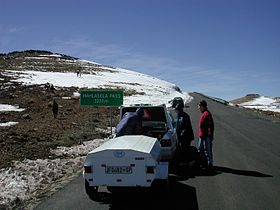
Elevation 3,222 m (10,571 ft) Location Location in Lesotho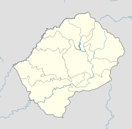

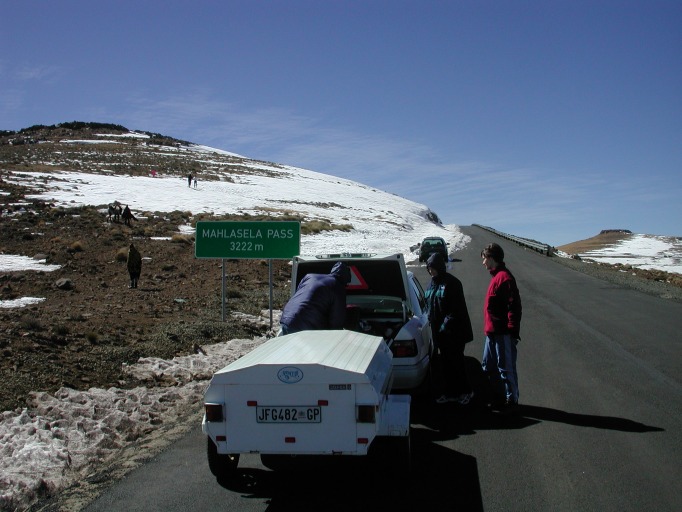
Coordinates 28°48′56″S 28°43′10″E / 28.81556°S 28.71944°ECoordinates: 28°48′56″S 28°43′10″E / 28.81556°S 28.71944°E The Mahlasela pass is a tarred pass in the Maluti mountains of Lesotho, reaching a height of 3222 meters.[1] It is one of two passes that links the town of Butha-Buthe with the diamond mining town of Mokhotlong, the other pass being the Moteng pass.[2] Heavy snowfalls frequently closes the pass in winter. The only skiing resort in Lesotho, Afriski is situated here. It is considered to be the highest road pass in Southern Africa.
References
- ^ Road Sign Elevation Photo, Jaco van Tonder, 2003
- ^ Map of Lesotho, South and North Sheet, Lesotho Government, 1978
Categories:- Landforms of Lesotho
- Mountain passes of Lesotho
- Lesotho geography stubs

Wikimedia Foundation. 2010.