Cryon, New South Wales

Cryon, New South Wales
Cryon
New South Wales
Cryon 4.JPG
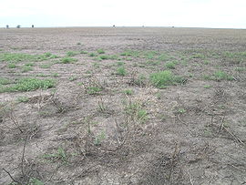
A paddock on the plain near Cryon
Cryon is located in New South Wales
{{{alt}}}
Cryon
Population: negligible
Postcode: 2387
LGA: Walgett Shire
County: Denham
State District: Barwon

Cryon is a parish and hamlet situated 685 km from Sydney, New South Wales, 130 km west of Narrabri and 52 km east of Walgett on the Kamilaroi Highway in the north-west of New South Wales, Australia, and lies in the Walgett Shire. The settlement sits at altitude of about 146 metres. When the Walgett railway line arrived here in 1905 this was a thriving settlement with a variety of businesses including a hotel and stores. For quite a few years it was the loading point for cattle from south west Queensland that were railed to the Sydney market. The railway now only carries freight (grain).

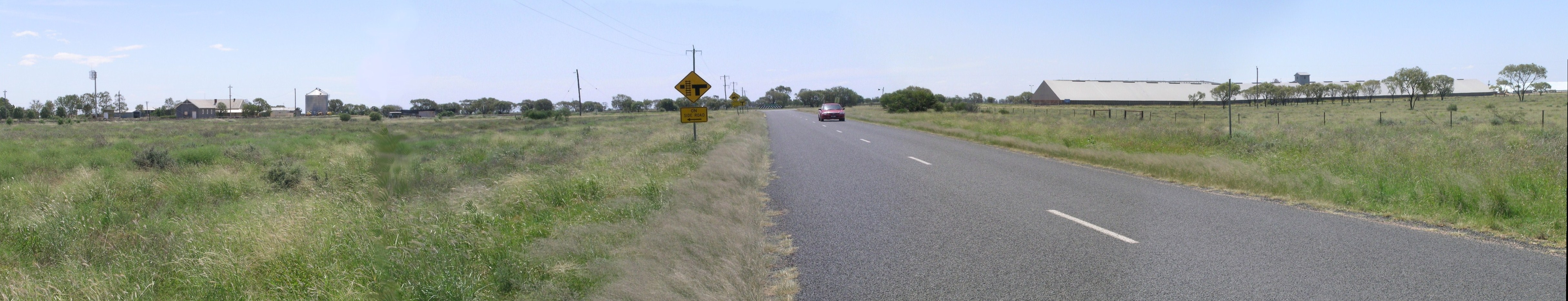
Today only several buildings remain, but the old hotel remains and now operates as Nomads Cryon, together with a wheat silo and several new bunker storages.

The main industry here is wheat farming with some livestock raised, too.

References

Lightning Ridge, Walgett and District; published by Walgett Shire, 2000

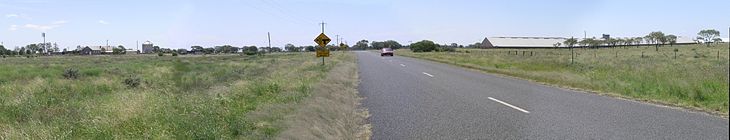
Nomads Cryon, the hall and the silos at Cryon, NSW

Coordinates: 29°55′S 148°42′E / 29.917°S 148.7°E / -29.917; 148.7


Wikimedia Foundation. 2010.

Игры ⚽ Поможем решить контрольную работу

Look at other dictionaries:

  • Denham County, New South Wales — Infobox Australian cadastral name = Denham state = New South Wales caption = Location in New South Wales near nw = Finch near n = Finch near ne = Benarba near e = Jamison near se = Baradine near s = Baradine near sw = Baradine near w =… …   Wikipedia

  • Mungindi railway line, New South Wales — The Mungindi railway line is a railway line in northern New South Wales, Australia. It branches from the Main North line at the town of Werris Creek and heads north west through the towns of Gunnedah and Narrabri before reaching Moree which for… …   Wikipedia

  • Denham County — Map of all coordinates from Google Map of all coordinates from Bing Export all coordinates as KML …   Wikipedia

  • Walgett Shire Council — Infobox Australian Place | type = lga name = Walgett Shire state = nsw caption = Location in New South Wales pop = 8,279 density = 0.37 area = 22336 est = seat = Walgett (77 Fox Street) mayor = region = Orana url = http://www.walgett.nsw.gov.au… …   Wikipedia

  • Mungindi railway line — Mungindi Line Legend …   Wikipedia

  • Blaugraue Maus — Systematik Unterordnung: Mäuseverwandte (Myomorpha) Überfamilie: Mäuseartige (Muroidea) Familie: Langschwanzmäuse (Muridae) Unterfamilie …   Deutsch Wikipedia

  • Walgett Shire — Shire of Walgett Lage des Walgett Shire in New South Wales Gliederung …   Deutsch Wikipedia

  • Kamilaroi Highway — Infobox Australian Road road name = Kamilaroi Highway route route route photo = caption = Proposed .] length = 598 direction = Northwest Southeast start = finish = est = through = Brewarrina, Walgett, Cryon, Burren Junction, Wee Waa, Narrabri,… …   Wikipedia

  • List of Doctor Who universe creatures and aliens — This is a list of fictional creatures and aliens from the universe of the long running BBC science fiction television series Doctor Who, including Torchwood, The Sarah Jane Adventures and K 9. It covers alien races and other fictional creatures,… …   Wikipedia

Share the article and excerpts

Direct link
Do a right-click on the link above
and select “Copy Link”