- Lock and Dam No. 24
Infobox_Dam
dam_name=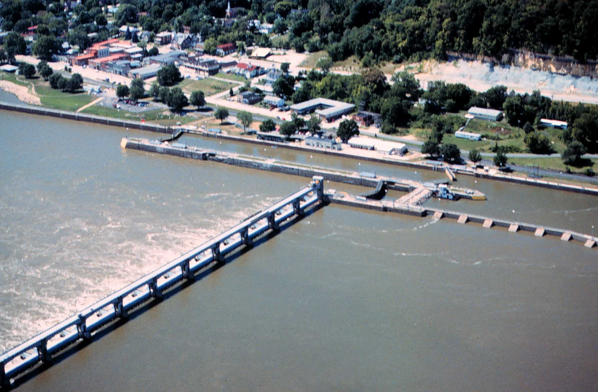
caption=Mississippi River Lock and Dam number 24
official_name=
crosses=Upper Mississippi River
reservoir=Pool 24
locale=Clarksville, Missouri
maint=United States Army Corps of Engineers
length= convert|1340|ft|m|1
height=
width=
began=July 1936
open=March 12 1940
closed=
reservoir_capacity=
reservoir_catchment=
reservoir_surface=
coordinates= coord|39|22|36|N|90|54|30|W|region:US_type:landmark
extra=Lock and Dam No. 24 is a lock and
dam located nearClarksville, Missouri aroundriver mile 273.4 on the UpperMississippi River . The main lock is convert|100|ft|m|1 wide and convert|600|ft|m|1 long with its bottom at an elevation of 430 feet. The auxiliary lock is not operational. Normal pool elevation behind the dam is 449 feet. The movable portion of the dam is convert|1340|ft|m|1 long and consists of 15 submersible, elliptical,tainter gate s. A convert|2720|ft|m|1 submersible earthen dike extends from the movable dam to the Illinois shore. In 2004, the facility was listed in theNational Register of Historic Places as Lock and Dam No. 24 Historic District, #04000183 covering convert|1027|acre|km2|1, 3 buildings, 15 structures, 4 objects.ee also
*
List of locks and dams of the Upper Mississippi River External links
* [http://www.clarksvillemo.us/visitorscenter.html Clarksville Visitor center, near the lock and dam with additional dimensions of the dam]
* [http://www2.mvr.usace.army.mil/NIC2/Documents/MissRiver/Map084-A.pdf Lock 24]
* [http://hdl.loc.gov/loc.pnp/hhh.mo1077 Upper Mississippi River Nine-Foot Channel Project, Lock & Dam No. 24, Clarksville, Pike County, MO]
Wikimedia Foundation. 2010.