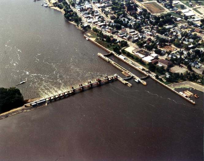
- Lock and Dam No. 10
Infobox_Dam
dam_name=
caption=Mississippi River Lock and Dam number 10.
official_name=
crosses=Upper Mississippi River
reservoir=Pool 10
locale=Guttenberg, Iowa
maint=United States Army Corps of Engineers
length= convert|5447|ft|m|1
height=
width=
began=1934
open=November 1937
closed=
reservoir_capacity=
reservoir_catchment=
reservoir_surface=
coordinates= coord|42|47|06|N|91|05|42|W|region:US_type:landmark
extra=location map|Iowa|label= |lat_deg=42|lat_min=47|lat_sec=06|lon_deg=-91|lon_min=-05Lock and Dam No. 10 is a lock and
dam located inGuttenberg, Iowa on the UpperMississippi River aroundriver mile 615.0. It was constructed and placed in operation November 1937. The site underwent major rehabilitation 1989 -- 2006. The dam consists of a concrete dam convert|763|ft|m|1 long with four roller gates and eighttainter gate s. The earth embankment is convert|4223|ft|m|1 long [ [http://hdl.loc.gov/loc.pnp/hhh.ia0180 Survey number HAER IA-22 - Upper Mississippi River 9-Foot Channel, Lock & Dam No. 10, Guttenberg, Clayton County, IA] as built drawings.] with a concretespillway convert|1200|ft|m|1 long. The lock is convert|110|ft|m|1 wide by convert|600|ft|m|1 long.The Friends of Pool 10 is a volunteer organization dedicated to the cleanup of the sloughs, backwaters and islands of the pool. Its first annual cleanup was in April 2007.
References
External links
* [http://www.mvp.usace.army.mil/navigation/default.asp?pageid=145&subpageid=182 USACE Lock and Dam 10]
* [http://www.umesc.usgs.gov/rivers/upper_mississippi/reach_1/pool_10/pool_10.html USGS Reach 1, Pool 10]
* [http://crunch.tec.army.mil/dpn/webpages/DPNDetail.CFM?ID=1197 Civil works Digital project notebook]
* [http://hdl.loc.gov/loc.pnp/hhh.ia0180 Survey number HAER IA-22 - Upper Mississippi River 9-Foot Channel, Lock & Dam No. 10, Guttenberg, Clayton County, IA]
* [http://www.mwnews.net/html/mcgregor_marquette.html news article on Friends of Pool 10]
Wikimedia Foundation. 2010.
