- Lock and Dam No. 2
Infobox_Dam
dam_name=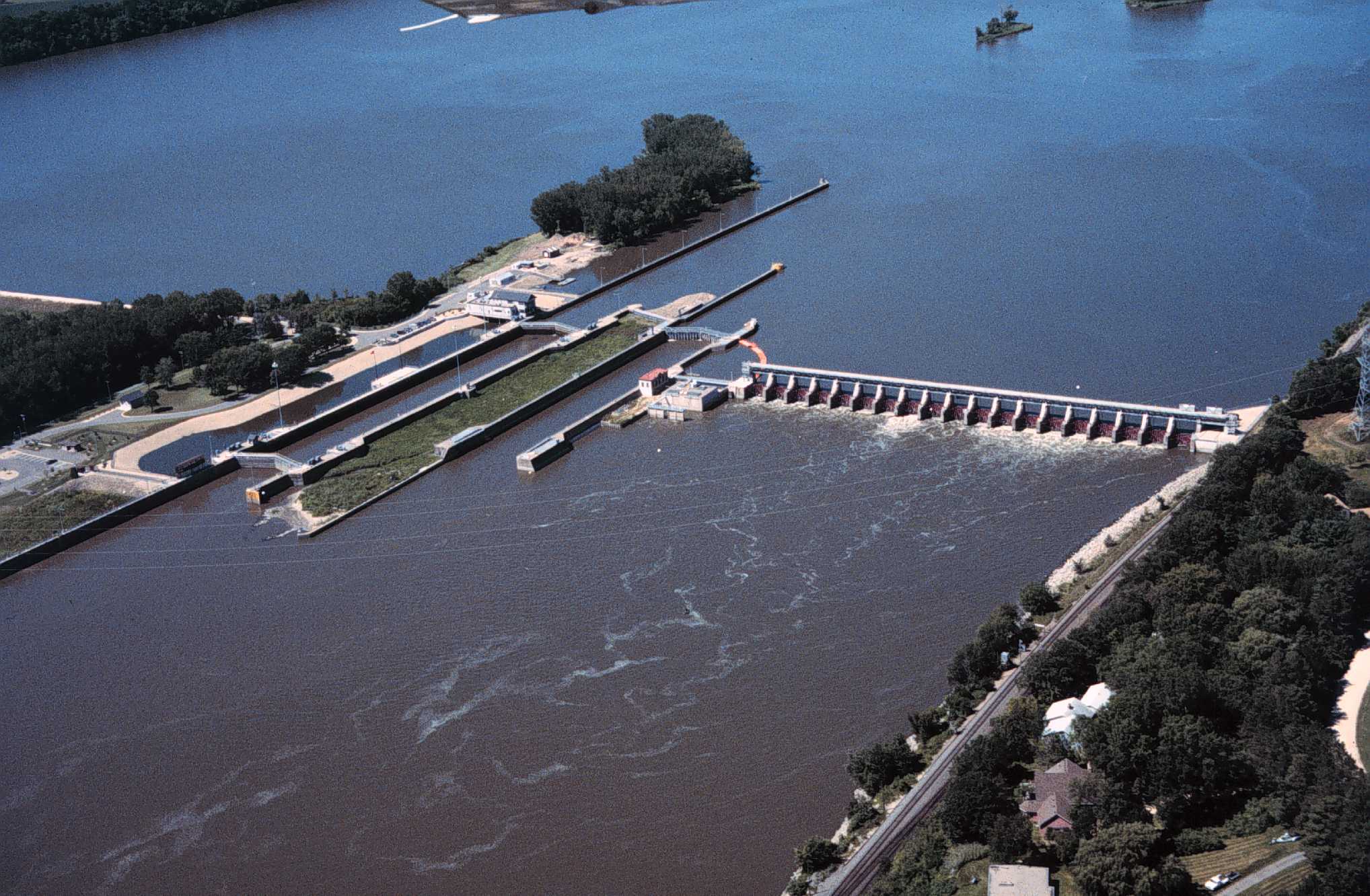
caption=Mississippi River Lock and Dam number 2.
official_name=
crosses=Upper Mississippi River
reservoir=Pool 2
locale=Hastings, Minnesota
maint=United States Army Corps of Engineers
length= convert|722|ft|m|1 (movable portion)
height=
width=
began=
open=
closed=
reservoir_capacity=
reservoir_catchment=
reservoir_surface=
coordinates= coord|44|45|35|N|92|52|07|W|region:US_type:landmark
extra=:"The first lock and dam to be built on the Mississippi was also called Lock and Dam No. 2. SeeMeeker Island Lock and Dam ".Lock and Dam No. 2 is located along the UpperMississippi River nearHastings, Minnesota and was originally built in1930 . The easterndam portion is 722 feet (220 m) wide and has 19tainter gate s. Ahydroelectric station that produces about 4.4megawatt s is owned by the city of Hastings, while the 110 × 600 foot (34 × 183 m) lock is operated by the St. Paul district of theU.S. Army Corps of Engineers 'Mississippi Valley Division . There's also a wide earthen dam on the western side of the facility.Following construction, the original lock walls settled and began to lean out of alignment, so a replacement lock was built. It was finished in
1948 . A rehabilitation phase ran from1987 to1995 .External links
* [http://www.mvp.usace.army.mil/navigation/default.asp?pageid=145&subpageid=161 USACE St. Paul District: Lock and Dam No. 2]
* [http://maps.google.com/maps?q=hastings,+mn&ll=44.759945,-92.867153&spn=0.01094,0.02238&t=h Google Maps: Lock and Dam No. 2]
* [http://www.umesc.usgs.gov/rivers/upper_mississippi/reach_1/sel_a_pool_r1.html USGS, Locks 1 through 13]
Wikimedia Foundation. 2010.