- Lock and Dam No. 22
Infobox_Dam
dam_name=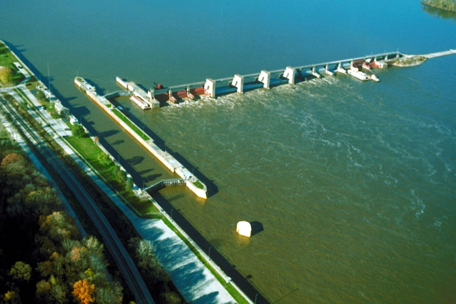
caption=Mississippi River Lock and Dam number 22
official_name=
crosses=Upper Mississippi River
reservoir=Pool 22
locale=Saverton, Missouri
maint=United States Army Corps of Engineers
length= convert|1224|ft|m|1 (movable portion)
height=
width=
began=1934
open=July 22 ,1938
closed=
reservoir_capacity=
reservoir_catchment=
reservoir_surface=
coordinates= coord|39|38|18|N|91|14|49|W|region:US_type:landmark
extra=location map|Missouri|label= |lat_deg=39|lat_min=38|lat_sec=18|lon_deg=-91|lon_min=-15Lock and Dam No. 22 is a lock and
dam located nearSaverton, Missouri on the UpperMississippi River aroundriver mile 301.2. The movable portion of the dam is convert|1224|ft|m|1 long and consists of three roller gates and tentainter gate s. A convert|1600|ft|m|1 long submersible earthen dike extends to a flood control levee on theIllinois shore. The main lock is convert|110|ft|m|1 wide by convert|600|ft|m|1 long there is also an incomplete auxiliary lock. In 2004, the facility was listed in theNational Register of Historic Places as Lock and Dam No. 22 Historic District, #04000182 covering convert|1268|acre|km2|1, 1 building, 5 structures, 4 objects.When the northern part of Mississippi freezes, near the first week of February, upwards of 20
Bald Eagle s fly down to fish in the churning waters below Lock and Dam No. 22.External links
* [http://hdl.loc.gov/loc.pnp/hhh.mo1076 HAER - Upper Mississippi River Nine-Foot Channel Project, Lock & Dam Complex No. 22, Upper Mississippi River, Saverton, Ralls County, MO]
Wikimedia Foundation. 2010.