- Nowe Miasto County
-
Nowe Miasto County
Powiat nowomiejski— County — 
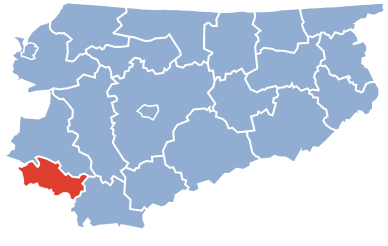
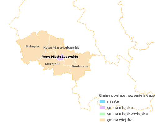
Coat of armsLocation within the voivodeship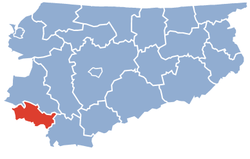 Division into gminas
Coordinates (Nowe Miasto Lubawskie): 53°25′N 19°35′E / 53.417°N 19.583°ECoordinates: 53°25′N 19°35′E / 53.417°N 19.583°E Country  Poland
Voivodeship Warmian-Masurian Seat Nowe Miasto Lubawskie Gminas Total 5 (incl. 1 urban)Area – Total 695.01 km2 (268.3 sq mi) Population (2006) – Total 43,388 – Density 62.4/km2 (161.7/sq mi) – Urban 11,036 – Rural 32,352 Car plates NNM Website http://www.powiat-nowomiejski.pl Nowe Miasto County (Polish: powiat nowomiejski) is a unit of territorial administration and local government (powiat) in Warmian-Masurian Voivodeship, northern Poland. It came into being on January 1, 1999, as a result of the Polish local government reforms passed in 1998. Its administrative seat and only town is Nowe Miasto Lubawskie, which lies 73 kilometres (45 mi) south-west of the regional capital Olsztyn.
The county covers an area of 695.01 square kilometres (268.3 sq mi). As of 2006 its total population is 43,388, out of which the population of Nowe Miasto Lubawskie is 11,036 and the rural population is 32,352.
Neighbouring counties
Nowe Miasto County is bordered by Iława County to the north, Działdowo County to the east, Brodnica County to the south and Grudziądz County to the west.
Administrative division
The county is subdivided into five gminas (one urban and four rural). These are listed in the following table, in descending order of population.
Gmina Type Area
(km²)Population
(2006)Seat Nowe Miasto Lubawskie urban 11.6 11,036 Gmina Biskupiec rural 241.3 9,652 Biskupiec Gmina Kurzętnik rural 149.9 8,646 Kurzętnik Gmina Nowe Miasto Lubawskie rural 138.0 7,859 Mszanowo Gmina Grodziczno rural 154.3 6,195 Grodziczno References
Seat Nowe Miasto Lubawskie (urban gmina)
Rural gminas Counties of Warmian-Masurian Voivodeship City counties 
Land counties Categories:- Nowe Miasto County
- Land counties of Warmian-Masurian Voivodeship


Wikimedia Foundation. 2010.