- Bartoszyce County
Infobox Settlement
name = Bartoszyce County
native_name = Powiat bartoszycki
settlement_type =
image_shield = POL powiat bartoszycki COA.svg
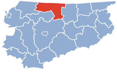
map_caption = Location within the voivodeship

map_caption1 = Division into gminas
subdivision_type = Country
subdivision_name = POL
subdivision_type1 = Voivodeship
subdivision_name1 = Warmian-Masurian
area_total_km2 = 1308.54
population_total = 61354
population_as_of = 2006
population_density_km2 = auto
population_urban = 34485
population_blank1_title = Rural
population_blank1 = 26869
coor_type = Bartoszyce
latd = 54
latm = 15
lats =
latNS = N
longd = 20
longm = 48
longs =
longEW = E
seat =Bartoszyce
parts_type =Gmina s
parts = Total 6 (incl. 2 urban)
p1 =Bartoszyce
p2 =Górowo Iławeckie
p3 =Gmina Bartoszyce
p4 =Gmina Bisztynek
p5 =Gmina Górowo Iławeckie
p6 =Gmina Sępopol
blank_name = Car plates
blank_info = NBA
website = http://www.powiatbartoszyce.republika.pl __NOTOC__Bartoszyce County ( _pl. powiat bartoszycki) is a unit of territorial administration and local government (powiat ) inWarmian-Masurian Voivodeship , northernPoland , on the border withRussia . It was created onJanuary 1 ,1999 as a result of the Local Government Reorganization Act of 1998. Its administrative seat and largest town isBartoszyce , which lies convert|56|km|mi|0 north of the regional capitalOlsztyn . The county contains three other towns:Górowo Iławeckie , convert|21|km|mi|0|abbr=on west of Bartoszyce,Bisztynek , convert|22|km|mi|0|abbr=on south of Bartoszyce, andSępopol , convert|14|km|mi|0|abbr=on east of Bartoszyce.The county covers an area of convert|1308.54|km2|sqmi|1. As of 2006 its total population is 61,354, out of which the population of Bartoszyce is 25,423, that of Górowo Iławeckie is 4,554, that of Bisztynek is 2,493, that of Sępopol is 2,015, and the rural population is 26,869.
Neighbouring counties
Bartoszyce County is bordered by
Kętrzyn County to the east,Olsztyn County to the south,Lidzbark County to the south-west andBraniewo County to the west. It also bordersRussia (Kaliningrad Oblast ) to the north.Administrative division
The county is subdivided into six
gmina s (two urban, two urban-rural and two rural). These are listed in the following table, in descending order of population.References
* [http://www.stat.gov.pl/gus/45_655_PLK_HTML.htm Polish official population figures 2006]

Wikimedia Foundation. 2010.