- Dunaivtsi
-
For other uses, see Dunaivtsi (disambiguation).
Dunaivtsi
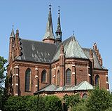
ДунаївціDunaivtsi city center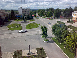
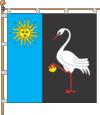
Flag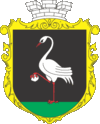
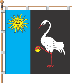
Coat of armsLocation of Dunaivtsi, Ukraine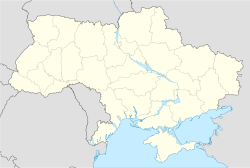
 Dunaivtsi
Coordinates: 48°53′22″N 26°51′25″E / 48.88944°N 26.85694°E Country
Oblast
RaionUkraine
Khmelnytskyi Oblast
DunaivtsiFirst mentioned 1403 Government - Mayor Stanislav B. Nebelsky Area - Total 1.91 km2 (0.7 sq mi) Elevation 300 m (984 ft) Population (2001) - Total 16,448 - Density 8,604/km2 (22,284.3/sq mi) Postal code 32400—32408 Area code(s) +380 3858 Twin towns Turek,  Poland
Brandýs nad Labem-Stará Boleslav, Czech Republic
Website www.dunrada.org.ua Dunaivtsi (Ukrainian: Дунаївці, Russian: Дунаевцы, Polish: Dunajowce) is the capital city of Dunaivtsi Raion, Khmelnytskyi Oblast (province), Ukraine. The city is located on the river Ternavka, 22 km away from the railway station Dunaivtsi and 68 km from the Khmelnytskyi. Population is 16,448 (2001). Reinforcement plant, repair and engineering works and butter-processing plant are located in the city.
Contents
History
The date of the first written mention in document about Dunaivtsi is 1403. This year is assumed to be the foundation date of the city. Almost two centuries later in 1577 King Sigismund III Vasa gave Dunaivtsi the city status and Magdeburg rights. Industrial peak of the city was on the 1870s, when 54 factories were working and close trade relations were between Dunaivtsi and Kiev, Warsaw, Chişinău, Kharkov, Poltava, Kherson, Łódź, Yarmolyntsi. At the end of the 19th century – beginning of the 20th century the city continued to grow: population and the number of factories and plants increased.
Geography
The city is located almost in the geographic center of Dunaivtsi Raion on the river Ternavka (the left tributary of the river Dniester), 68 km away from the center of the Khmelnytskyi Oblast — the city Khmelnytskyi.
Geographical coordinates of the city are 48°53'22" (latitude) and 26°51'25" (longitude).
The total area of the city is 12.84 km² including 2.14 km² of the built-up area and 0.483 km² of the city's plantation. The total length of the streets, passages and embankments is 93.8 km.[1]
Population
630 houses and about 3 thousand inhabitants were in Dunaivtsi in 1629. According to the census of 1909 the population of Dunaivtsi was 13 733 (8 966 Jews, 2 349 Orthodoxes, 1 266 Lutheran, 1 188 Catholic, 4 members of Armenian Apostolic Church). In [1911] more than 13 thousand people lived in Dunaivtsi, where 553 houses were in this year.[2]
According to the census of 1989 Dunaivtsi population was 17 482 and according to the census of 2001 16 448 inhabitants were in Dunaivtsi.[3]
According to more recent data provided by Khmelnytskyi Oblast Rada in 2006 population of Dunaivtsi city was 16 223, in 2007 — 16 187, in 2008 — 16 094, in 2009 — 16 140.[4]
Thus, population of the city is stable during the whole century. On January 1, 2010 it reached the peak value of 20 724 inhabitants.[5]
Famous citizens
- Bolesław Woytowicz (Polish pianist and composer)
- Nikifor Grigoriev (paramilitary leader)
- Frantz Lender (Soviet weapons designer)
- Gennady Semigin (Russian politician)
- Pavlo Hai-Nyzhnyk (historian)
- Wincenty Krasiński (political activist and military leader)
- Zygmunt Krasiński (Polish Romantic poet)
Economy
Supermarket "Vopak" was open in Dunaivtsi on September 20, 2007.[6]
Twin towns
 Roman Catholic church in Turek
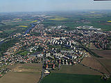 Aerial view of Brandýs nad Labem-Stará Boleslav
Dunaivtsi has two twin towns — Turek (
Poland)[7] and Brandýs nad Labem-Stará Boleslav ( Czech Republic).[8] Cooperation of Dunaivtsi with Turek was established in 2000, while with Czech city — on May 10, 2010.References
- ^ Business Dunaivtsi (About the city) (Ukrainian)
- ^ History of the city (Ukrainian)
- ^ Ukrainian cities and the largest towns
- ^ Dunaivtsi city at Khmelnytskyi Oblast Rada (official website) (Ukrainian)
- ^ Population of Khmelnytskyi Oblast at http://www.da-ta.com.ua/ (Ukrainian)
- ^ New supermarket opens in Dunaivtsi (Russian)
- ^ Twin town Turek at the [http://www.dunrada.org.ua/ official website of Dunaivtsi city government (Ukrainian)
- ^ Delegation from Brandýs nad Labem-Stará Boleslav visited Dunaivtsi on Victory Day. official website of Dunaivtsi raion government (Ukrainian)
External links
- Registration form of city in the Ukrainian Parliament official website (Ukrainian)
- Dunaivtsi website (Ukrainian)
Administrative divisions of Khmelnytskyi Oblast, Ukraine Raions Bilohirskyi · Chemerovetskyi · Derazhnianskyi · Dunaivtsi · Horodok · Iziaslavskyi · Kamianets-Podilskyi · Khmelnytskyi · Krasylivskyi · Letychivskyi · Novoushytskyi · Polonskyi · Shepetivskyi · Slavutskyi · Starokostiantynivskyi · Starosyniavskyi · Teofipolskyi · Vinkovetskyi · Volochyskyi · Yarmolynetskyi

Cities Derazhnia · Dunaivtsi · Horodok · Iziaslav · Kamianets-Podilskyi · Khmelnytskyi · Krasyliv · Netishyn · Polonne · Shepetivka · Slavuta · Starokostiantyniv · VolochyskUrban-type
settlementsAntoniny · Bazaliya · Bilohirya · Chemerivtsi · Chornyi Ostriv · Dunaivtsi · Hrytsiv · Letychiv · Lozove · Medzhybizh · Narkevychi · Nova Ushytsia · Poninka · Sataniv · Smotrych · Stara Syniava · Stara Ushytsia · Teofipol · Vinkivtsi · Viytivtsi · Vovkovyntsi · Yampil · Yarmolyntsi · Zakupne · more...Villages Coordinates: 48°54′N 26°50′E / 48.9°N 26.833°E
Categories:- Cities in Ukraine
- Khmelnytskyi Oblast
- Shtetls


Wikimedia Foundation. 2010.