- Minganie Regional County Municipality, Quebec
-
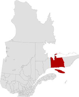
Minganie is a regional county municipality of Quebec in Canada. The regional seat is Havre-Saint-Pierre. Anticosti Island is included within this region. It has a land area of 56,116.77 square kilometres (21,666.81 sq mi).
The population at the Canada 2006 Census was 6,390 inhabitants, about half of whom lived in Havre-Saint-Pierre. The census groups Minganie with the neighboring Golfe-du-Saint-Laurent RCM as the single census division of Minganie-Basse-Côte-Nord.[1]
Until 2002, the Minganie encompassed the entire lower north shore right up to Blanc-Sablon. In 2002, it lost all the communities east of the Natashquan River when the Basse-Côte-Nord Territory was formed. In July 2010, the RCM lost another 44% of its territory when the Petit-Mécatina Unorganized Territory was transferred to the new Le Golfe-du-Saint-Laurent Regional County Municipality.[2]
Contents
Subdivisions
The First Nations reserves of Mingan and Natashquan are within the boundaries but administratively not part of the regional county municipality.
Municipalities
- Aguanish
- Baie-Johan-Beetz
- Havre-Saint-Pierre
- L'Île-d'Anticosti
- Longue-Pointe-de-Mingan
- Rivière-au-Tonnerre
- Rivière-Saint-Jean
Townships
Unorganized territories
- Lac-Jérôme
References
- ^ Minganie--Basse-Côte-Nord, Quebec, Statistics Canada.
- ^ Audrée Soucy (July 2010), "Municipalité régionale de comté (MRC)", Modifications aux municipalités du Québec (Quebec: Institut de la statistique du Québec), ISSN 1715-6408, http://www.stat.gouv.qc.ca/publications/referenc/pdf2010/modif_juillet10.pdf, retrieved 2010-09-17
External links
 Administrative divisions of Côte-Nord (Region 09)
Regional county municipalities
and equivalent territoriesLa Haute-Côte-Nord · Le Golfe-du-Saint-Laurent · Manicouagan · Sept-Rivières · Caniapiscau · Minganie
Municipalities Forestville · Baie-Comeau · Sept-Îles · Port-Cartier · Havre-Saint-Pierre · Fermont · Schefferville
Categories:- Regional county municipalities in Côte-Nord
- Quebec geography stubs

Wikimedia Foundation. 2010.