- Cumbria Way
-
Cumbria Way 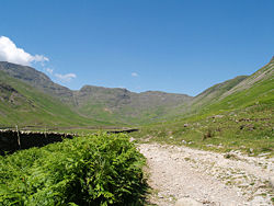
Cumbria Way leaves Langdale travelling alongside Mickleden Beck. Length 112km Location Cumbria, England Trailheads Ulverston
54°11′42″N 3°05′31″W / 54.195°N 3.092°W
Carlisle
54°53′42″N 2°56′02″W / 54.895°N 2.934°WUse Hiking Highest point High Pike 658 metres (2,159 ft)[1] Lowest point Ulverston Trail difficulty Moderate Season All year Sights Mountains, Tarns, Woodland Hazards Exposed sections, Weather The Cumbria Way is a linear long distance footpath in Cumbria, England passing through the towns of Coniston and Keswick. It also passes through the Langdale and Borrowdale valleys. The majority of the route is inside the boundaries of the Lake District National Park.
This 112 km route through the heart of the Lake District National Park links the two historic Cumbrian towns of Ulverston and Carlisle. The route cuts through classic Lakeland country via Coniston, Langdale, Borrowdale, Derwent Water, Skiddaw Forest and Caldbeck. It is a primarily low-level long distance footpath but does contain some high-level exposed sections.[2]
Contents
History
The Cumbria Way was originally devised in the 1970s by local Ramblers' Association members. The waymarking of the entire route was completed by volunteers and national park staff in May 2007. [3]
Route
The route can be walked in either direction but is described here as south to north beginning at the trailhead of Ulverston (grid reference SD284785) and ending in Carlisle (grid reference NY400554).
Stage 1: Ulverston to Coniston
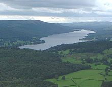 Coniston Water seen from the North
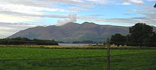
The route leaves the urban area of Ulverston, birthplace of Stan Laurel,[4] and heads north towards the village of Gawthwaite and the boundary of the Lake District National Park. The route, which consists primarily of field paths at this stage, then progresses towards the settlement of Sunny Bank and the shore of Coniston Water. The western shoreline of Coniston Water is followed before reaching the settlement of Coniston. [5] Grizedale Forest is visible to the east of the lake with Coniston Old Man and Dow Crag being visible to the west on approach to Coniston. This stage is approximately 24 km in length.
Stage 2: Coniston to Langdale
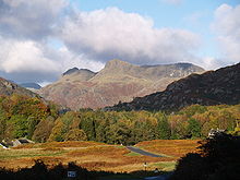 Langdale Pikes
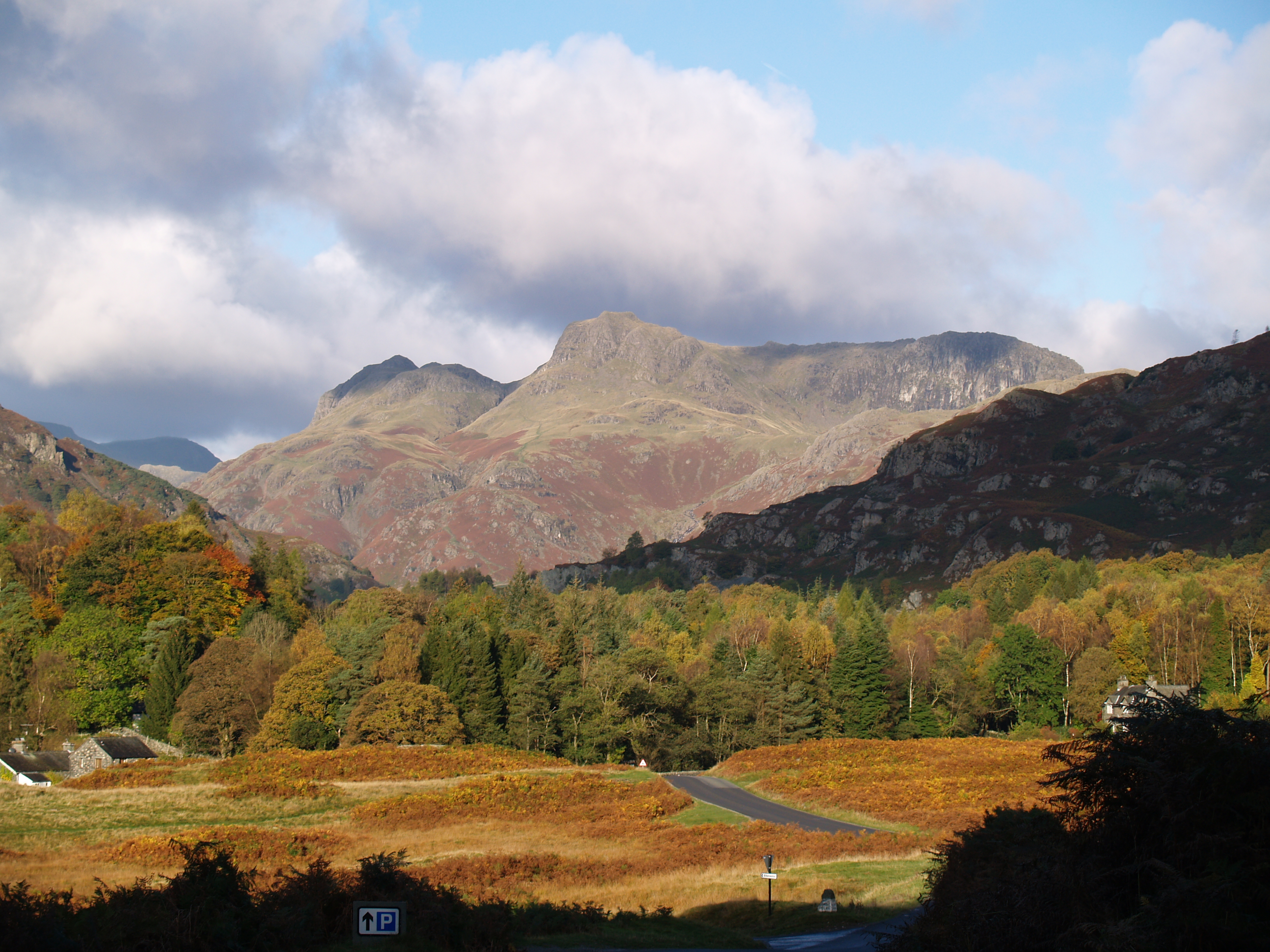
The route leaves Coniston heading in a NNW direction through woodland towards Tarn Hows. The route involves some road walking as it passes through the villages of Colwith and Skelwith Bridge. The Langdale Pikes soon become visible as the route leaves Skelwith Bridge in a NNE direction, passing Elter Water before entering the Great Langdale valley.[6] This stage is approximately 17.5 km in length.
Stage 3: Langdale to Keswick
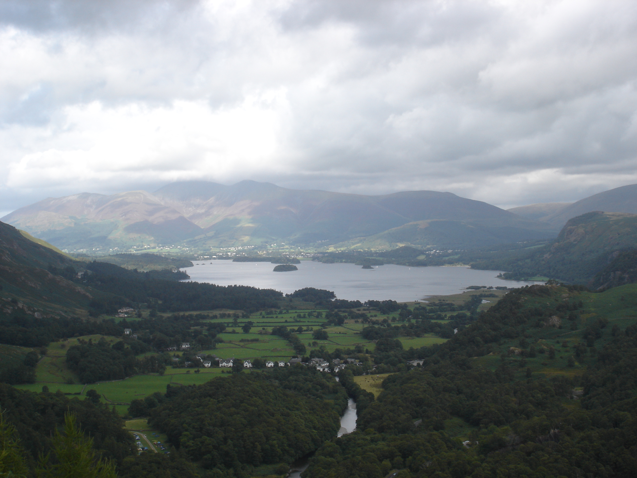
The route leaves Langdale and travels alongside Mickleden beck. The mountain of Bow Fell passed to the west with the Langdale Pikes to the east. After a significant gain in elevation the route crosses Stake pass before descending via Langstrath beck and turning towards the villages of Stonethwaite and Rosthwaite. The route subsequently follows the River Derwent before reaching Derwent Water where it follows the shoreline path to reach the town of Keswick. The mountains Skiddaw and Blencathra may be visible to the north.[7] This stage is approximately 24 km in length.
Stage 4: Keswick to Caldbeck
After some urban walking on the exit from Keswick, the route crosses the A591 road before ascending past Latrigg towards Skiddaw House (465m AMSL). After crossing the area of fells known as Back o'Skiddaw the route passes High Pike and the Caldbeck Fells before descending towards the village of Caldbeck.[8] This stage is approximately 22.5 km in length.
Stage 5: Caldbeck to Carlisle
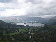
 Carlisle
After leaving the village of Caldbeck this final low-level section of the route follows the course of the River Caldew to the largest Cumbrian town of Carlisle. The route passes through the villages of Sebergham, Buchaban and Dalston following primarily woodland and farmland public footpaths and bridleways.[9] This stage is approximately 24 km in length.
Geology and Biology
Flora and Fauna
The tarns encountered on the route provide a habitat for a wide range of species including vendace, charr, crayfish and schelly.[10]
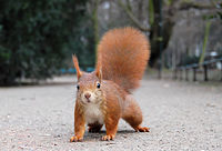
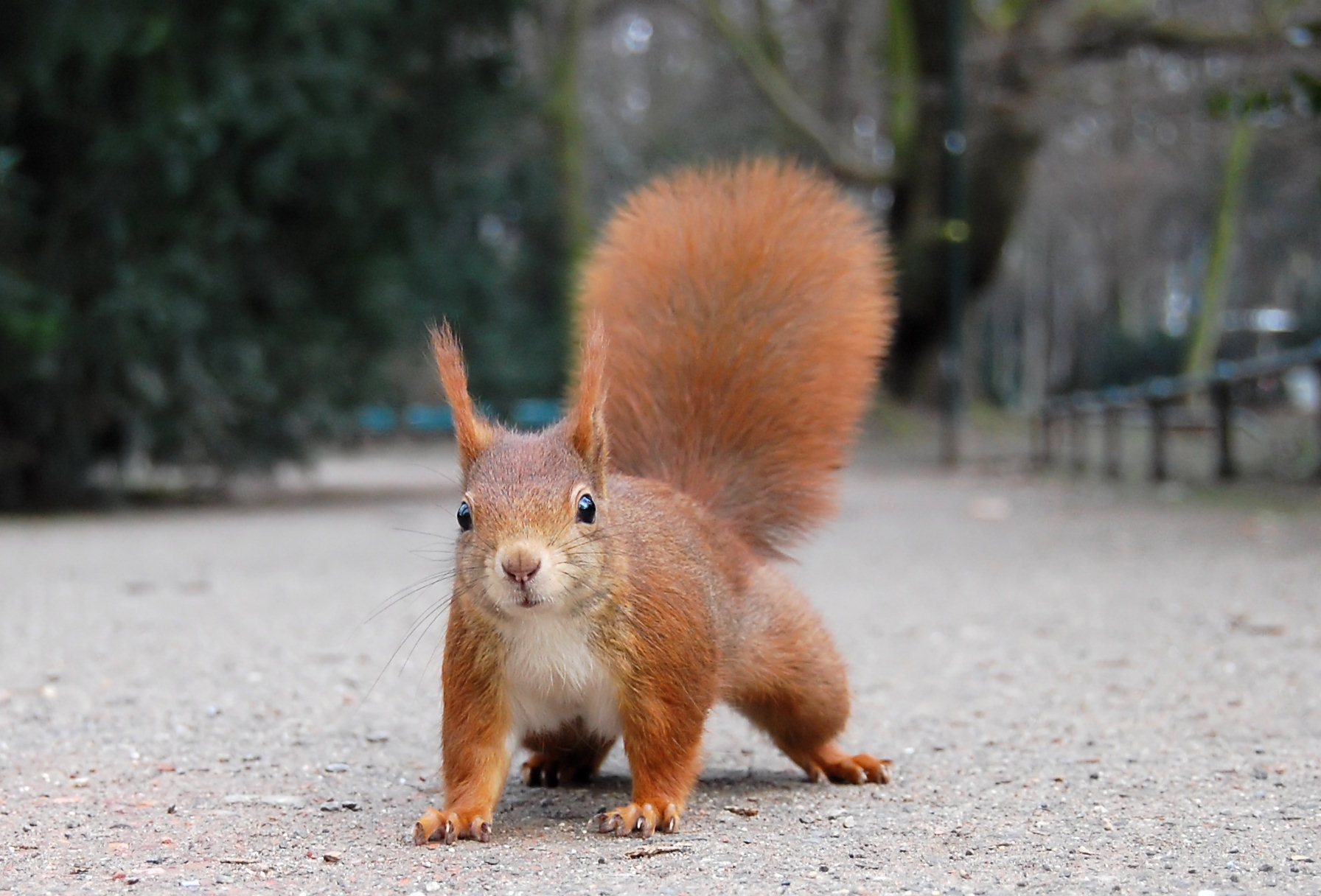
The red squirrel can be found in woodland encountered on the route.[11]
 Red Squirrel
The Ancient woodland encountered throughout the route provide a favorable habitat, due to high precipitation, for mosses, liverworts, ferns and lichens. The boggy areas encountered, particularly during the high-level parts of the route, provide a habitat for carnivorous plants including sundew and butterwort.[12]
Connecting trails
The route connects with the Allerdale Ramble, Cumbria Coastal Way, Coast to Coast Walk, Hadrian's wall path, Cistercian Way, Eden Way and Windermere Way.
Further reading
The following Ordnance Survey maps cover the route:
- Explorer 1:25k sheets OL4, OL5, OL6, OL7 and 315
- Landranger 1:50k sheets 85, 90 and 97
The following guidebooks detail the route:
- The Cumbria Way and the Allerdale Ramble, Jim Watson, Cicerone Press, ISBN 9781852842420
- The Cumbria Way, Anthony Burton, ISBN 1854106155. Aurum Press.
- The Cumbria Way, John Trevelyan, ISBN 1855681978. Dalesman
References
- ^ "Trails: Cumbrian Way". Sherpa Van (commercial site). http://www.sherpavan.com/trails/cumbrian_way.asp. Retrieved 2008-05-17.
- ^ "Paths. Recreational Route: Cumbria - Cumbria Way". Ramblers Association. http://www.ramblers.org.uk/info/paths/cumbria.html. Retrieved 2008-05-17.
- ^ Crawford, S (2007-05-30). "Marking the way for walkers". Cumberland News. http://beta.cumberland-news.co.uk/1.74045. Retrieved 2008-05-17.
- ^ "Stan Laurel". www.nndb.com. http://www.nndb.com/people/056/000031960/. Retrieved 2008-05-17.
- ^ "Cumbria Way Stage 1". Ulverston.net (local tourism). http://www.ulverston.net/pdfs/Cumbria_Way_pdfs/Stage_1.pdf. Retrieved 2008-05-17.
- ^ "Cumbria Way Stage 2". Ulverston.net (local tourism). http://www.ulverston.net/pdfs/Cumbria_Way_pdfs/Stage_2.pdf. Retrieved 2008-05-17.
- ^ "Cumbria Way Stage 3". Ulverston.net (local tourism). http://www.ulverston.net/pdfs/Cumbria_Way_pdfs/Stage_3b.pdf. Retrieved 2008-05-17.
- ^ "Cumbria Way Stage 4". Ulverston.net (local tourism). http://www.ulverston.net/pdfs/Cumbria_Way_pdfs/Stage_4.pdf. Retrieved 2008-05-17.
- ^ "Cumbria Way Stage 5". Ulverston.net (local tourism). http://www.ulverston.net/pdfs/Cumbria_Way_pdfs/Stage_5.pdf. Retrieved 2008-05-17.
- ^ "Lake District Special Properties". The Lake District National Park Authority. http://www.lake-district.gov.uk/index/understanding/specialqualities.htm. Retrieved 2008-05-17.
- ^ "Understanding Wildlife". The Lake District National Park Authority. http://www.lake-district.gov.uk/index/understanding/posters/poster4_wildlife.htm. Retrieved 2008-05-17.
- ^ "Cumberland Mountain Flowers". Flora of the Fells. http://www.floraofthefells.com/info/cumbmountflowers.htm. Retrieved 2008-05-17.[dead link]
External links
Categories:- Geography of Cumbria
- Long-distance footpaths in England
- Visitor attractions in Cumbria


Wikimedia Foundation. 2010.