- Mount Canobolas
-
Mount Canobolas 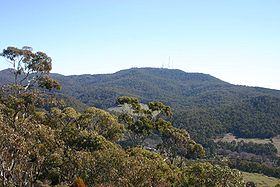
Mount Canobolas from the Pinnacle.Elevation 1,395 m (4,577 ft) AHD Location Location New South Wales, Australia Coordinates 33°20′39″S 148°58′57″E / 33.3442°S 148.9824°ECoordinates: 33°20′39″S 148°58′57″E / 33.3442°S 148.9824°E Climbing Easiest route Drive Mount Canobolas, at an altitude of 1,395 metres (4,577 ft) above sea level, is the highest mountain in the central tablelands district of New South Wales, Australia.
The mountain is of volcanic origin. It is located 13 kilometres (8 mi) southwest of the city of Orange, and it is about 250 kilometres (155 mi) west of Sydney.
The northern slopes of the mountain, with fertile volcanic soil, are becoming a popular cold-climate wine producing area.
The name comes from two Aboriginal words, 'coona' and 'booloo' meaning two headed beast or conjoined twins. There is a 360 degree view from the summit, which is often snow-capped in winter. The mountain is now part of a 15 square kilometre area controlled by the National Parks and Wildlife Service, which offers various walks: to Bald Hill; to Young Man Canobolas; Federal Falls to Mount Towac, etc.[1] The volcanic peaks give wide views and there are some attractive waterfalls. The mountain was first climbed by a European when Major Thomas Mitchell came there in 1835. An early squatter on the slopes of the Canobolas Range was Thomas Hood, whose father, John Hood, came from England for a visit in 1841, and wrote an account of the district. By 1848 Hood was lessee for Boree Cabonne.
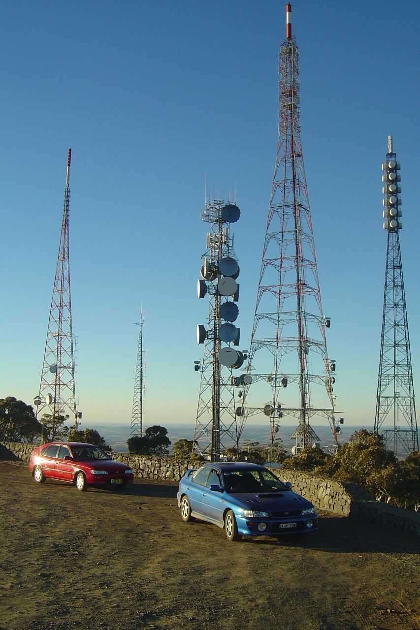
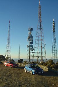 Transmission towers atop Mount Canobolas
The top of the mountain is now dominated by numerous towers used for television and radio transmissions across large areas of central New South Wales. These transmitters include towers for Airservices Australia, Royal Australian Air Force, Prime Television, WIN Television, Australian Broadcasting Corporation and Southern Cross Ten.
Each year the Orange Community runs the Great Volcanic Mountain Challenge, an 11 km walk and fun run from the Pinnacle to the Summit of Mount Canobolas by the volcanic plugs of Mount Towac and Young Man Canobolas. The inaugural event was held in 2006.[2]
Highest Point claims
Mount Canobolas is as claimed the highest point in New South Wales west of the Great Dividing Range, but is not, as is sometimes claimed, the highest point between Australia's Great Dividing Range and Africa, with both Mount Zeil in Australia's Northern Territory and Mount Woodroffe in South Australia being higher, at 1,531 metres and 1,435 metres respectively. This would in any case be an insignificant claim to fame, since many of the tallest peaks in the Great Dividing Range are in fact further west than Mount Canobolas is. For example, Mount Bogong in Victoria at 1,986 metres and 36°44′S 147°18′E / 36.733°S 147.3°E is 591 metres higher and almost a degree and a half longitude further west. This translates to a difference of around 125 kilometres using the degree length formula.
The islands of Réunion and Madagascar also have higher peaks and are between the Great Dividing Range and Africa.
See also
References
- ^ Mount Canobolas State Conservation Area Department of Environment and Climate Change NSW. Accessed May 5, 2007
- ^ Runners facing uphill challenge - Course as tough as ever: Davis Central Western Daily 24 March 2007. Accessed May 5, 2007
Categories:- Volcanoes of New South Wales
- Mountains of New South Wales
- Extinct volcanoes

Wikimedia Foundation. 2010.