- Pohnpei
-
Not to be confused with Pompeii, the ancient city destroyed by Vesuvius in AD 79.
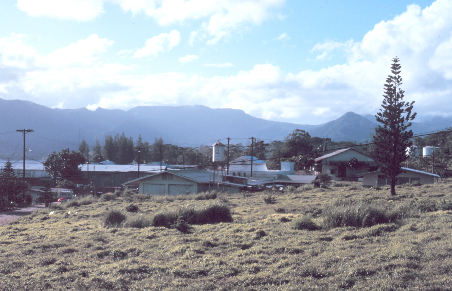
 Kolonia Town looking down from Sokehs Ridge
 Municipality map of Pohnpei
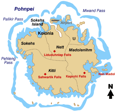
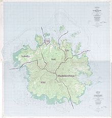 Detailed map of Pohnpei, showing the borders of the five 'independent tribes’
 Map of Pohnpei Island
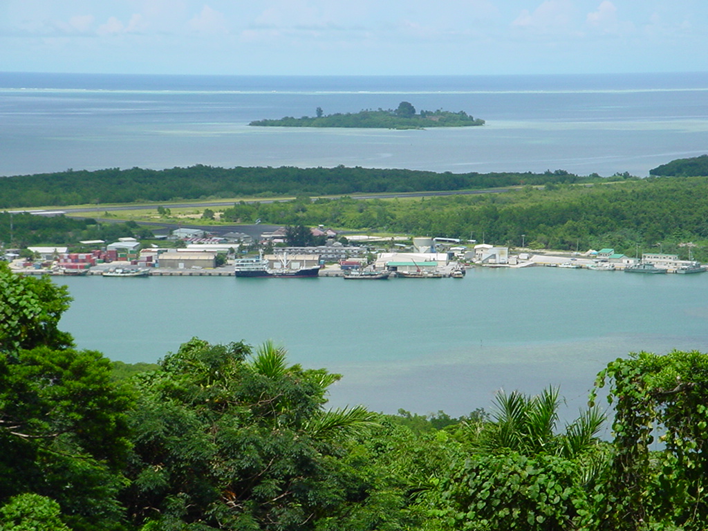
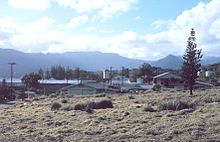 District center of Pohnpei Circa 1960
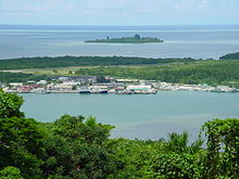
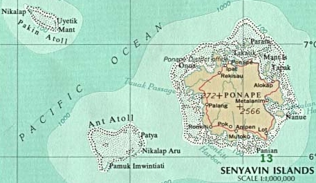
 Senyavin Islands (Pohnpei plus two neighboring atolls)
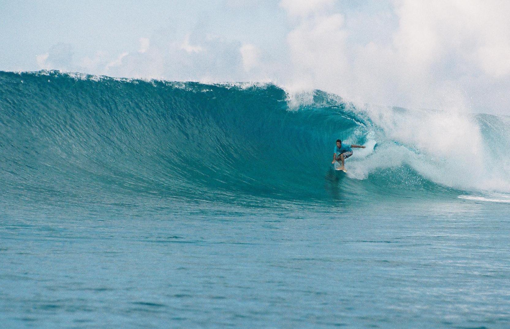
 World Class Surf of Pohnpei's Palikir Pass a.k.a. P-Pass
Pohnpei "upon (pohn) a stone altar (pei)" (formerly known as Ponape)[1] is the name of one of the four states in the Federated States of Micronesia (FSM), situated among the Senyavin Islands which are part of the larger Caroline Islands group. Palikir, the FSM's capital, is located on Pohnpei Island. Pohnpei International Airport (IATA code PNI) is located near Kolonia, on a small island named Deketik off the northern coast of the main island.
Pohnpei Island is the largest, highest, most populous, and most developed single island in the FSM. The islanders of Pohnpei have a reputation as being the most welcoming of outsiders among residents of the island group. The island also contains a wealth of biodiversity.
Pohnpei is one of the wettest places on earth with annual recorded rainfall exceeding 300 inches (7,600 mm) each year in certain mountainous locations.
Contents
Geography
General
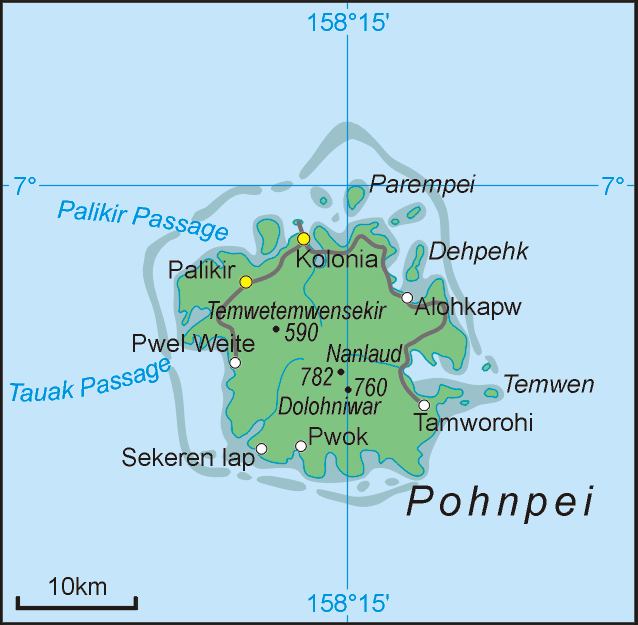
The state of Pohnpei is located in the Pacific Ocean. It is located near the eastern end of the Caroline Islands and is about midway between Honolulu and Manila. Pohnpei's outer islands include Pingelap, Mokil, Ant, Pakin, Ngatik, Nukuoro, and Kapingamarangi. The land area of Pohnpei is given as 133.2 square miles (345 km2). With the exception of coastal plains, talus slopes and alluvial fans most of Pohnpei is ruggedly mountainous, lush and verdant, with the highest peak at 791 metres (2,595 ft). The rainforest is dense and rich; extensive mangrove swamps line much of the low shore. The island is roughly circular in outline, its 80-mile (130 km) circumference is surrounded by a coral reef.
Pohnpei is home to several dozen bird species including four endemic species, the Pohnpei Lorikeet, the Pohnpei Fantail, the Pohnpei Flycatcher and the Long-billed White-eye. A fifth endemic, the Pohnpei Starling, is thought to have recently gone extinct. The only land reptiles are a few species of lizard. Aboriginally, only three mammals existed: rats, bats and dogs. Pigs were introduced, some are now feral, as are the deer brought during German times. The lagoons are rich in fish, mollusks, turtles and other marine fauna.[2]
Population
Pohnpeian historic society was highly structured into five tribes, various clans and sub-clans; each tribe headed by two principal chiefs. The tribes were organized on a feudal basis. In theory, "all land belonged to the chiefs, who received regular tribute and whose rule was absolute." Punishments administered by chiefs included death and banishment. Tribal wars included looting, destruction of houses and canoes and killing of prisoners. "By Spanish times [battles with colonial troops] had become considerably bloodier," a report of one battle alone in 1890 lists 300 Spanish casualties.[3] In the German period officials attempted to identify agitators from both tribal sides and then ship them off to Rabaul in German New Guinea for one year of penal servitude.[4]
Pre-Spanish population estimates are deemed unreliable, however, a drastic population decline occurred after 1854 due to a smallpox epidemic after European contact. The German census of 1911-12 shows 3,190 Pohnpeians, 585 Central Carolinians and 279 Melanesians. Many of the out-islanders were resettled (mainly on Sokehs Island) in consequence of destructive typhoons in their home islands. A special census conducted in late 1947 shows a total population of 5,628, of which 4,451 were Pohnpeians, and 1,177 were natives of other Pacific islands. By 1963 the population had grown to nearly 10,000.[5] The population of the state in 2010 is approximately 34,000. While the majority of the population consider themselves ethnic Pohnpeians, Pohnpei is more ethnically diverse than any other island in the FSM. This is largely due to more than a century of foreign colonial occupation, bringing in Spanish, German, Japanese, Chamorro, Filipino, American, Australian, other western Europeans, and it being home to the capital of the national government, which employs hundreds of people from the other three FSM States (Yap, Chuuk, Kosrae) having distinct ethnic and cultural origins. The indigenous makeup also includes the multiple regional ethnicities of the outer islands within Pohnpei State, resulting in a mix of Australasian Pacific Islanders and hence making Pohnpei Island the FSM's melting pot.
History
Pohnpei's first European visitor was Pedro Fernandez de Quiros, commanding the Spanish ship San Geronimo.[6] He sighted the island on 23 December 1595; his description is brief, he made no attempt to land. A second visitor, for whom good documentation exists, was the Australian John Henry Rowe, his barque John Bull did not arrive until 10 September 1825, he did not land either as his vessel was chased off by native canoes. The first lengthy description of the island and its inhabitants is presented by the Russian explorer Fyodor Litke, whose ship Senyavin gave the island group of Pohnpei, Ant and Pakin its name. From 14 January to 19 January 1828, his boats attempted to land but could not due to the hostility shown by the islanders, but natives then came aboard his ship, "some trading occurred, a short vocabulary was compiled, and a map made."[7] F.H. von Kittlitz, a member of the Litke expedition made a further descriptive account, including the offshore ruins of Nan Madol, and the two reports together provided the first real knowledge of Pohnpei.[7] It is not clear who the next visitors were; however, when Capt. J.H. Eagleston of the barque Peru sighted the island on 3 January 1832 it was already on his charts as “Ascension Island.”[7][8]
From this time onward whaling and trading vessels came in increasing numbers. Very soon a "large colony of beachcombers, escaped convicts, and ship's deserters became established ashore," identified as "chiefly bad characters," according to the log of the Swedish frigate Eugenie.[9] The first missionary to arrive was Father Louis Desiré Maigret, a Roman Catholic priest. He had sailed from Honolulu on the schooner Notre Dame de Paix and began his efforts in December 1837, but he departed on 29 July 1838 for Valparaiso after seven unsuccessful months.[10] In his company were "several Mangarevans and Tahitians," some of whom remained on Pohnpei and left descendants.[11] Ten years later Maigret returned to the Hawaiian kingdom as Bishop of Honolulu.[12] A group of Protestant missionaries from New England established themselves permanently on Pohnpei in 1852. Their letters and journals contain a wealth of information about the island and are preserved at Harvard University.[11]
By 1886 the Spaniards claimed the Caroline Islands and began to exert political authority. In consequence of the 1898 Spanish-American War, the German Empire purchased the Caroline island group from Spain in 1899 together with the Marianas (except Guam) and 4 years later the Marshall Islands for 17 million goldmark.
During the German administration a fundamental change in land ownership was implemented on Pohnpei and throughout the Carolines. Beginning in 1907 the feudal system, where all land is held in fief, was gradually replaced with the issuance of individual deeds to land. The chief's economic advantages were thus reduced, and only force of tradition granted a first harvest tribute to chiefs.[13] With land holding, taxes came due and new owners, in lieu of payment, were obliged to work 15 days per year on public projects, such as wharf construction, road building, etc. One such work for taxes engagement sparked the Sokehs Rebellion. It began as an insubordination event during road construction on Sokehs Island, then escalated into the murder of 9 persons, the subsequent apprehension and trial of 36 Sokehs rebels, the execution of 15 insurgents, and banishment for others to Babelthuap in the German Palau Islands.
With the Treaty of Versailles Japan as mandatory power assumed control of all German colonial possessions north of the equator, having occupied Pohnpei along with the rest of the Carolines, the Marshalls, the Marianas (except for American-owned Guam) and Kiautschou Bay during World War I. In subsequent years and during World War II the Japanese garrison strength was composed of about 2,000 men of the IJN under Captain Jun Naito and 5,984 IJA men under Lieutenant General Masao Watanabe.[14] However, Pohnpei was bypassed by the US Navy during the island-hopping amphibious campaigns of 1943-1945.[14] The island was shelled on several occasions, including by the battleships USS Massachusetts and USS Iowa, as well as air attacks launched from USS Cowpens. In 1945 all Japanese citizens were forced off the island; many of their Pohnpeian family members remained.
The Federated States of Micronesia achieved independence in 1986 after being administered by the United States under UN auspices since 1947 as part of the Trust Territory of the Pacific Islands.
The natives of Pohnpei, especially the 'older' generations, often refer to events in their past as having occurred, e.g., in "German times" or "before the Spaniards," which identifies the historical periods as follows:[11]
-
-
-
-
Period Years Native Period Before 1825 Pre-Spanish Period 1825-1886 Spanish Period 1886-1899 German Period 1899-1914 Japanese Period 1914-1945 American Period 1945-1986 Independence Period Since 1986
-
-
-
Native Language
Pohnpeians have a native language called 'Pohnpeian' (former spelling 'Ponapean'). The Pohnpeian language is spoken in different dialects.
Administrative divisions
Municipalities of Pohnpei:
- Kapingamarangi (far southwest atoll)
- Kitti (main island, southwest — includes Ant/Ahnd Atoll)
- Kolonia (main island, north)
- Madolenihmw (main island, east)
- Mokil Atoll (near east atoll)
- Nett (main island, north/center, formerly including state capital Kolonia on the north coast)
- Ngatik (near southwest atoll)
- Nukuoro (southwest atoll)
- Oroluk (west atoll, includes Minto Reef)
- Pingelap (far east atoll)
- Sokehs (main island, northwest — includes Pakin Atoll)
- U (main island, northeast)
Nearby islands
- The atoll of Pingelap, located 270 kilometres (170 mi) to the east of Pohnpei, but part of Pohnpei State, is notable for the prevalence of the extreme form of color blindness known as maskun. Maskun is relatively rare but often shows up in communities with small gene pools. Pingelap was featured in the book The Island of the Colorblind by neurologist Oliver Sacks. His account includes detailed descriptions of Pohnpei, and of a Pingelap immigrant community on the island.
- The ancient artificial islands of Nan Madol are immediately adjacent to Pohnpei.
- Oroluk Atoll
Sport
Pohnpei is incorrectly said to have a national soccer team described as "the worst team in the world."[15] Pohnpei is, however, not a nation - it is but one of four states in the FSM. A Pohnpei football team is currently active and moves are underway to re-create a national Federated States of Micronesia team.
The FSM is part of the international Olympic movement and sent teams to the last two summer games in Beijing and Sydney with athletes participating in track and field, swimming and weightlifting, but not soccer. The FSM last organized a national football side for the South Pacific Games football tournament in 2003, where it lost all its matches. Prior to that tournament, however, the FSM National team went undefeated winning the Micronesian Cup 1999. The most notable Pohnpeian athlete is marathoner Elias Rodriguez who ran for the FSM at the Sydney Olympics. Rodriguez finished last in the marathon but was cheered on by tens of thousands of spectators and watched by millions of television viewers as he entered the Olympic stadium for a final lap immediately prior to the closing ceremony which was delayed to allow his finish.
With its spectacular and relatively unspoiled coral reefs, Pohnpei has long had a following among deep-sea fishermen and SCUBA enthusiasts.
Pohnpei in fiction
Pohnpei plays a central role in the fictional Cthulhu Mythos, in which it is only about a ten days journey by fast ship away from the fictional sunken city of R'lyeh, where Cthulhu resides. Several stories by H. P. Lovecraft, August Derleth and others use this island as a setting or contain references to it.
Pohnpei's role in the Mythos was inspired by the ruins of Nan Madol (see above), which had already been used as the setting for a lost race story by Abraham Merritt, The Moon Pool, in which the islands are called Nan-Matal.[16] Some people believe Nan Madol to be connected to the lost continent of Lemuria.
Pohnpei and the ruins of Nan Madol also play a central role in author James Rollins' book, Deep Fathom.
These are also featured in Clive Cussler's 2009 novel Medusa.
Pohnpei, or "Ponape" as it is spelled, is stated as the home island of "Mike" on the popular blog Dunce Upon A Time, authored by BC Woods.[17]
See also
Notes
- ^ http://books.google.com/books?id=OzgF5vZByVoC&lpg=PR11&ots=SVZC-pKq70&dq=upon%20a%20stone%20altar%20david%20hanlon&lr&pg=PR15#v=onepage&q&f=false
- ^ The foregoing is compiled partially from Pacific Islands Year Book, Judy Tudor, editor. Sydney: Pacific Publications. Tenth Edition, January 1968; Eleventh Edition, January 1972
- ^ Riesenberg, S.H. The Native Polity of Ponape. Washington: Smithsonian Institution Press, 1968 (Smithsonian Contributions to Anthropology, Volume 10), p. 60
- ^ Riesenberg, p. 62
- ^ Riesenberg, p. 6
- ^ Riesenberg, p. 2
- ^ a b c Riesenberg, p. 3
- ^ Riesenberg writes that it is uncertain who first called it Ascension Island, but the name became established until the Spanish period
- ^ Riesenberg, p. 4
- ^ Bunson, Maggie. Faith in Paradise. Boston: St. Paul Publishing. 1977, p. 43
- ^ a b c Riesenberg, p. 5
- ^ Bunson, p. 65
- ^ Riesenberg, p. 29
- ^ a b Takizawa, Akira; Alsleben, Allan (1999-2000). "Japanese garrisons on the by-passed Pacific Islands 1944-1945". Forgotten Campaign: The Dutch East Indies Campaign 1941-1942. http://www.dutcheastindies.webs.com/japan_garrison.html.
- ^ Bristol Evening Post, 14 August 2009.
- ^ "they had set forth for the Nan-Matal, that extraordinary group of island ruins clustered along the eastern shore of Ponape in the Carolines"
- ^ "The Micronesian Elvis". Dunce Upon A Time. 2007-08-30. http://www.dunceuponatime.com/the-micronesian-elvis. Retrieved 2009-08-17.
References
- L, Klemen (1999-2000). "Forgotten Campaign: The Dutch East Indies Campaign 1941-1942". http://www.dutcheastindies.webs.com/index.html.
Further reading
- The Island of the Colour-blind, Oliver Sacks, Publisher: Pan Macmillan (June 6, 1997), paperback, ISBN 0-330-35234-2.
- Upon a Stone Altar:A History of the Island of Pohnpei to 1890, David Hanlon, Publisher: University of Hawaii Press (May, 1988), paperpack, ISBN 978-0-8248-1124-2
- Pohnpei, an Island Argosy, Gene Ashby, Publisher: Rainy Day Pr West; Revised edition (June 1987), paperback, ISBN 978-0931742149
- Nest in the Wind: Adventures in anthropology on a tropical island, Martha C Ward, Publisher: Waveland Press Inc. (1989), paperback, ISBN 0-88133-405-7
- Thomas Morlang: Rebellion in der Südsee. Der Aufstand auf Ponape gegen die deutschen Kolonialherren 1919/1911, Christoph Links Verlag, Berlin, Germany ISBN 978-3-861513-604-8
External links
- Palikir Marine Adventures
- The Surf Travel Company
- The undisclosed Surfer magazine cover of Dan Malloy riding Palikir Pass, Pohnpei, the Federated States of Micronesia, February 2000
- myMicronesia/Pohnpei section
- Pohnpei-Between Time & Tide
- A Tour of Pohnpei
- FSM Visitors Board/Pohnpei Section
- Jane's Pohnpei Page
- Postcards from Pohnpei: marine life
- Micronesia Conservation Trust
- Pohnpei travel guide at Travellerspoint
Federated States of Micronesia Politics Elections · Political parties · President · Congress · Constitution · Foreign relations · Law enforcement · Military · Compact of Free Association
History Geography Economy Culture Categories:- States of the Federated States of Micronesia
- Islands of Pohnpei
- Pohnpei
-


Wikimedia Foundation. 2010.