- Oroluk Atoll
-
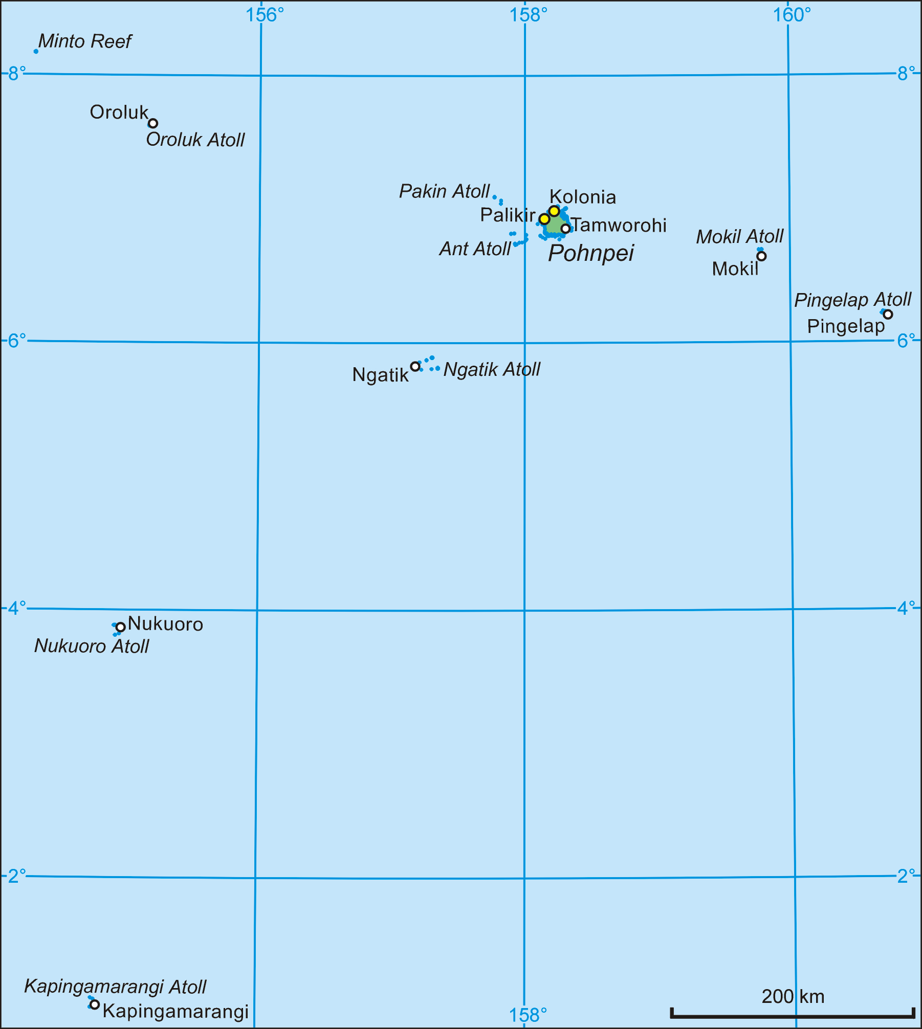
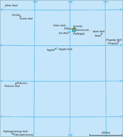 Map of Pohnpei State (with Oroluk Atoll)
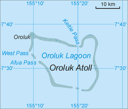 Map of Oroluk Atoll
Oroluk Atoll is an atoll belonging to Pohnpei State in the Micronesia.
Description
Oroluk Atoll stretches from the northwest to the southeast with a length of about 32 km (20 mi) and an average width of 20 km (12 mi). The lagoon's surface is roughly 420 km2 (162 sq mi).
The more than 25 sandy islets and banks, predominantly on the eastern rim of the atoll, have been washed away by cyclones through the years. Only one island remains, Oroluk Island in the very northwest corner of the atoll. Oroluk Atoll is believed to have been first discovered and named by navigators from Namoluk Island in the Mortlock Islands.
The inhabitants of Oroluk are only between eight and ten in number. They come mainly from Sector 4 of the Kapinga Village in Kolonia, Pohnpei, and tend to the plantations of bananas and taro. A supply ship generally calls into the lagoon once every 6 weeks. The island can be contacted by SSB on the frequency 7876.5 daily at 0600Z for a period of 15 minutes
Municipality
Oroluk municipality, which includes Oroluk Atoll and Minto Reef is one of the twelve municipalties of Pohnpei State.
External links
- Heinrich Schnee, Deutsches Kolonial-Lexikon. Quelle & Meyer, Leipzig 1920, Band II, S. 684
- Havarie der Norna (1861)
Coordinates: 7°26′47″N 155°21′30″E / 7.44639°N 155.35833°E
Categories:- Atolls of the Federated States of Micronesia
- Pohnpei
- Federated States of Micronesia geography stubs

Wikimedia Foundation. 2010.