- Cintheaux
-
Cintheaux

 CintheauxLocation within Lower Normandy region
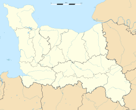 Cintheaux
Administration Country France Region Lower Normandy Department Calvados Arrondissement Caen Canton Bretteville-sur-Laize Intercommunality Cingal Mayor Michel Le Baron
(2008–2014)Statistics Elevation 69–122 m (226–400 ft)
(avg. 118 m/387 ft)Land area1 7.58 km2 (2.93 sq mi) Population2 188 (2008) - Density 25 /km2 (65 /sq mi) INSEE/Postal code 14160/ 14680 1 French Land Register data, which excludes lakes, ponds, glaciers > 1 km² (0.386 sq mi or 247 acres) and river estuaries. 2 Population without double counting: residents of multiple communes (e.g., students and military personnel) only counted once. Coordinates: 49°03′22″N 0°17′27″W / 49.0561111111°N 0.290833333333°W
Cintheaux is a commune in the Calvados department in the Basse-Normandie region in northwestern France.
Contents
Geography
The commune is located between Caen and Falaise and is the home to the Bretteville-sur-Laize Canadian War Cemetery.
Gaumesnil was originally a separate village, now attached to Cintheaux; it has fewer than 19 residents.
Sights
The main town is situated around the church of Saint-Germain, classified as an official French historic monument. It was built around 1150 by the Marmion family; Robert Marmion offered it in patronage to the Barbery Abbey, subject to the Bayeux diocese, in 1181. The main (north) chapel and the cross tower, dating to the 16th century, was destroyed in 1688. The north bell tower was added in the 18th century. The church was restored between 1857 and 1902.
History
World War II
Cintheaux was devastated by American artillery, which sought to annihilate the 12th SS Panzer Division in 1944, during Operation Totalize.
Population
Historical population of Cintheaux 1962 1968 1975 1982 1990 1999 2008 190 172 159 161 172 180 188 See also
References
Categories:- Communes of Calvados
- Calvados geography stubs


Wikimedia Foundation. 2010.