- Dozulé
-
Dozulé


 DozuléLocation within Lower Normandy region
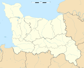 Dozulé
Administration Country France Region Lower Normandy Department Calvados Arrondissement Lisieux Canton Dozulé Intercommunality Pays d'Auge dozuléen Mayor Sophie Gaugain
(2008–2014)Statistics Elevation 8–139 m (26–456 ft)
(avg. 22 m/72 ft)Land area1 5.23 km2 (2.02 sq mi) Population2 1,899 (2008) - Density 363 /km2 (940 /sq mi) INSEE/Postal code 14229/ 14430 1 French Land Register data, which excludes lakes, ponds, glaciers > 1 km² (0.386 sq mi or 247 acres) and river estuaries. 2 Population without double counting: residents of multiple communes (e.g., students and military personnel) only counted once. Coordinates: 49°13′57″N 0°02′31″W / 49.2325°N 0.0419°W
Dozulé is a commune in the Calvados department in the Basse-Normandie region in northern France.
Contents
Population
Historical population of Dozulé 1962 1968 1975 1982 1990 1999 2008 934 984 1279 1407 1515 1615 1899 Twin towns
Dozule is twinned with Leonard Stanley, a village in Gloucestershire, United Kingdom.
See also
- Cross of Dozulé
- Movement of Love Saint Juan Diego
- Communes of the Calvados department
References
Categories:- Communes of Calvados
- Calvados geography stubs


Wikimedia Foundation. 2010.