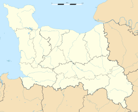
- Deux-Jumeaux
-
Deux-Jumeaux
Administration Country France Region Lower Normandy Department Calvados Arrondissement Bayeux Canton Isigny-sur-Mer Intercommunality Isigny Grandcamp Intercom Mayor Jacques Planchon
(2008–2014)Statistics Elevation 8–47 m (26–154 ft)
(avg. 48 m/157 ft)Land area1 4.07 km2 (1.57 sq mi) Population2 77 (2008) - Density 19 /km2 (49 /sq mi) INSEE/Postal code 14224/ 14230 1 French Land Register data, which excludes lakes, ponds, glaciers > 1 km² (0.386 sq mi or 247 acres) and river estuaries. 2 Population without double counting: residents of multiple communes (e.g., students and military personnel) only counted once. Coordinates: 49°20′55″N 0°57′45″W / 49.34871°N 0.96257°W
Deux-Jumeaux is a commune in the Calvados department in the Basse-Normandie region in northwestern France.
Contents
History
World War II
After the liberation of the area by Allied Forces in early June 1944, engineers of the Ninth Air Force IX Engineering Command began construction of a combat Advanced Landing Ground to the northeast of the town. Declared operational on 30 June, the airfield was designated as "A-4", it was used by the 48th Fighter Group which flew P-47 Thunderbolts until the end of August when the unit moved into Central France. Afterward, the airfield was closed.[1][2]
Population
Historical population of Deux-Jumeaux 1962 1968 1975 1982 1990 1999 2008 152 138 102 101 78 69 77 See also
References
- ^ Johnson, David C. (1988), U.S. Army Air Forces Continental Airfields (ETO), D-Day to V-E Day; Research Division, USAF Historical Research Center, Maxwell AFB, Alabama.
- ^ Maurer, Maurer. Air Force Combat Units of World War II. Maxwell AFB, Alabama: Office of Air Force History, 1983. ISBN 0-89201-092-4.
Categories:- Communes of Calvados
- Calvados geography stubs
Wikimedia Foundation. 2010.


