- Freestone, California
Infobox Settlement
official_name = Freestone, California
imagesize =
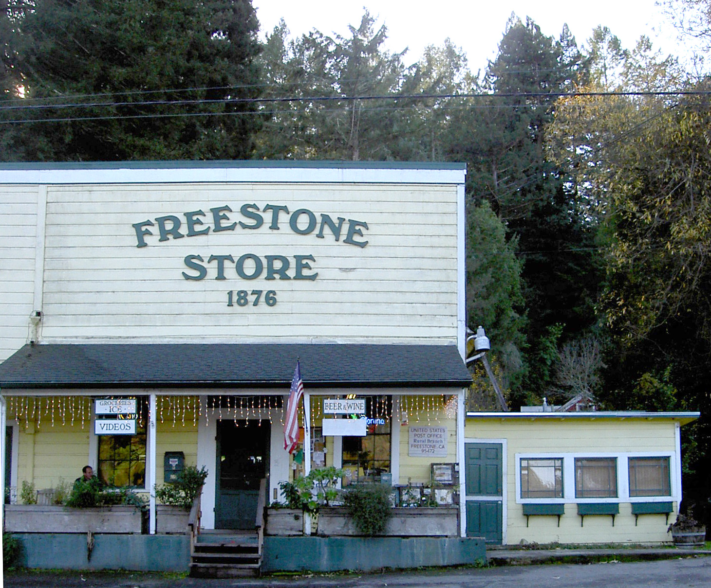
image_caption = The Freestone general store as of 2007.
pushpin_
pushpin_label_position = right
pushpin_map_caption = Location within the state of California
subdivision_type = Country
subdivision_name =United States
subdivision_type1 = State
subdivision_name1 =California
subdivision_type2 = County
subdivision_name2 = Sonoma
timezone = PST
utc_offset = -8
timezone_DST = PDT
utc_offset_DST = -7
latd = 38 |latm = 22 |lats = 21 |latNS = N
longd = 122 |longm = 54 |longs = 56 |longEW = W
elevation_footnotes = gnis|1658578|Freestone]
elevation_m = 67
elevation_ft = 220
postal_code_type =ZIP code
postal_code = 95472
area_code = 707
blank_name = FIPS code
blank_info = 06-25618
blank1_name = GNIS feature ID
blank1_info = 1658578Freestone is a small, unincorporated community in Sonoma County,
California , USA located at the intersection of Bohemian Highway and Bodega Highway. It's west of Sebastopol along Salmon Creek on the U.S. Geological Survey 7.5-minute quadrangle, "Valley Ford, California".Local landmarks include the Wild Flour Bread bakery and Osmosis enzyme-bath and spa.
The
ZIP code for Freestone is 95472, which it shares with Sebastopol and two other communities.History
The town's name dates back to 1853 and refers to a public sandstone quarry. Starting in the 1873, Freestone was a stop on the
North Pacific Coast Railroad cite web
url=http://users.ap.net/~chenae/socotown.html
title=Towns of Sonoma County
accessdate=2008-01-31] which eventually connected Cazadero to the Sausalito ferry.References
*U.S. Geological Survey, National Geographic Names Database.
*External links
Geographic Location
Centre = Freestone
North = Occidental
Northeast = Graton
East = Sebastopol
Southeast = Bloomfield
South = Valley Ford
Southwest =
West = Bodega
Northwest =
Wikimedia Foundation. 2010.


