- Scarba
-
Scarba Location 
 Scarba
Scarba shown within Scotland OS grid reference NM690044 Names Gaelic name Sgarba Pronunciation [ˈs̪kaɾapə] (  listen)
Norse name Skarpoe Meaning of name Old Norse for "sharp, stony, hilly terrain" Area and summit Area 1,474 hectares (5.7 sq mi) Area rank 39 Highest elevation Cruach Scarba 449 metres (1,473 ft) Population Population Not permanently inhabited since the 1960s Main settlement Kilmory Lodge Groupings Island group Islay Local Authority Argyll and Bute 

References [1][2][3] If shown, area and population ranks are for all Scottish islands and all inhabited Scottish islands respectively. Population data is from 2001 census. Cruach Scarba (Scottish Gaelic: Cruach Sgarba) Elevation 449 m (1,473 ft) Prominence 449 m (1,473 ft) Listing Marilyn Translation Hill of Scarba (Gaelic) Pronunciation  ˈkʰɾuəx ˈs̪kaɾapə (help·info)
Location Location Inner Hebrides, Scotland Topo map OS Landranger 55 OS grid NM690044 Scarba (Scottish Gaelic: Sgarba) is a small island, in Argyll and Bute, Scotland, just north of the much larger island of Jura. The island is owned by Richard Hill, 7th Baron Sandys and has not been permanently inhabited since the 1960s.[2] It is now covered in heather and used for grazing animals. Kilmory Lodge is used seasonally as a shooting lodge, the island having a flourishing herd of red deer.
The island's name is from the Norse and may mean "sharp, stony, hilly terrain"[2] or "cormorant island".[4]
Contents
Description
Scarba is not served by any public ferries, but access from Craobh Haven or Crinan Harbour is possible by arrangement with local boatmen. The rough summit ridge can be accessed from the harbour at the north end, from where a vehicle track leads up past Kilmory Lodge to a height of about 200 metres. After that, there are no paths or well defined routes, and the terrain becomes rough and boggy. The island rises steeply to a peak (Cruach Scarba) of 449 metres (1,473 ft). Although there are no technical difficulties, the summits are often shrouded in mist, through which navigation skill may be required. A cylindrical triangulation point marks the highest of several summits, which are surrounded by several small lochs.
Corryvreckan
Between Scarba and Jura lies the Gulf of Corryvreckan, known for its whirlpool. Writing in 1549, Dean Monro wrote of "Skarbay" that between it and "Duray":
Ther runnes ane streame, above the power of all sailing and rowing, with infinit dangers, callit Corybrekan. This stream is aught myle lang, quhilk may not be hantit bot be certain tyds. This Skarbay is four myles lange from the west to the eist, and an myle breadth, ane high rough yle, inhabit and manurit, with some woods in it.[5]
Scarba and a few nearby islets (Lunga and the Garvellachs) are collectively the Scarba, Lunga and the Garvellachs National Scenic Area.
Gallery
-

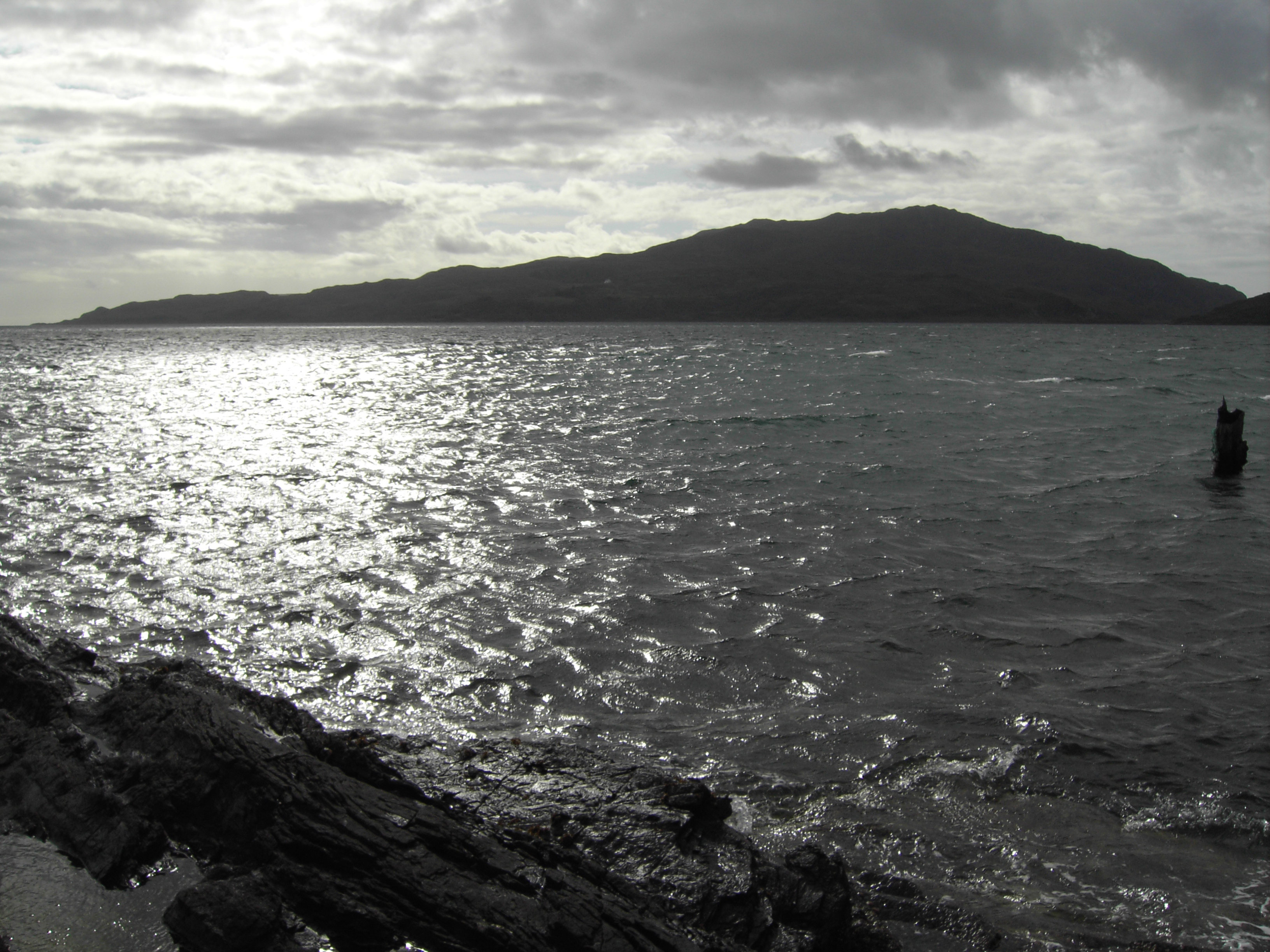
The Corryvreckan whirlpool
-

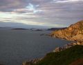
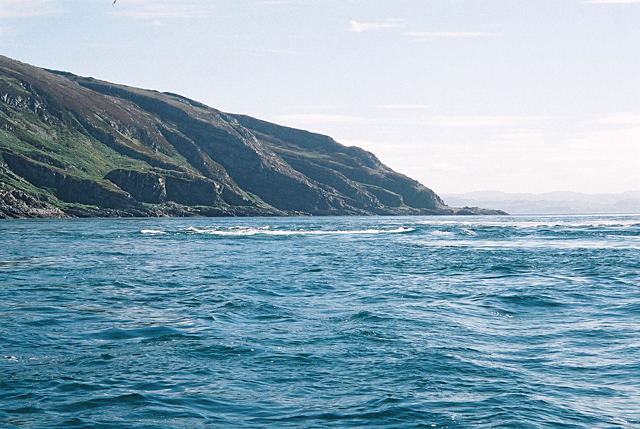
The view from Luing looking towards Scarba
-
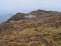
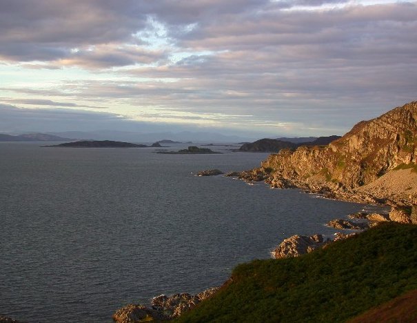
Na h-Urrachann, Isle of Scarba, looking north towards the Slate Islands
-
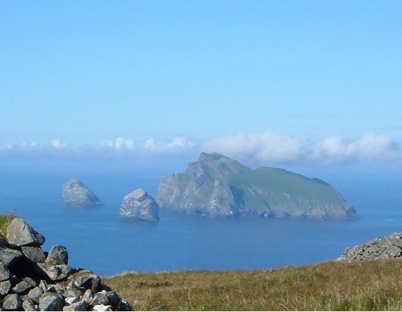
A view northwards along the summit ridge from a short distance north of the highest point.
Footnotes
- ^ 2001 UK Census per List of islands of Scotland
- ^ a b c Haswell-Smith (2004) p. 60
- ^ Ordnance Survey
- ^ Mac an Tàilleir (2003) p. 104
- ^ Monro (1594) "Skarbay" No. 16
References
- Monro, Sir Donald (1549) A Description Of The Western Isles of Scotland. Appin Regiment/Appin Historical Society. Retrieved 3 March 2007. First published in 1774.
- Iain Mac an Tàilleir. "Placenames" (pdf). Pàrlamaid na h-Alba. http://www.scottish.parliament.uk/vli/language/gaelic/pdfs/placenamesP-Z.pdf. Retrieved 23 July 2010.
National Scenic Areas in Scotland The Borders Firth of Clyde and Mainland Argyll Stirling Perth and Kinross Grampians Highland Assynt-Coigach • Ben Nevis and Glen Coe • Dornoch Firth • Glen Affric • Glen Strathfarrar • Kintail • Knoydart • Kyle of Tongue • Loch Shiel • Morar, Moidart and Ardnamurchan • North-West Sutherland • Wester RossHebrides The Cuillin Hills • Jura • Lynn of Lorn • Loch na Keal, Isle of Mull • Scarba, Lunga and The Garvellachs • Small Isles • St Kilda • South Lewis, Harris and North Uist • South Uist Machair • TrotternishNorthern Isles Islands of Scotland Northern Isles 
Hebrides Other Coordinates: 56°10′34″N 5°43′24″W / 56.17607°N 5.72324°W
Categories:- Islands of the Inner Hebrides
- Argyll and Bute
- National Scenic Areas in Scotland
- Marilyns of Scotland
- Mountains and hills of the Scottish islands
- Mountains and hills of Argyll and Bute
- Scottish protected area stubs
- Argyll and Bute geography stubs
-

Wikimedia Foundation. 2010.