- Mila, Algeria
-
Mila (Arabic: ميلة) is a city in the Northeast of Algeria, capital of Mila Province. In antiquity, in was known by its Latin name Milevum, which is currently a titular episcopal see in the Roman province of Numidia.
Contents
History
Antique history
In Ptolemy's "Geography", IV, iii, 7, the city is mentioned under the name of Mileum or Mireon. During the Roman era it was called Colonia Sarnensis Milevitana, after the River Sarnus in Campania, whence the colonists had emigrated. This name is often found in the inscriptions of the city. Together with Cirta, Collo and Rusicade, Milevum formed the confederation known as the Four Colonies, the territory of which was very extensive. In the sixth century the Byzantine Emperor Justinian had Milevum enclosed by a fortified wall, which still stands and forms a rampart for the muslim city of Mila [1]. It has yielded quite a number of Latin inscriptions from this city and a colossal statue of Saturn. Two councils were held at Milevum, one in 402 and the other in 416. The second appealed to Pope Innocent I for the repression of the Pelagian heresy. Among the bishops of this titular see were Pollianus, present at the Council of Carthage in 255 and martyred two years later; St. Optatus, noted for his work against the Donatists, died circa 385, and commemorated on 4 June; Honorius; Severus, fellow-countryman and friend of St. Augustine Benenanus (484); Restitutus, who attended the Fifth Œcumenical Council in 553. Between 675 and 682 the city may have been conquered by the Umayyad Arabs commanded by Abu al-Muhajir Dinar[2]. In the 14th century Ibn Khaldun described it as being a town dominated by Kutama Berbers. Dr. Robert Brown, in an early 20th century edition of Leo Africanus' geographical work on Africa, described it as a significant European population, with the city having a 'Berber quarter'.
Modern history
Milevum, modern Arabic name Mila, was under French colonial rule a city in the department of Constantine in Algeria, with in the early 20th century 8000 inhabitants, 400 of whom are Europeans. That department later became Constantine Province after the indepence of Algeria, of which Mila was dependent till the creation of Mila Province in 1984. As of 1998, the most recent census in the country, the city has a population of 59,959.
Notes
- ^ Ch. Diehl, Afrique byzantine, Paris, 1896, 603 sq.
- ^ Mila is the name given by the 9th-century historian Khalifa ibn Khayyat but this might perhaps refer to the Numidian fortress of Gemellae near the modern-day village of Mlili; see article by Benabbès cited below.
Source
 "Milevum". Catholic Encyclopedia. New York: Robert Appleton Company. 1913.
- A. Benabbès: "Les premiers raids arabes en Numidie byzantine: questions toponymiques." In Identités et Cultures dans l'Algérie Antique, University of Rouen, 2005 (ISBN 2-87775-391-3)
- P. Trousset (2002). Les limites sud de la réoccupation Byzantine. Antiquité Tardive v. 10, p. 143-150.
This article incorporates text from a publication now in the public domain: Herbermann, Charles, ed (1913). "Milevum". Catholic Encyclopedia. Robert Appleton Company.Provincial seats of Algeria Adrar • Aïn Defla • Aïn Témouchent • Algiers • Annaba • Batna • Béchar • Béjaïa • Biskra • Blida • Bordj Bou Arréridj • Bouïra • Boumerdès • Chlef • Constantine • Djelfa • El Bayadh • El Oued • El Taref • Ghardaïa • Guelma • Illizi • Jijel • Khenchela • Laghouat • Mascara • Médéa • Mila • Mostaganem • M'Sila • Naâma • Oran • Ouargla • Oum el-Bouaghi • Relizane • Saida • Sétif • Sidi Bel Abbès • Skikda • Souk Ahras • Tamanrasset • Tébessa • Tiaret • Tindouf • Tipaza • Tissemsilt • Tizi Ouzou • Tlemcen
Coordinates: 36°27′01″N 6°15′52″E / 36.45028°N 6.26444°E
Capital: MilaDistricts Aïn Beida Harriche · Bouhatem · Chelghoum Laïd · Ferdjioua · Grarem Gouga · Mila · Oued Endja · Rouached · Sidi Merouane · Tadjenanet · Tassadane Haddada · Teleghma · Terrai Bainem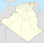
Communes Ahmed Rachedi · Aïn Beida Harriche · Aïn Mellouk · Aïn Tine · Amira Arras · Benyahia Abderrahmane · Bouhatem · Chelghoum Laid · Chigara · Derradji Bousselah · El Mechira · Elayadi Barbes · Ferdjioua · Grarem Gouga · Hamala · Mila · Minar Zarza · Oued Athmania · Oued Endja · Oued Seguen · Ouled Khalouf · Rouached · Sidi Khelifa · Sidi Merouane · Tadjenanet · Tassadane Haddada · Telerghma · Terrai Bainem · Tessala Ldematai · Tiberguent · Yahia Beniguecha · ZeghaiaCategories:- Province seats of Algeria
- Populated places in Mila Province
- Communes of Algeria
- Archaeological sites in Algeria
- History of Algeria
- History of North Africa
- Algeria geography stubs

Wikimedia Foundation. 2010.