- Béchar
-
Béchar
بلدية بشار— Municipality — Commune of Béchar Location of Béchar within Algeria
 Béchar
Coordinates: 31°37′N 2°13′W / 31.617°N 2.217°WCoordinates: 31°37′N 2°13′W / 31.617°N 2.217°W Country  Algeria
Province Béchar (seat) District Béchar (coextensive) Government – PMA Seats 23 Area – Total 5,050 km2 (1,949.8 sq mi) Elevation 747 m (2,451 ft) Population (1998) – Total 134,954 – Density 26.7/km2 (69.2/sq mi) Time zone CET (UTC+01) Postal code 08000 ONS code 0801 Béchar (Arabic: بشار), formerly known as Colomb-Béchar, is a capital city of Béchar Province, Algeria. The area is controlled by Algeria, though claims have also been made on it by Morocco. In 1998 the city had a population of 134,954.
Before coal was found here in 1907, Bechar was a small populated town. It thrived on the activity of the coal mines until petroleum production seized the market.
The city is noted for its leatherwork and jewellery. Dates, vegetables, figs, cereals and almonds are produced near Béchar. Bituminous coal reserves in the region are not exploited to their greatest potential because of high transportation costs. The city was once the site of a French Foreign Legion post.
Near Béchar, there is Kenadsa longwave transmitter, whose masts are the tallest structures in Algeria.
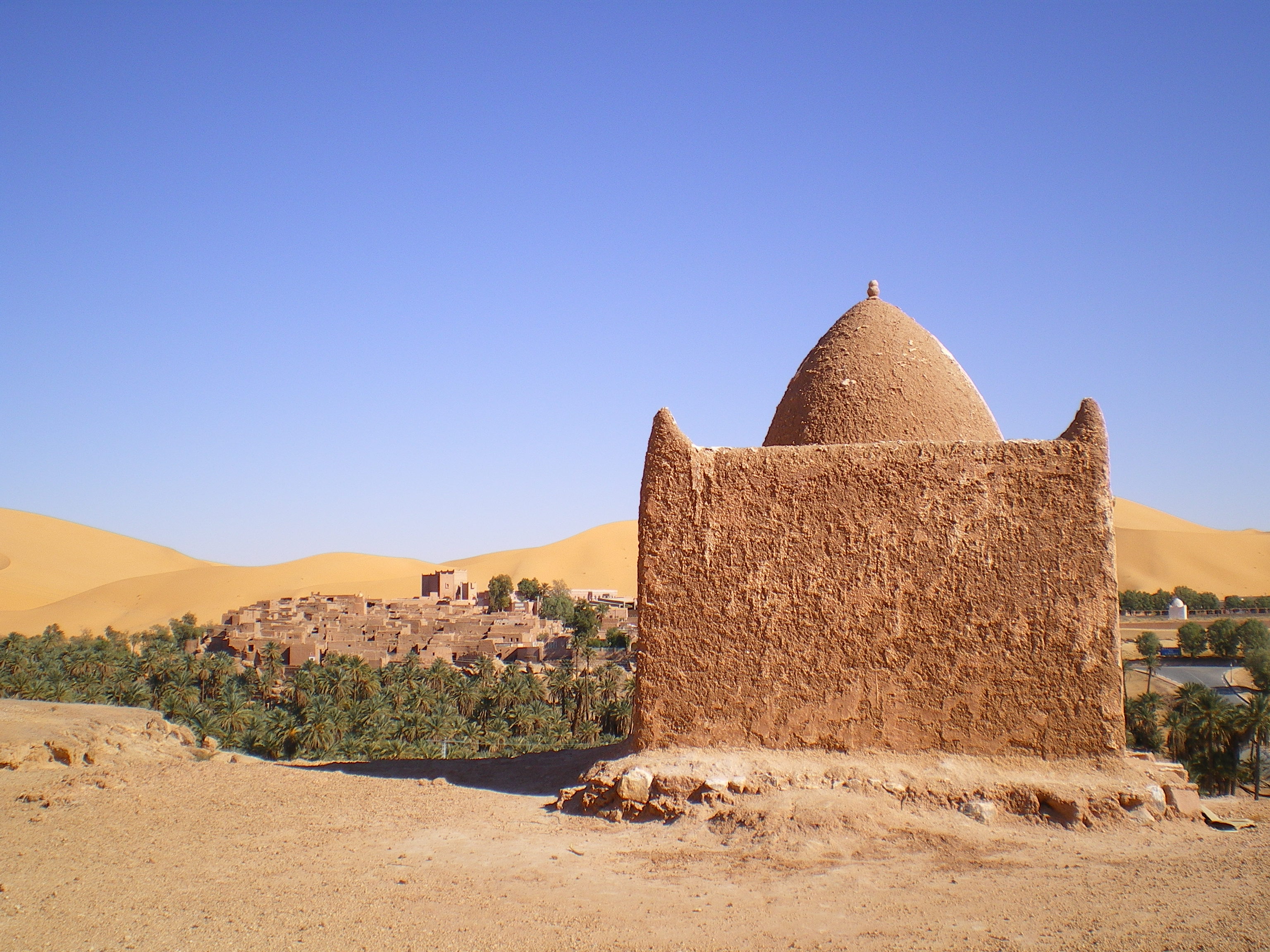
 Photo of Qibba, Thaghirt Oasis (Béchar, Algerie).
Contents
Location
Béchar is located in northwestern region of Algeria roughly 58 km south of the Moroccan border.
Climate
Climate data for Bechar Month Jan Feb Mar Apr May Jun Jul Aug Sep Oct Nov Dec Year Average high °C (°F) 15.9
(60.6)18.8
(65.8)22.4
(72.3)26.2
(79.2)30.6
(87.1)40.1
(104.2)40.1
(104.2)39.2
(102.6)34.2
(93.6)27.5
(81.5)20.9
(69.6)17
(63)27.74
(81.94)Average low °C (°F) 3.5
(38.3)6.0
(42.8)9.8
(49.6)13.7
(56.7)18.3
(64.9)23.5
(74.3)26.9
(80.4)26.5
(79.7)21.9
(71.4)15.6
(60.1)9.2
(48.6)4.8
(40.6)14.98
(58.96)Precipitation mm (inches) 9.0
(0.354)8.5
(0.335)8.8
(0.346)7.5
(0.295)5.3
(0.209)5.0
(0.197)0.7
(0.028)2.0
(0.079)7.4
(0.291)10.6
(0.417)13.6
(0.535)8.2
(0.323)86.6
(3.409)Avg. precipitation days 2 2 2 2 2 2 1 1 3 3 2 2 24 Source: World Meteorological Organization (UN) Transport
It is served by a narrow gauge railway station of SNTF, which in 2008, may be replaced with a standard gauge railway. From 1941 to 1963 it was reached by the standard gauge Mediterranean-Niger-Railway.
Historical population
Year Population[1] 1936 5,100 1954 43,300 1966 46,500 1977 56,600 (town)
72,800 (municipality)1987 107,300 1998 134,500 See also
References
Provincial seats of Algeria Adrar • Aïn Defla • Aïn Témouchent • Algiers • Annaba • Batna • Béchar • Béjaïa • Biskra • Blida • Bordj Bou Arréridj • Bouïra • Boumerdès • Chlef • Constantine • Djelfa • El Bayadh • El Oued • El Taref • Ghardaïa • Guelma • Illizi • Jijel • Khenchela • Laghouat • Mascara • Médéa • Mila • Mostaganem • M'Sila • Naâma • Oran • Ouargla • Oum el-Bouaghi • Relizane • Saida • Sétif • Sidi Bel Abbès • Skikda • Souk Ahras • Tamanrasset • Tébessa • Tiaret • Tindouf • Tipaza • Tissemsilt • Tizi Ouzou • Tlemcen Categories:
- Province seats of Algeria
- Populated places in Béchar Province
- Communes of Algeria
- Algeria geography stubs

Wikimedia Foundation. 2010.