- Davenport, Greater Manchester
-
Coordinates: 53°23′18″N 2°09′32″W / 53.388374°N 2.158888°W
Davenport 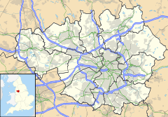
 Davenport
Davenport shown within Greater ManchesterPopulation 11,764 OS grid reference SJ895879 District Stockport Shire county Greater Manchester Region North West Country England Sovereign state United Kingdom Post town STOCKPORT Postcode district SK7 Dialling code 0161 Police Greater Manchester Fire Greater Manchester Ambulance North West EU Parliament North West England UK Parliament Stockport List of places: UK • England • Greater Manchester Davenport is a district of Stockport, Greater Manchester in the North West region of England.
Contents
History
Davenport's name arose from the building of Davenport railway station at the behest of the Davenport family who since the later 14th century had owned nearby Bramall Hall in the neighbouring village of Bramhall. The family, in its turn, took its name from their ancestral estate of that name located between Holmes Chapel and Congleton, in mid-Cheshire, an estate recorded in the Domesday Book of 1086, where it is listed as 'Deneport'.
Originally Davenport's expansion in the 1850s consisted of three key routes; Bramhall Lane, Kennerley Road and Buxton Road, all of which remain in place today.
The aforementioned railway station is positioned at Davenport's main road junction, and allows travel by rail towards Manchester, Stockport and Buxton.
The 1900s saw an increase in construction of residential houses and commercial developments. Later, the aftermath of World War II saw the demolition of larger, older properties, standing in quite extensive gardens, to make way for the building of smaller private residences and flats in Davenport.
Building continues in Davenport in the present day, as its appeal to those on the property market increases.
Politics
Since 2011 Davenport has been represented by two Labour Councillors and one Liberal Democrat Councillor. Brian Hendley was elected as a Labour Councillor in 2011 with a majority of 1,264. David White left the Liberal Democrats in February 2011 and is now also a Labour Councillor.
David White was returned with a majority of 421 in 2010
David White is Vice Chair of the Central Stockport Area Committee.
Ann Smith was returned in 2008 with a majority of 480.
Ann Smith is Vice Chair of the Children and Young People Scrutiny Committee.
The Davenport and Cale Green Ward Councillors are recognised as standing up for Davenport and Cale Green Ward.Places of interest
Davenport is home to a favoured local shopping community through its link to Stockport, with a number of local businesses setting up retail ventures within the district. A list of local shops, businesses and other amenities can be found on the Bramhall Lane website.
Davenport railway station remains a focal point and link for residents, wishing to commute to convenient town centre Stockport, or city centre Manchester. A primary bus route supported by Stagecoach services is also accessible, with the popular 192 service running regularly through Buxton Road.
Praised for its continued efforts to retain environmental heritage, Cale Green Park is a popular local attraction for residents of all ages, with its own bowling green, tennis court and playground.
The local public house is known as the Jolly Sailor.
Education
Residents have a breadth of options for schooling, within local Adswood, Adswood Primary School and St Ambrose Catholic Primary School are the nearest options for introductory education. Hillcrest Grammar School is an independent, co-educational school catering for ages 2½ to 16.
Stockport Grammar School (mixed, independent, founded 1485)lies next to Davenport Park on Buxton Road, whilst immediately across the road is the loacal authority comprehensive, Stockport School.
Another of Davenport's other educational facilities within the village, Oriel Bank High School - an independent girls' school, closed in 2005, and has been converted back to housing.
A full list of schools within Stockport's Local Education Authority can be found here. [1]
Areas and suburbs of Stockport Brinnington · Bosden Farm · Cale Green · Cheadle Heath · Davenport · Davenport Park · Edgeley · Foggbrook · Great Moor · Heaviley · Heaton Chapel · Heaton Mersey · Heaton Moor · Heaton Norris · Little Moor · North Reddish · Offerton · Offerton Green · Portwood · Reddish · Reddish Green · Reddish Vale · Shaw Heath · South Reddish · Stepping Hill · WoodsmoorCategories:- Districts of Greater Manchester
- Geography of Stockport

Wikimedia Foundation. 2010.