- New York State Route 337
-
This article is about the current alignment of NY 337. For previous alignments of NY 337, see New York State Route 337 (disambiguation).
NYS Route 337
Route information Maintained by NYSDOT Length: 2.61 mi[2] (4.20 km) Existed: April 1, 1980[1] – present Major junctions South end:  NY 7 in Rotterdam
North end:  I-890 in Rotterdam
Location Counties: Schenectady Highway system Numbered highways in New York
Interstate • U.S. • N.Y. (former) • Reference • County←  NY 336
NY 340  →
→New York State Route 337 (NY 337) is a short state highway located entirely within the Town of Rotterdam in Schenectady County, New York. It forms a connection from NY 7 to Interstate 890 along the western edge of the city of Schenectady and passes by the Rotterdam Square shopping mall.
Contents
Route description
NY 337 begins at NY 7 (Duanesburg Road) just southeast of New York State Thruway (Interstate 90) exit 25A in the Schenectady County town of Rotterdam and heads northeast as the two-lane Burdeck Street through a largely residential area of the town. Just over a half-mile (0.8 km) from NY 7, NY 337 intersects NY 159 (Mariaville Road). North of NY 159, the structures surrounding the route gradually become more commercial and industrial in nature. This trend ends, however, upon crossing the CSX Transportation-owned Selkirk Subdivision.[3]
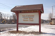
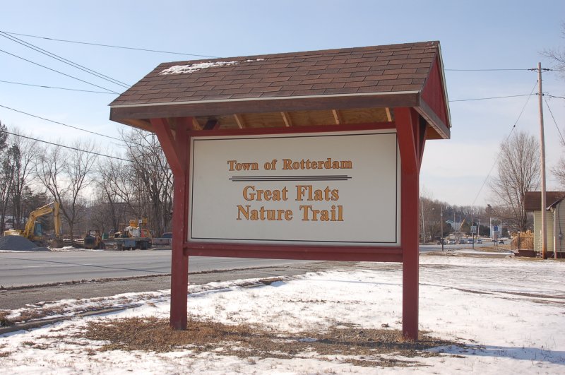
The route continues on through lightly developed residential and commercial neighborhoods to West Campbell Road, a westward extension of Schenectady's Campbell Avenue. While Burdeck ends here, NY 337 continues on, following Campbell northwest under the Delaware and Hudson Railway mainline as the route descends into a small valley surrounding Poentic Kill. At the base of the dip, NY 337 widens to four lanes as it approaches Rotterdam Square, a large shopping mall situated to the east of Campbell Road. The route heads north, then east along the western and northern edges of the mall property before curving to the northeast toward the Mohawk River. NY 337 passes east of the Great Flats Nature Trail in its final quarter-mile (0.4 km) before terminating at Interstate 890 exit 2 across the river from Scotia.[3]
History
Burdeck Street and the portion of West Campbell Road between Burdeck and Interstate 890 were maintained by Schenectady County until April 1, 1980, when both were transferred to New York State as part of a large highway maintenance swap between the two levels of government.[1] Following the swap, the two roads were designated as NY 337.[4] The bridge carrying NY 337 over Poentic Kill near the western entrance to Rotterdam Square, 25.9 metres (85 ft) in length, was replaced in 1999.[5]
Major intersections
The entire route is in Rotterdam, Schenectady County.
Mile[2] Destinations Notes 0.00 NY 70.54  NY 159
2.61 I-890Exit 2 (I-890) 1.000 mi = 1.609 km; 1.000 km = 0.621 mi References
- ^ a b New York State Legislature. "Highway Law, Article 12, Section 341". http://public.leginfo.state.ny.us/menugetf.cgi?COMMONQUERY=LAWS. Retrieved March 15, 2008.
- ^ a b "2008 Traffic Volume Report for New York State" (PDF). New York State Department of Transportation. June 16, 2009. p. 215. https://www.nysdot.gov/divisions/engineering/technical-services/hds-respository/NYSDOT%20TVR%202008%20by%20Route.pdf. Retrieved January 31, 2010.
- ^ a b Google, Inc. Google Maps – New York State Route 337 (Map). Cartography by Google, Inc. http://maps.google.com/maps?ie=UTF8&ll=42.802832,-73.991632&spn=0.044963,0.11467&t=h&z=14. Retrieved March 15, 2008.
- ^ Rand McNally (1985). New York (Map). ISBN 0-528-91040-X.
- ^ Federal Highway Administration (2008). "Structure 1305020". National Bridge Inventory. United States Department of Transportation. http://nationalbridges.com/nbi_record.php?StateCode=36&struct=000000001305020. Retrieved March 15, 2008.
External links
Categories:- State highways in New York
- Transportation in Schenectady County, New York

Wikimedia Foundation. 2010.