- Mount Tarawera
-
For other places with the same name, see Tarawera (disambiguation).
Mount Tarawera 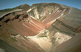
Fissure formed during 1886 Tarawera eruptionElevation 1,111 m (3,645 ft) Location North Island, New Zealand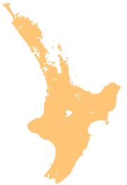
 Mount Tarawera
Coordinates 38°13′00″S 176°31′00″E / 38.2166667°S 176.5166667°ECoordinates: 38°13′00″S 176°31′00″E / 38.2166667°S 176.5166667°E Geology Volcanic arc/belt Taupo Volcanic Zone Last eruption 10 June 1886 Mount Tarawera is the volcano responsible for New Zealand's largest historic eruption. Located 24 kilometres southeast of Rotorua in the North Island, it consists of a series of rhyolitic lava domes that were fissured down the middle by an explosive basaltic eruption in 1886, which killed over a hundred people. These fissures run for about 17 kilometres northeast-southwest.
The volcano's component domes include Ruawahia Dome (the highest at 1111 metres), Tarawera Dome and Wahanga Dome. It is surrounded by several lakes, most of which were created or drastically altered in the 1886 eruption. These lakes include Lakes Tarawera, Rotomahana, Rerewhakaaitu, Okataina, Okareka, Tikitapu (Blue Lake) and Rotokakahi (Green Lake). The Tarawera River runs northeastwards across the northern flank of the mountain from Lake Tarawera.
Contents
1886 eruption
 Volcanic crater
Shortly after midnight on the morning of 10 June 1886, a series of more than 30 increasingly strong earthquakes were felt in the Rotorua area and an unusual sheet lightning display was observed from the direction of Tarawera. At around 2:00 am[1] a larger earthquake was felt and followed by the sound of an explosion. By 2:30 am Mount Tarawera's three peaks had erupted, blasting three distinct columns of smoke and ash thousands of metres into the sky. At around 3.30 am, the largest phase of the eruption commenced; vents at Rotomahana produced a pyroclastic surge that destroyed several villages within a 6 kilometre radius, and the Pink and White Terraces appeared to be obliterated.
The eruption was heard clearly as far away as Blenheim and the effects of the ash in the air were observed as far south as Christchurch, over 800 km south. In Auckland the sound of the eruption and the flashing sky was thought by some to be an attack by Russian warships.
Although the official contemporary death toll was 153, exhaustive research by physicist Ron Keam only identified 108 people killed by the eruption (including seven Europeans). Much of the discrepancy was due to misspelled names and other duplications. Allowing for some unnamed and unknown victims, he estimated that the true death toll was 120 at most.[1][2] Some people claim that many more people died.[3]
 Crumbling scoria cliffs surround the summit rift
The eruption also buried many Māori villages, including Te Wairoa which has now become a tourist attraction, and the world famous Pink and White Terraces were lost. (A small portion of the Pink Terraces was rediscovered under Lake Rotomahana 125 years later.)[4] Approximately 2 cubic kilometres of tephra was erupted,[5] more than Mount St. Helens ejected in 1980. Many of the lakes surrounding the mountain had their shapes and areas dramatically altered, especially the eventual enlargement of Lake Rotomahana, the largest crater involved in the eruption, as it re-filled with water. The rift created during the eruption extends 17 km across the mountain, Lake Rotomahana and through the Waimangu Volcanic Rift Valley.
The phantom canoe
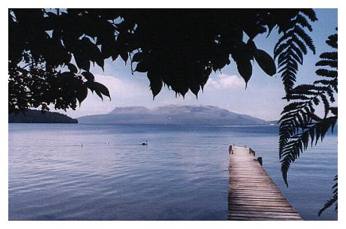
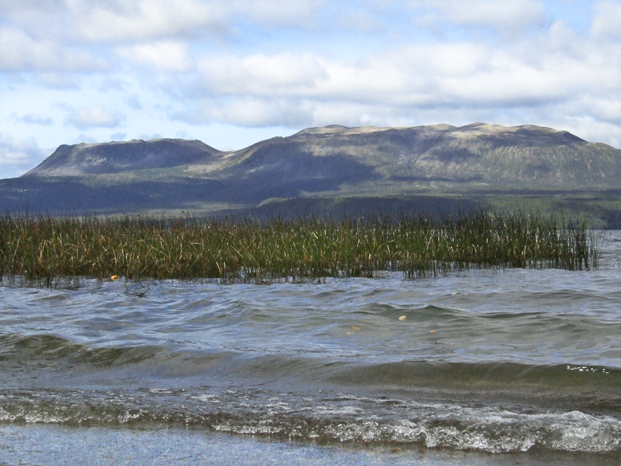
 Mount Tarawera from across Lake Tarawera
One legend[6] surrounding the 1886 eruption is that of the phantom canoe. Eleven days before the eruption, a boat full of tourists returning from the Terraces saw what appeared to be a war canoe approach their boat, only to disappear in the mist half a mile from them. One of the witnesses was a clergyman, a local Maori man from the Te Arawa iwi. Nobody around the lake owned such a war canoe, and nothing like it had been seen on the lake for many years. It is possible that the rise and fall of the lake level caused by pre eruption fissures had freed a burial waka(canoe)from its resting place.Traditionally dead chiefs were tied in an upright position.A number of letters have been published from the tourists who experienced the event.
Though skeptics maintained that it was a freak reflection seen on the mist, tribal elders at Te Wairoa claimed that it was a waka wairua (spirit canoe) and was a portent of doom. It has been suggested that the waka was actually a freak wave on the water, caused by seismic activity below the lake, but locals believe that a future eruption will be signalled by the reappearance of the canoe.
Gallery
-
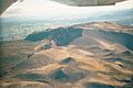
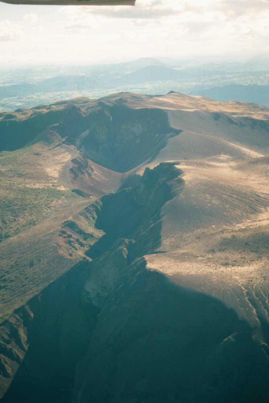
View from the north
-

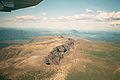
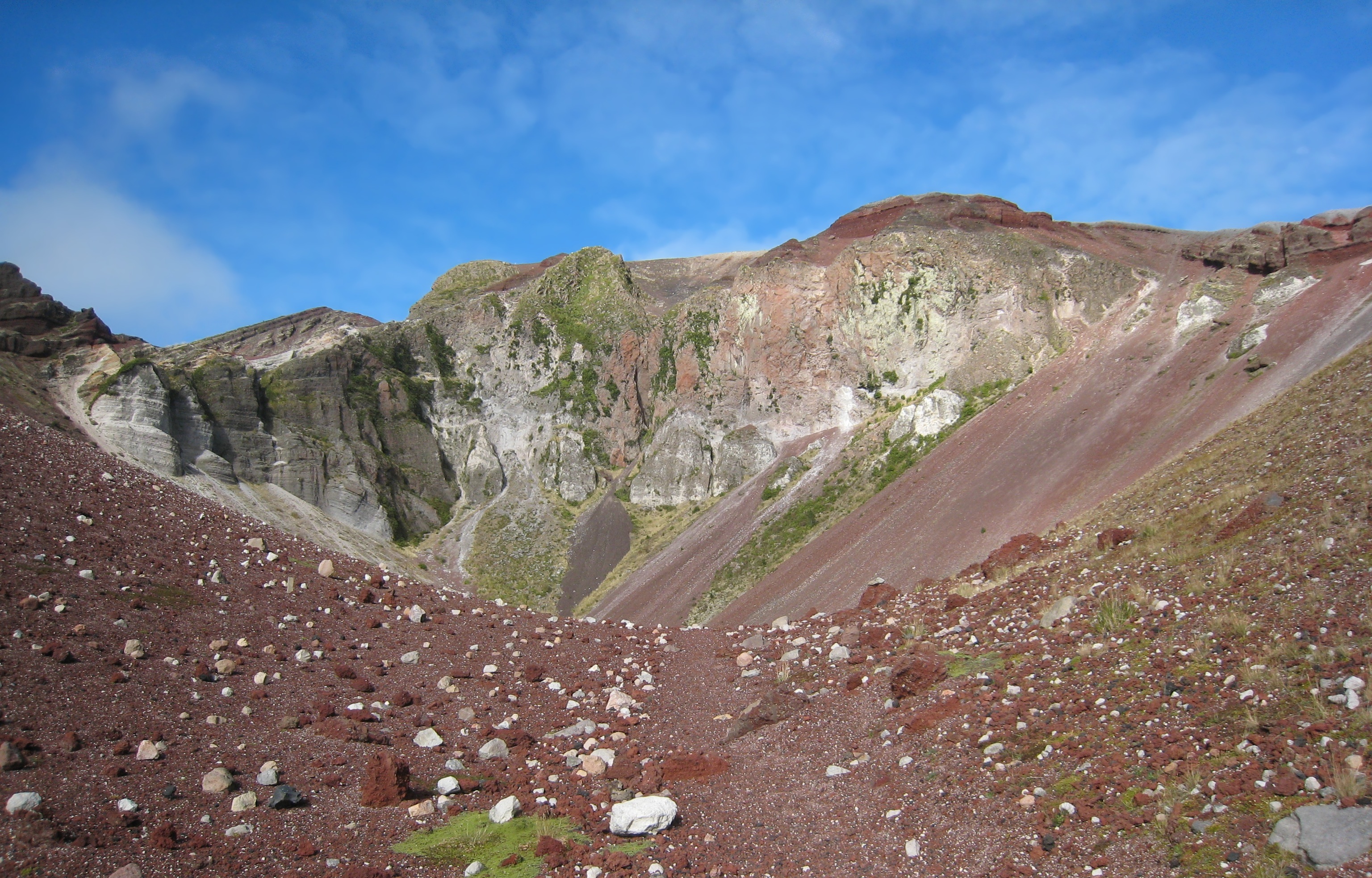
Closeup of one chasm
-
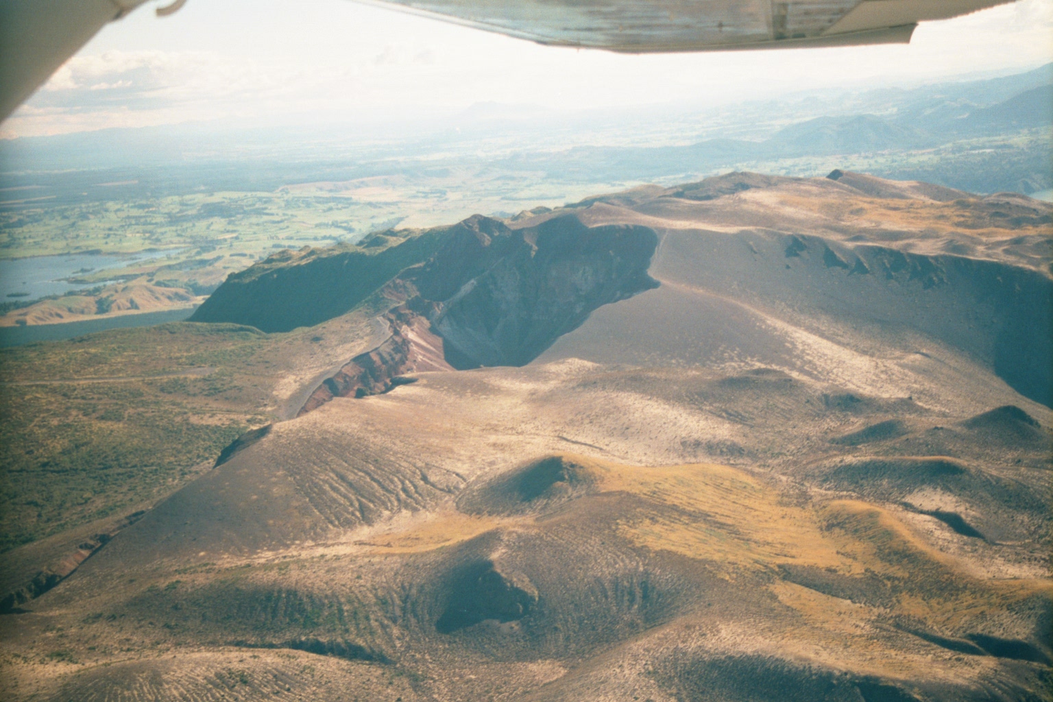
Southwest side
-

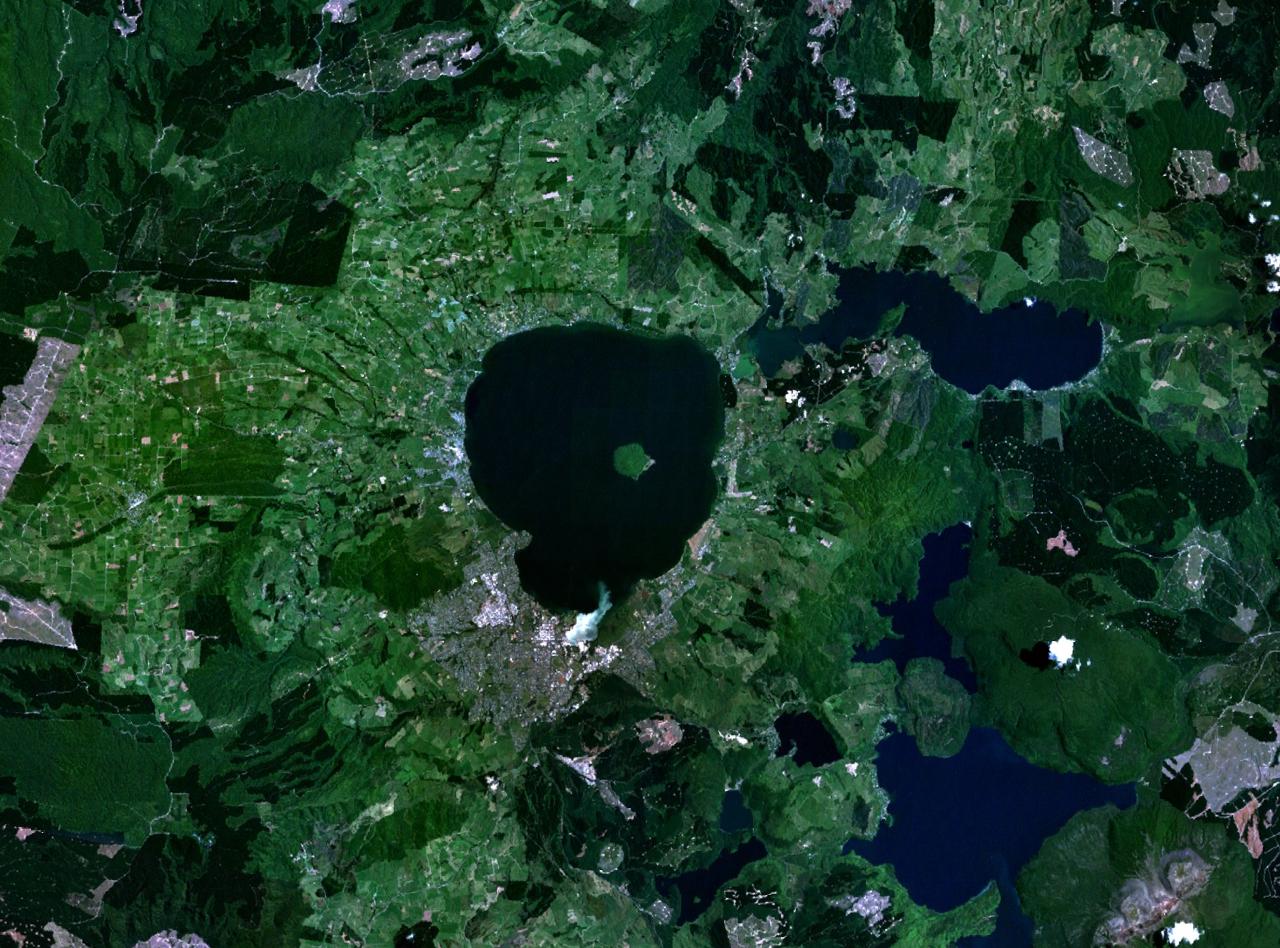
Satellite view of Lake Rotorua; Mount Tarawera is in the lower right corner
-

Mount Tarawera standing behind Lake Tarawera
See also
- Volcanism of New Zealand
- List of volcanoes in New Zealand
- List of mountains of New Zealand by height
- List of volcanic eruptions by death toll
References
- ^ a b R. F. Keam (1988). Tarawera. ISBN 0-473-00444-5.
- ^ Aftermath - Death list, Anheizen.com. Accessed 20 March 2009.
- ^ In 2007, the General Manager of the Earthquake Commission said that "... Ngati Hinemihi oral accounts put the death toll in the thousands." David Middleton (2007). A Roof Over Their Heads? The challenge of accommodation following disasters. Accessed 2008-04-12.
- ^ NZPA and NBR staff (2 February 2011). "Scientists find Pink Terraces - NZ's lost 'eighth wonder of the world'". National Business Review. http://www.nbr.co.nz/article/scientists-find-pink-terraces-new-zealands-lost-eight-wonder-world-nn-84968. Retrieved 26 October 2011.
- ^ "Okataina: Eruptive History". Global Volcanism Program, Smithsonian Institution. http://www.volcano.si.edu/world/volcano.cfm?vnum=0401-05=&volpage=erupt.
- ^ [1]
External links
Categories:- Okataina Volcanic Centre
- Volcanoes of New Zealand
- Volcanic events
- Mountains of New Zealand
- Lava domes
- Disasters in New Zealand
- 1886 natural disasters
- 1886 in New Zealand
- 19th-century volcanic events
- History of the Bay of Plenty Region
-


Wikimedia Foundation. 2010.