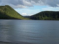
Lake Tikitapu

Lake Tikitapu
Lake Tikitapu
Location North Island
Coordinates 38°12′S 176°20′E / 38.2°S 176.333°E / -38.2; 176.333Coordinates: 38°12′S 176°20′E / 38.2°S 176.333°E / -38.2; 176.333
Lake type crater lake
Basin countries New Zealand
Max. length 1.6 km[1]
Max. width 1.3 km[1]
Surface area 1.4 km2[1]
Average depth 19.1 m[1]
Max. depth 27.5 m[1]
Surface elevation 418 m[1]
References [1]

Lake Tikitapu or Blue Lake, is the smallest of four small lakes lying between Lake Rotorua and Lake Tarawera in the Bay of Plenty region of New Zealand's North Island. The others are Lake Rotokakahi (Green Lake), Lake Okareka, and Lake Okataina.

Along with the others, Lake Tikitapu lies within a volcanic caldera formed within the last 300,000 years. The blue colour of the lake can be attributed to rhyolite and pumice on the lake bed. The lake has no visible outlet, however subsurface flow drains towards Lake Tarawera.[2]

In summer, the lake is used for recreational purposes, with many sports events being held such as water skiing and triathlons. Like many of the lakes in the Rotorua district, it is also used for trout fishing.

References

  1. ^ a b c d e f g Viner, A.B., ed (1987). Inland waters of New Zealand. Wellington: DSIR Science Information Publishing Centre. pp. 471–474. ISBN 0-477-06799-9. 
  2. ^ Lake Tikitapu Environment Bay of Plenty

Wikimedia Foundation. 2010.

Игры ⚽ Поможем сделать НИР

Look at other dictionaries:

  • Lake Tikitapu — Der Lake Tikitapu oder Blue Lake ist der kleinste von vier Seen zwischen dem Lake Rotorua und dem Lake Tarawera in der Region Bay of Plenty auf der Nordinsel Neuseelands. Die anderen drei sind der Lake Rotokakahi (Green Lake), der Lake Okareka… …   Deutsch Wikipedia

  • Lake Rotokakahi — Luftaufnahme, der Lake Tarawera befindet sich in der oberen rechten Ecke Geographische Lage Bay of Plenty (Region), Nordinsel (Neuseeland) …   Deutsch Wikipedia

  • Lake Tarawera — Geographische Lage Rotorua Distrikt, Bay of Plenty, Nordinsel, Neuseeland Zuflüsse …   Deutsch Wikipedia

  • Lake Okareka — Bild gesucht  BW Geographische Lage Bay of Plenty (Region), Nordinsel (Neuseeland) …   Deutsch Wikipedia

  • Lake Okataina — Luftbild aus Süden Geographische Lage Bay of Plenty (Region), Nordinsel (Neuseeland) Daten …   Deutsch Wikipedia

  • Lake Rotokakahi — Infobox lake lake name = Lake Rotokakahi Green Lake image lake = Lake Rotokakahi.jpg caption lake = image bathymetry = caption bathymetry = location = Bay of Plenty, North Island coords = coord|38|13|S|176|20|E|region:NZ… …   Wikipedia

  • Lake Okataina — Infobox lake lake name = Lake Okataina image lake = LakeOkataina.jpg caption lake = Aerial view from the south image bathymetry = caption bathymetry = location = Bay of Plenty, North Island coords = coord|38|07|S|176|25|E|region:NZ… …   Wikipedia

  • Lake Okareka — Infobox lake lake name = Lake Okareka image lake = caption lake = image bathymetry = caption bathymetry = location = North Island coords = coord|38|10|S|176|22|E|region:NZ type:waterbody|display=inline,title type = inflow = outflow = catchment =… …   Wikipedia

  • Lake Tarawera — Infobox lake lake name = Lake Tarawera image lake = Lake Tarawera.jpg caption lake = image bathymetry = caption bathymetry = location = Rotorua District, Bay of Plenty Region, North Island coords = coord|38|12|S|176|27|E|region:NZ… …   Wikipedia

  • Blue Lake — ist der Name folgender Seen: Blue Lake (South Australia), Australien Blue Lake ist der Name folgender Seen in Neuseeland: Blue Lake (Canterbury) Blue Lake (Otago) Blue Lake (Tasman) Blue Lake (Raoul Island) auf Raoul Island in den Kermadec Inseln …   Deutsch Wikipedia

Share the article and excerpts

Direct link
Do a right-click on the link above
and select “Copy Link”