- Daraa Governorate
-
Dar'a Governorate
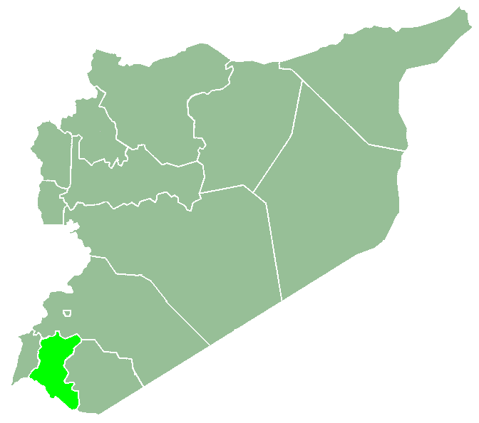
مُحافظة درعا— Governorate — Map of Syria with Dar'a highlighted
Coordinates (Daraa): 32°54′N 36°12′E / 32.9°N 36.2°ECoordinates: 32°54′N 36°12′E / 32.9°N 36.2°E Country  Syria
SyriaCapital Daraa Manatiq (Districts) 3 Area – Total 3,730 km2 (1,440.2 sq mi) Population (2010) – Total 998,000 – Density 267.6/km2 (693/sq mi) Time zone EET (UTC+2) – Summer (DST) EEST (UTC+3) ISO 3166 code SY-DR Main language(s) Arabic Dar'a Governorate (Arabic: مُحافظة درعا) is one of the fourteen Governorates of Syria. It is situated in the south-west of the country and covers an area of 3,730 km². It is bordered by Jordan to the south, Quneitra Governorate to the west, Rif Dimashq Governorate to the north and Al-Suwayda Governorate to the east. The governorate has a population of 998,000 (2010 census office estimate). The capital is the city of Daraa.
Districts
The governorate is divided into 3 districts (manatiq):
These are further divided into ? sub-districts (nawahi).
External links
- Official Site of Daraa Governorate (Arabic)
- edaraa The First Complete website for daraa news and services

Rif Dimashq Governorate Quneitra Governorate 
As-Suwayda Governorate  Daraa Governorate

 Irbid GovernorateMafraq Governorate
Governorates of Syria Al-Hasakah · Aleppo · Damascus · Daraa · Deir ez-Zor · Hama · Homs · Idlib · Latakia · Quneitra · Ar-Raqqah · Rif Dimashq · As-Suwayda · Tartus

Daraa Governorate Cities 
Towns and villages Categories:- Daraa Governorate
- Fertile Crescent
- Governorates of Syria
- Syria geography stubs
Wikimedia Foundation. 2010.