- Deir ez-Zor Governorate
-
Deir ez-Zor Governorate
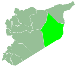
مُحافظة دير الزور— Governorate — Map of Syria with Deir ez-Zor highlighted Coordinates (Deir ez-Zor): 35°20′10″N 40°08′42″E / 35.336°N 40.145°ECoordinates: 35°20′10″N 40°08′42″E / 35.336°N 40.145°E Country  Syria
SyriaCapital Deir ez-Zor Manatiq (Districts) 3 Area – Total 33,060 km2 (12,764.5 sq mi) Population (2010) – Total 1,202,000 – Density 36.4/km2 (94.2/sq mi) Time zone EET (UTC+2) – Summer (DST) EEST (UTC+3) ISO 3166 code SY-DY Main language(s) Arabic Deir ez-Zor Governorate or Muhafazah Dayr az Zawr (Arabic: مُحافظة دير الزور) is one of the fourteen governorates of Syria. It is situated in eastern Syria, bordering Iraq. It has an area of 33,060 km² and a population of 1,202,000 (2010 estimate). The capital is Deir ez-Zor.[1]
Contents
Districts
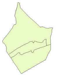
The governorate is divided into 3 districts (manatiq):
These are further divided into ? sub-districts (nawahi).
Operation Orchard
Deir ez-Zor was also the location of Israel's execution of Operation Orchard on September 6, 2007. Israel bombed a northern Syrian complex near which was suspected of holding nuclear materials from North Korea.[2]
References
- ^ "City Population: Syria". http://www.citypopulation.de/Syria.html. Retrieved 19 August 2011.
- ^ Mahnaimi, Uzi; Baxter, Sarah (2007-09-23). "Israelis ‘Israelis seized nuclear material in Syrian raid’". London: The Sunday Times. http://www.timesonline.co.uk/tol/news/world/middle_east/article2512380.ece. Retrieved May 1, 2010.
External links
- edeiralzor The First Complete website for Deir ez-Zor news and services
Governorates of Syria Al-Hasakah · Aleppo · Damascus · Daraa · Deir ez-Zor · Hama · Homs · Idlib · Latakia · Quneitra · Ar-Raqqah · Rif Dimashq · As-Suwayda · Tartus

Deir ez-Zor Governorate Cities 

Towns and villages Categories:- Deir ez-Zor Governorate
- Fertile Crescent
- Governorates of Syria
- Syria geography stubs
Wikimedia Foundation. 2010.


