- Chettisham
-
Coordinates: 52°25′N 0°16′E / 52.42°N 0.27°E
Chettisham 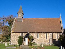
St. Michael and All Angels, Chettisham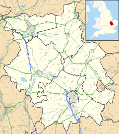
 Chettisham
Chettisham shown within CambridgeshireOS grid reference TL541823 District East Cambridgeshire Shire county Cambridgeshire Region East Country England Sovereign state United Kingdom EU Parliament East of England List of places: UK • England • Cambridgeshire Chettisham a very small village in East Cambridgeshire between Ely and Littleport. The main claim to fame is the level crossing along the A10, the few houses in the layby and the old signal box where there was once a Chettisham railway station on the line between Ely and March.
There are some pictures and a description of the church at the Cambridgeshire Churches website [1].
References
External links
 Media related to Chettisham at Wikimedia Commons
Cities 
Towns Villages Aldreth • Ashley • Barway • Bottisham • Brinkley • Burwell • Chettisham • Cheveley • Chippenham • Coveney • Dullingham • Fordham • Haddenham • Isleham • Little Downham • Little Thetford • Littleport • Lode • Longmeadow • Mepal • Prickwillow • Pymoor • Queen Adelaide • Reach • Stetchworth • Stretham • Stuntney • Sutton • Swaffham Bulbeck • Swaffham Prior • Upware • Wicken • Wilburton • Witcham • Witchford • WooddittonCivil Parishes Categories:- Villages in Cambridgeshire
- Cambridgeshire geography stubs


Wikimedia Foundation. 2010.