Chuck River Wilderness

Chuck River Wilderness
IUCN Category Ib (Wilderness Area)
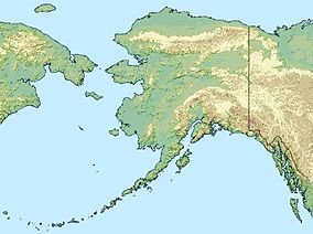
Map showing the location of Chuck River Wilderness
Location Hoonah-Angoon Census Area, Alaska, USA
Nearest city Hobart Bay, Alaska
Coordinates 57°28′00″N 133°11′00″W / 57.4666667°N 133.1833333°W / 57.4666667; -133.1833333Coordinates: 57°28′00″N 133°11′00″W / 57.4666667°N 133.1833333°W / 57.4666667; -133.1833333
Area 74,298 acres (30,067 ha)
Established 1990
Governing body U.S. Forest Service

Chuck River Wilderness is a 74,298-acre (30,067 ha) wilderness area located within the Tongass National Forest in the U.S. state of Alaska. It was designated by the United States Congress in 1990.

Located at the head of Windham Bay, Chuck River Wilderness is adjacent to the Tracy Arm-Fords Terror Wilderness. The Chuck River flows northward from its headwaters near Port Houghton through dense forest with thick vegetation before emptying into Windham Bay where the historic Chuck Mining Camp operated until the 1920s. There is private land in the lower river and in portions of the bay where there was once a small settlement.[1]

References

  1. ^ Chuck River Wilderness - Wilderness.net

External links


Wikimedia Foundation. 2010.

Игры ⚽ Нужно решить контрольную?

Look at other dictionaries:

  • Chuck Pratt — in the early 1960s Personal information Nationality American Born March 5, 1939(1939 03 05) …   Wikipedia

  • Chuck Strahl — Charles Strahl Member of the Canada Parliament for Chilliwack Fraser Canyon In office 2004–2011 Preceded by new riding Succeeded by Mark Strahl Mem …   Wikipedia

  • Glacier Peak Wilderness — Lac Triad, près de High Pass Catégorie UICN Ib (zone de nature sauvage) Emplacement Washington …   Wikipédia en Français

  • Noatak Wilderness — IUCN Category Ib (Wilderness Area) …   Wikipedia

  • Mollie Beattie Wilderness — IUCN Category Ib (Wilderness Area) …   Wikipedia

  • Chamisso Wilderness — IUCN Category Ib (Wilderness Area) Chamisso Island …   Wikipedia

  • Glacier Peak Wilderness — Infobox protected area | name = Glacier Peak Wilderness iucn category = Ib caption = locator x = 32 locator y = 14 location = Washington, USA nearest city = Seattle, WA lat degrees = 48 lat minutes = 06 lat seconds = 45 lat direction = N long… …   Wikipedia

  • Coronation Island Wilderness — is a 19,232 acre (7,783 ha) wilderness area in the U.S. state of Alaska. It was designated by the United States Congress in 1980. The wilderness area encompasses the entirety of Coronation Island plus the Spanish Islands. It is part of… …   Wikipedia

  • Chena River State Recreation Area — Not to be confused with Chena River State Recreation Site. The Chena River seen from the Angel Rocks tor formation Chena River State Recreation Area is a 254,080 acre (1,028 km²) state park in the U.S. state of Alaska, located east of… …   Wikipedia

  • Chena River State Recreation Site — Not to be confused with Chena River State Recreation Area. Chena River State Recreation Site (also called Chena Wayside) is a 29 acre (0.12 km²) state park in Fairbanks in the U.S. state of Alaska. It features access to the Chena River as… …   Wikipedia

Share the article and excerpts

Direct link
Do a right-click on the link above
and select “Copy Link”