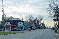
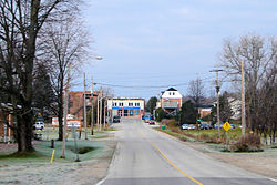
- Chatsworth, Ontario
-
Chatsworth — Township — Coordinates: 44°23′N 80°52′W / 44.383°N 80.867°WCoordinates: 44°23′N 80°52′W / 44.383°N 80.867°W Country  Canada
Province  Ontario
County Grey Settled Formed January 1, 2001 Government - Mayor Bob Pringle - Federal riding Bruce—Grey—Owen Sound - Prov. riding Bruce—Grey—Owen Sound Area[1] - Land 595.35 km2 (229.9 sq mi) Population (2006)[1] - Total 6,392 - Density 10.7/km2 (27.7/sq mi) Time zone EST (UTC-5) - Summer (DST) EDT (UTC-4) Postal Code N0H 1G0 Area code(s) 519 and 226 Website www.chatsworth.ca Chatsworth is a township in south-western Ontario, Canada, in Grey County, located at the headwaters of the Styx River, the Saugeen River, the Sauble River, the Bighead River, the Spey River, and the Sydenham River.
The current township was formed in late year 2000 with the almagation of Holland Township, Sullivan Township, and the village of Chatsworth.
Contents
Communities
In addition to the village of Chatsworth itself, the township comprises the communities of Arnott, Berkeley, Desboro, Dornoch, Glascott, Grimston, Harkaway, Hemstock Mill, Holford, Holland Centre, Keward, Kinghurst, Lily Oak, Lueck Mill, Marmion, Massie, Mooresburg, Mount Pleasant, Peabody, Scone, Strathavon, Walters Falls and Williamsford.
Williamsford is most known for an F3 tornado that struck and destroyed several homes on April 20, 1996 during the Southern Ontario Tornadoes of 1996.
Canadian suffragette and activist Nellie McClung was born in the town of Chatsworth.
The Sullivan Township area has a large Amish poplutation.
Demographics
According to the 2006 Statistics Canada Census:[1]
- Population: 6,392
- % Change (2001-2006):1.8
- Area (km².): 595.35
- Density (persons per km².): 10.7
- Private dwellings occupied by usual residents: 2366 (total dwellings: 2742)
Population trend:[2]
- Population in 2006: 6392
- Population in 2001: 6280
- Population total in 1996: 6278
- Chatsworth (village): 522
- Holland (township): 2904
- Sullivan (township): 2852
- Population in 1991:
- Chatsworth (village): 521
- Holland (township): 2792
- Sullivan (township): 2668
The community of Chatsworth has the status of designated place, separately from the rest of the township, in Canadian census data.
Hungerford's crawling water beetle
A short stretch of the North Saugeen River just over the Bruce County border at the Chatsworth community of Scone is home to one of the most critically endangered of all insects: the Hungerford's crawling water beetle. The only known population of Hungerford's crawling water beetles outside of the United States was discovered near there in 1986 when 42 beetles were identified at a site downstream from the community's dam. An unspecified number of beetles were last recorded in 2001, but surveys in 2002 uncovered no specimens. As a result, the status of this population of Hungerford's crawling water beetles is uncertain at present.
Although the Hungerford's crawling water beetle was categorized as endangered on March 7, 1994, under the provisions of the U.S. Endangered Species Act, it is currently not protected in Canada.
References
- ^ a b c "Chatsworth community profile". 2006 Census data. Statistics Canada. http://www12.statcan.gc.ca/census-recensement/2006/dp-pd/prof/92-591/details/page.cfm?Lang=E&Geo1=CSD&Code1=3542037&Geo2=PR&Code2=35&Data=Count&SearchText=Chatsworth&SearchType=Begins&SearchPR=01&B1=All&Custom=. Retrieved 2011-01-24.
- ^ Statistics Canada: 1996, 2001, 2006 census
External links
Township of Chatsworth, Ontario

Georgian Bluffs, Meaford 
Arran–Elderslie 
Grey Highlands  Chatsworth

Brockton West Grey Template:Grey County
Categories:- Designated places in Ontario
- Township municipalities in Ontario
- Municipalities in Grey County, Ontario
- Western Ontario geography stubs
Wikimedia Foundation. 2010.


