- Dalserf
-
Coordinates: 55°44′06″N 3°54′50″W / 55.735°N 3.914°W
Dalserf 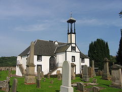
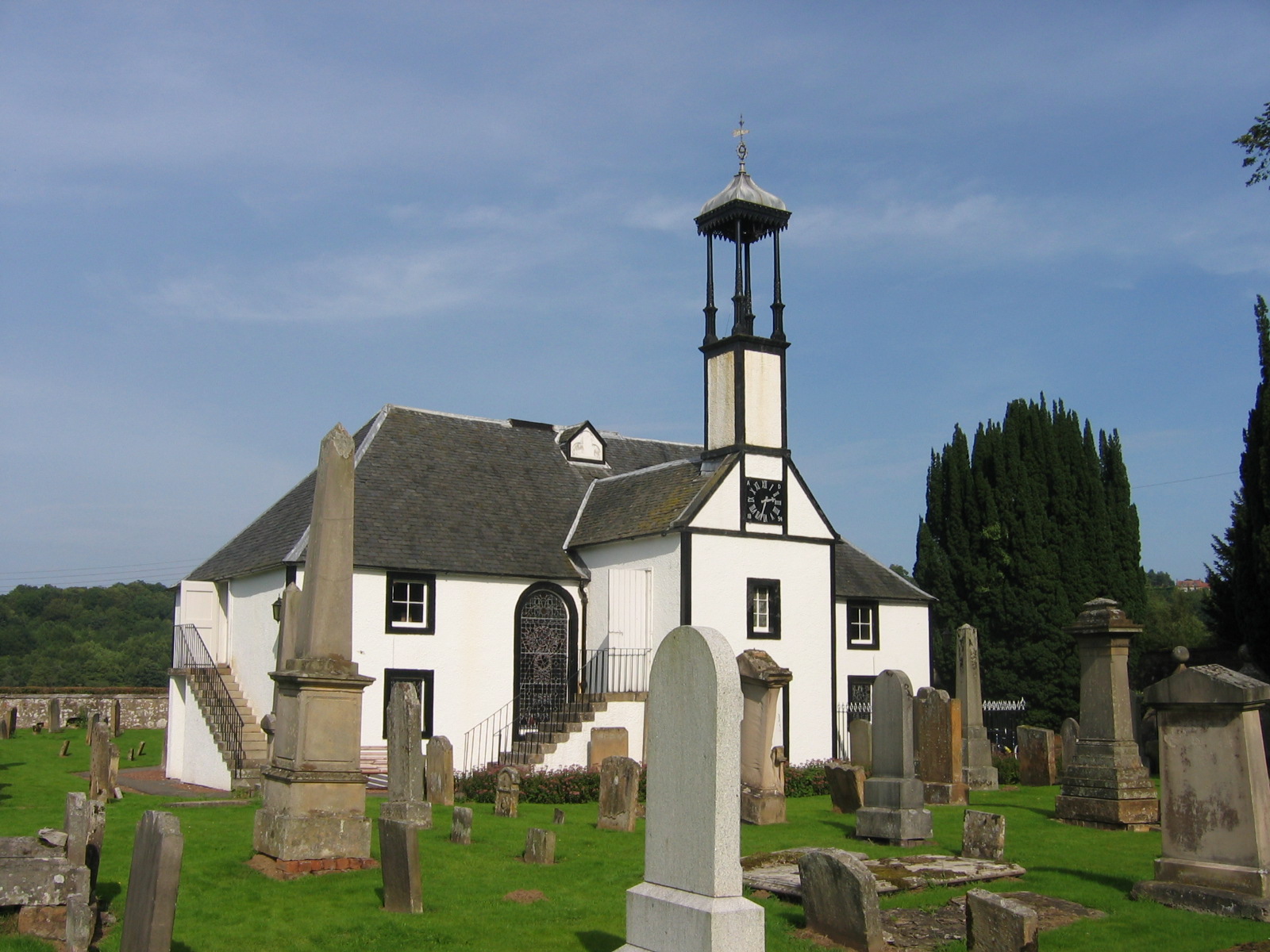
Dalserf Kirk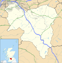
 Dalserf
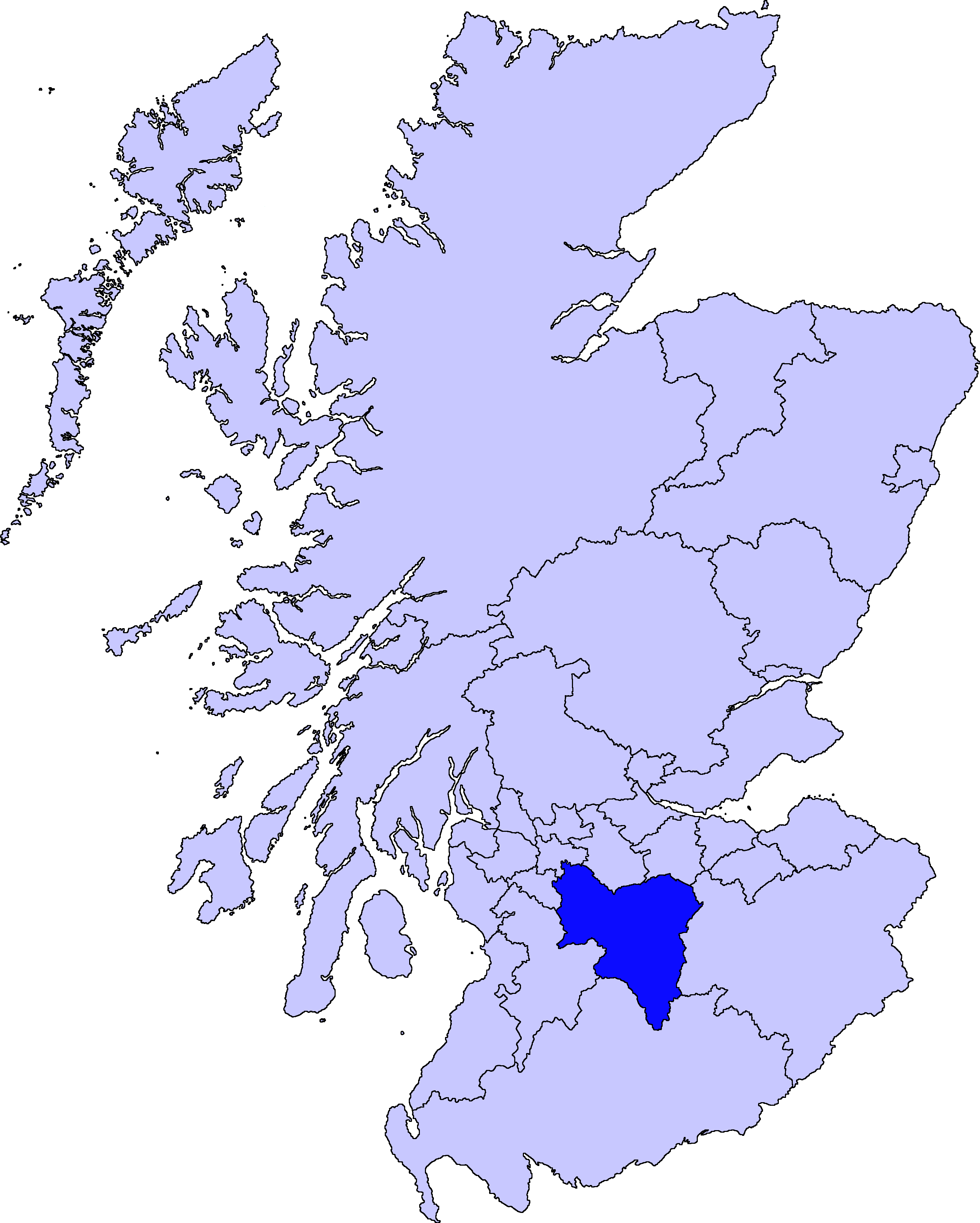
Dalserf shown within South LanarkshirePopulation 17,985 (2001) OS grid reference NS7950 Parish Dalserf Council area South Lanarkshire Lieutenancy area Lanarkshire Country Scotland Sovereign state United Kingdom Post town LARKHALL Postcode district ML9 Dialling code 01698 Police Strathclyde Fire Strathclyde Ambulance Scottish EU Parliament Scotland UK Parliament Lanark and Hamilton East Scottish Parliament Hamilton, Larkhall and Stonehouse List of places: UK • Scotland • Dalserf is a small village and civil parish in South Lanarkshire, Scotland. It lies on the River Clyde 2 miles (3.2 km) east of Larkhall and 7 miles (11 km) south east of Hamilton. As of 2006, its population is 52.[citation needed] The larger civil parish, which includes Ashgill, Larkhall, Netherburn, Rosebank and Shawsburn, has a population of 17,985.[1]
The name of the village comes from the Gaelic dail, meaning field, and Serf, the name of a 6th century saint who lived here. The village kirk, built in 1655, is dedicated to Saint Serf, and may be built on the site of an early church founded by him. The church dates from the The Killing Time, when the rebel Covenanters were persecuted for their faith, and was a centre of Covenanter activity. John McMillan, reformist preacher and first minister of the Reformed Presbyterian Church, is buried in the kirkyard. The kirk is Category A listed.
A ferry once operated across the Clyde at Dalserf, although this has long since been superseded by the nearby Garrion Bridge.
References
- ^ "KS01 Usual Resident Population: Dalserf". Scotland's Census Results Online. General Register Office for Scotland. http://www.scrol.gov.uk/scrol/analyser/analyser?topicId=1&tableId=&tableName=Usual+resident+population&selectedTopicId=&aggregated=false&subject=&tableNumber=&selectedLevelId=&postcode=&areaText=&RADIOLAYER=&actionName=view-results&clearAreas=&stateData1=&stateData2=&stateData3=&stateData4=&debug=&tempData1=&tempData2=&tempData3=&tempData4=&levelId=4&areaId=217. Retrieved 6 September 2011.
External links
See also
Settlements in South Lanarkshire Towns Biggar · Blantyre · Bothwell · Cambuslang · Carluke · East Kilbride · Hamilton · Larkhall · Lanark · Lesmahagow · Rutherglen · Strathaven · Uddingston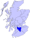
Villages and Hamlets Abington · Allanton · Ashgill · Auchengray · Auchenheath · Blackwood · Braidwood · Carnwath · Carstairs Junction · Carstairs Village · Cartland · Chapelton · Coalburn · Cobbinshaw · Coulter · Crawford · Crawfordjohn · Crossford · Dalserf · Dolphinton · Douglas · Dunsyre · Elsrickle · Forth · Garrion Bridge · Glassford · Kilncadzow · Kirkfieldbank · Kirkmuirhill · Law · Leadhills · Newbigging · Nerston · Pettinain · Quothquan · Ravenstruther · Rigside · Roberton · Rosebank · Sandford · Stonehouse · Symington · Tarbrax · Thankerton · Thorntonhall · Tillietudlem · Wiston · Woolfords · YieldshieldsCategories:- South Lanarkshire geography stubs
- Villages in South Lanarkshire

Wikimedia Foundation. 2010.