- Stonehouse, South Lanarkshire
Stonehouse is a small rural village in
South Lanarkshire ,Scotland . It is located onAvon Water in an area of natural beauty and historical interest, near to theClyde Valley .In 1971 Stonehouse was designated to become one of
Scotland 's New Towns. It would be designed to accommodate population overspill from the city ofGlasgow similar to the towns ofEast Kilbride ,Cumbernauld andLivingston , in particular, which proved to be very successful New Towns, undoubtely offering a transformation in the living conditons of many local residents. However a determined attempt to regenerate areas within Glasgow by renewing older properties precipitated a change in policy and in light of these considerations, indecision as to whether to build or not lasted several years until finally in 1976 it was decided that Stonehouse would not be built into a New Town.Location
Situated between the small nearby towns of
Strathaven andLarkhall , Stonehouse lies on the A71 a couple of miles south of its junction with the M74. It is only 30 minutes from the city of Glasgow and approximately 1 hour from Edinburgh.History
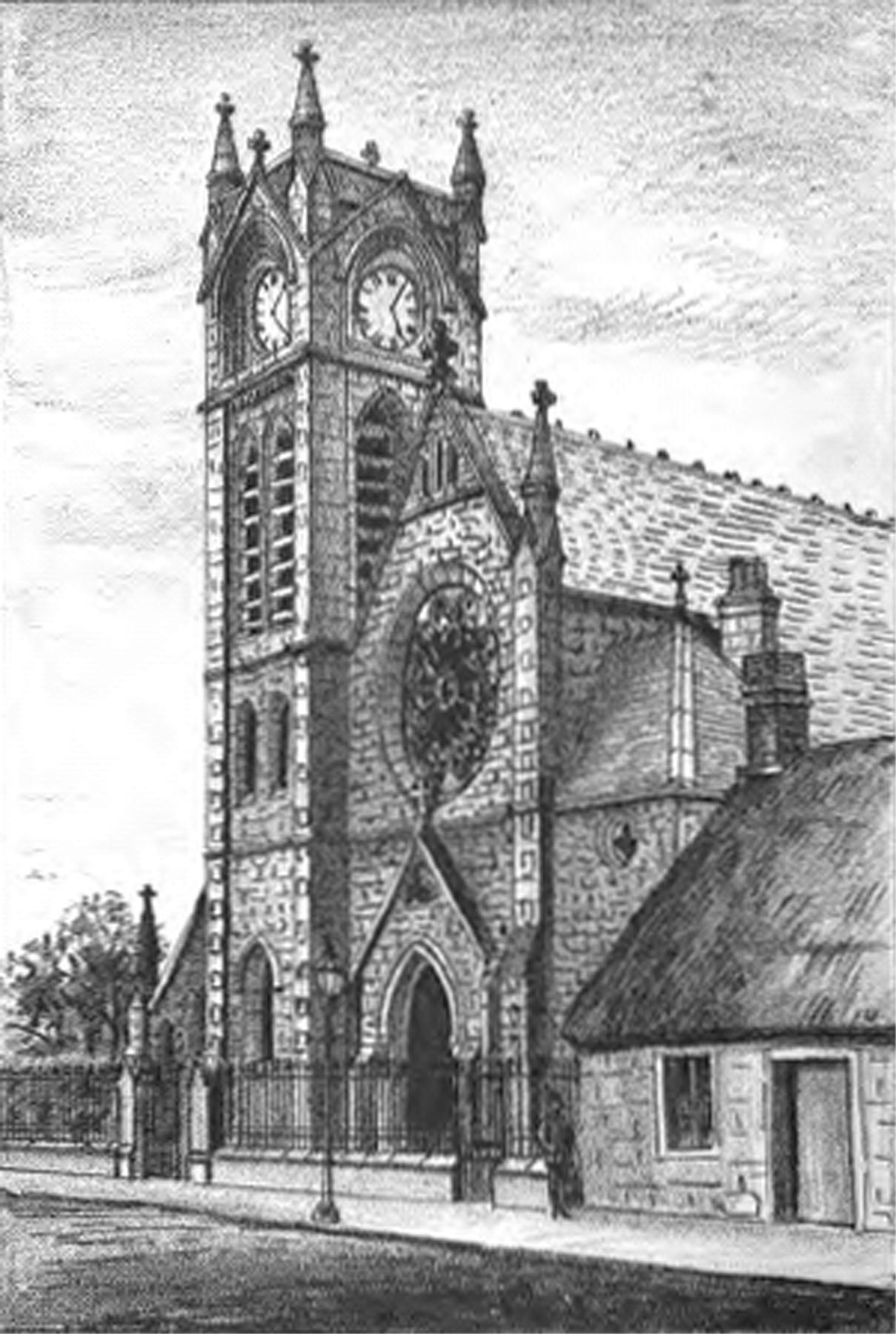
United_Presbyterian_ChurchImage:Scene.near.Glen-Avon.Stonehouse.jpg|Scene_near_Glen-AvonImage:Montage.falls.fair.Glassford.bridge.Stonehouse.jpg|Montage_of_scenes:_a_falls,_the_fair_at_Auld_Stonehouse,_and_Glassford_BridgeImage:Free.Church.Stonehouse.jpg|Free_ChurchImage:Cross.and.King.Street.Stonehouse.jpg|Cross_and_King_StreetImage:Cross.and.Irongate.Stonehouse.jpg|Cross_and_TrongateImage:Churchyard.River.Avon.Stonehouse.jpg|Churchyard_and_River_AvonImage:CamEducation
Stonehouse has two Primary Schools situated within the village - Stonehouse Primary and Newfield Primary. Both these schools are within the catchment area of
Larkhall Academy, but some children in the village attend Strathaven Academy. The local Catholic Primary School is St Patricks Primary School inStrathaven .Transportation
Stonehouse has regular and convenient bus transportation to the nearby towns of Larkhall,
Hamilton , East Kilbride and Strathaven.The Alexander Hamilton Memorial Park
The Alexander Hamilton Memorial Park was presented to the village by Alexander Hamilton in 1925, along with it's band stand from the Great Glasgow Exhibition of 1911. The band stand looks over the Avon Valley giving one of the most beautiful views in the village. The park itself was once famous for containing the longest chute in Scotland and today possesses a floodlit athletics track, football pitch, multi-surface games area as well as woodland walks and various play areas.
External links
* [http://stonehouse.community.users.btopenworld.com/ Stonehouse Community Website]
* [http://www.stonehouseheritage.co.uk/ Stonehouse Heritage Group]
* [http://www.st-ninians-stonehouse.org.uk/ St. Ninian's Parish Church Stonehouse]
* [http://www.theglasgowstory.com/story.php?id=TGSFG10/ The Glasgow Story]
*oscoor gbx|NS755466ee also
*
List of places in South Lanarkshire
Wikimedia Foundation. 2010.