- Ohio State Route 435
-
State Route 435
Route information Maintained by ODOT Length: 3.97 mi[1] (6.39 km) Existed: 2003 – present Major junctions West end:  US 35 near Octa
 I-71 in Octa
US 35 near MilledgevilleEast end:  SR 729 near Milledgeville
Location Counties: Fayette Highway system Ohio highways
Interstates • U.S. Routes • State Routes←  SR 430
SR 444  →
→State Route 435 (SR 435, OH 435) is a 3.97-mile (6.39 km) long east–west state highway in the southwestern portion of the U.S. state of Ohio. The western terminus of SR 435 is at a partial interchange with U.S. Route 35 (US 35) approximately 5.50 miles (8.85 km) southwest of Jeffersonville, and its eastern terminus is a T-intersection with SR 729 nearly 2 miles (3.2 km) northeast of Milledgeville.
This route follows a former alignment of US 35, which now bypasses this area along a freeway alignment. SR 435 provides access between current U.S. Route 35 and Interstate 71 (I-71), as no direct interchange exists between the two highways.
Contents
Route description
The entirety of SR 435 is nestled within the northwestern quadrant of Fayette County. This highway is not included as a part of the National Highway System (NHS). The NHS is a network of routes identified as being most important for the economy, mobility and defense of the nation.[2]
History
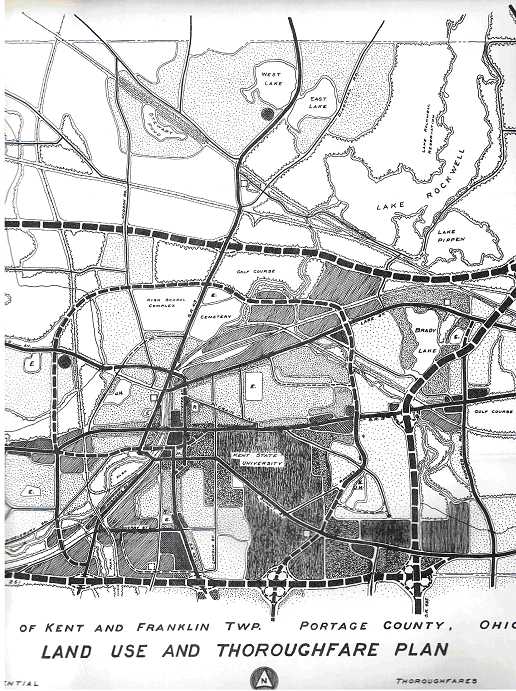
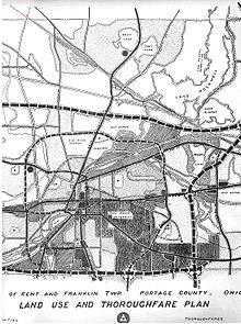 Thoroughfare plan for Kent
US 35 between Xenia and Washington Court House was moved onto a new freeway alignment in 2003. Consequently, the majority of the former two-lane routing was removed from the state highway system. However, the re-routing resulted in there being no direct connection between US 35 and I-71 at Octa. To alleviate this, a new connector was built between the freeway just northwest of I-71 and the former routing of US 35. From this point to the easternmost point of the SR 729 overlap of the previous routing of US 35, the old routing of US 35 was kept in the state highway system. The connector, along with this portion of former US 35, was assigned the SR 435 designation. This allowed for not only a connection between I-71 and the new US 35 freeway, but also SR 729 and the freeway.[citation needed]
SR 435 was once a proposed limited-access north–south highway in Portage County and Stark County, as a result of a regional planning report. Connections in Portage would have been at SR 14, SR 59, SR 261, I-76 and US 224. Connections in Stark would have been at SR 619, State Street NE, SR 173, US 62, SR 153, SR 172, US 30 and would have terminated at SR 183 in Sandy. Designed to relieve traffic from SR 43 and SR 44, its centerline was 1-mile (1.6 km) east of State Route 43. However, the plan never took off. Instead, the city of Kent and Brimfield Township have expanded SR 43 from two lanes to four to provide better access to I-76.[citation needed]
Major intersections
The entire route is in Fayette County.
Location Mile[1] Destinations Notes Jefferson Township 0.00 US 35Western terminus at partial interchange, with access provided from US 35 eastbound to SR 435 eastbound and from SR 435 westbound to US 35 westbound only Octa 1.51 I-71Exit 65 off of I-71, a diamond interchange Jefferson Township 2.22 US 35Partial interchange, with access provided from SR 435 to US 35 eastbound and from US 35 westbound to SR 435 only Jasper Township 2.80 SR 729 southT-intersection marking western split of SR 435/SR 729 duplex;
SR 729 joins from the south3.97 SR 729 northEastern terminus at T-intersection that doubles as eastern split of SR 435/SR 729 duplex;
SR 729 departs to the north1.000 mi = 1.609 km; 1.000 km = 0.621 mi
Concurrency terminus • Closed/Former • Incomplete access • UnopenedReferences
- ^ a b Ohio Department of Transportation. "Technical Services Straight Line Diagrams: SR 435, Fayette County". http://www.odotonline.org/techservapps/SLD/pdf_files/faysr0435r.pdf. Retrieved 2011-10-23.
- ^ Federal Highway Administration (December 2003) (PDF). National Highway System: Ohio (Map). http://www.fhwa.dot.gov/planning/nhs/maps/oh/oh_Ohio.pdf. Retrieved 2011-10-23.
Categories:- State highways in Ohio

Wikimedia Foundation. 2010.