- Chandravati
-
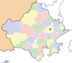
Chandravati — village — Coordinates 24°27′00″N 72°46′00″E / 24.45°N 72.7666667°ECoordinates: 24°27′00″N 72°46′00″E / 24.45°N 72.7666667°E Country India State Rajasthan Time zone IST (UTC+05:30) Chandravati (Hindi:चन्द्रावती) is a village situated near Abu Road on the bank of the West Banas River in the Indian state of Rajasthan. In ancient times it was an extensive town, and present villages such as Dattani, Kiverli, Kharadi and Santpura were its suburbs. The old ruins, such as temples, torans and images scattered over the large area, bear testimony to its past glory.
History
Chandravati was ruled by the Paramaras of Abu. The first Paramar ruler of the area was Sindhuraja in the early tenth century. The Ugrasena Panwar founded the Panwar rule at Abu. Raja Bhoja (1010-1050 AD) was an illustrious rulers of this dynasty.[1]
In 1024 AD, Chandravati was attacked and plundered by Mahmud Ghazni when he passed through Rajasthan to attack Anahilavada. After defeating Prithviraja III in 1192 AD the Muslim army also attacked Chandravati. In 1197 AD Qutubuddin general Khusrav defeated then ruler of Chandravati Dharavarsha near the foot of Mount Abu.
In about 1315 AD Chandravati passed into the hands of Deora Chauhans.
Sahasamala Devada shifted his capital to Sirohi around 1450 AD, and from then on Chandravati lost its glory. It is now a small village.
Arts and literature
There were a large number of temples in Chandravati. They were mainly Shiva temples and Jain temples.
Many European scholars who visited this area in the nineteenth century have written about surviving artistic specimens. James Tod has given pictures of some of these temples in his Travels in Western India. In 1824 Charles Colville and his party visited Chandravati and found twenty marble edifices of different sizes. One temple to Brahma was adorned with rich and finely executed sculptured figures and ornaments in high relief. Another scholar, Ferguson, found the pillars so highly ornamented in details and varieties that no two pillars are exactly alike.
At present not a single temple is in order. The pieces of old temples were removed and used in temples in distant cities. The many monuments were destroyed by contractors of Rajputana Malwa Railway before independence. The remaining were stolen or were destroyed when Abu Road industrial area was extended.
Rulers of Chandravati patronized literature too. Jain saints wrote some literary works here.
References
- ^ Mathur, Vijayendra Kumar: Aitihasik Sthanavali (Hindi), Vaigyanik tatha Takaniki Shabdawali Ayog, Government of India, 1990, p.319
State of Rajasthan (India) Rajasthan Topics Major cities 
Divisions Districts Ajmer · Alwar · Banswara · Baran · Barmer · Bharatpur · Bhilwara · Bikaner · Bundi · Chittorgarh · Churu · Dausa · Dholpur · Dungarpur · Hanumangarh · Jaipur · Jaisalmer · Jalore · Jhalawar · Jhunjhunu · Jodhpur · Karauli · Kota · Nagaur · Pali · Pratapgarh · Rajsamand · Sawai Madhopur · Sikar · Sirohi · Sri Ganganagar · Tonk · UdaipurCategories:- History of Rajasthan
- Villages in Sirohi district
Wikimedia Foundation. 2010.


