- Driftwood Canyon Provincial Park
-
Driftwood Canyon Provincial Park is a provincial park in British Columbia, Canada. Driftwood Canyon Provincial Park covers 23 ha of the Bulkley River Valley, on the east side of Driftwood Creek, a tributary of the Bulkley River, 10 km northeast of the town of Smithers. The park is accessible from Driftwood Road from Provincial Highway 16. It was created in 1967 by the donation of the land by the late Gordon Harvey (1913-1976) to protect fossil beds on the east side of Driftwood Creek. The beds were discovered around the turn of the century. The park lands are part of the asserted traditional territory of the Wet'suwet'en First Nation. [1] [2]
Contents
Access
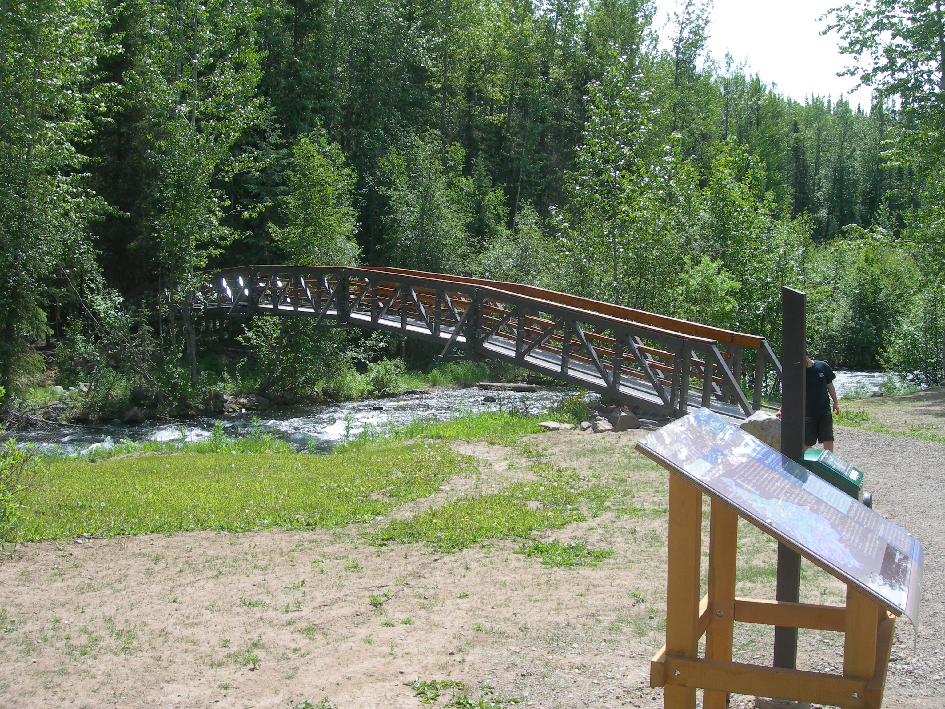
A car park just off the road access, leads to an interpretive sign and a bridge across Driftwood Creek. A short interpretive trail leads visitors to a cliff-face exposure of Eocene shales that were deposited in an inter-montane lake. Interbedded within the shales are volcanic ash beds, the result of area volcanoes that were erupting throughout the life of the Eocene lake that produced the shales. Preserved within the shale formations are plant, animal and insect species that inhabited the area over 50 million years ago. The BC Parks management plan for Driftwood Canyon Provincial Park lists these conservation attributes:
-
- internationally-significant Eocene fossil beds: most northerly site in North America with fossilised Eocene insects; fossils also include ancestral salmon, trout and suckers, including Eosalmo driftwoodensis;
- site of ongoing paleontological research;
- remnant Bulkley Basin Ecosection (high priority, underrepresented ecosection) SBSdk (dry cool sub-boreal spruce subzone; underrepresented biogeoclimatic subzone).
Limited personal fossil collecting was originally permitted in Driftwood Canyon Park, and the site is listed in several tourism and rock collection guides as a place to visit for this activity. However, in the past 5 or so years following recommendations to cease unrestricted public and commercial collection of fossils, BC Parks has discouraged fossil collecting due to:
- concerns over visitor safety as falling rocks from the shale cliff face may endanger visitors collecting fossils;
- the loss of the palaeontological resource (also, fossil removal contravenes the Park Act);
- as well as concerns that soil and rocks dislodged during fossil collecting will contribute to sediment in Driftwood Creek, potentially impacting downstream fish spawning habitat.
In 2010 the interpretive trail was redeveloped by BC Parks, in partnership with the Bulkley Valley Naturalists, and the Smithers Rotary Club and funded by the Canadian Federal Government, BC Parks, the Wetzin’kwa Community Forest, and the National Trails Coalition.[3] A new bridge over Driftwood Creek was built, a new wheel-chair accessible trail constructed, and new signage put in place. The new interpretive signs explain both the cultural heritage of the area, including Wet'suwet'en First Nation fishing and other cultural practices in the area, both traditional and present day, as well as the sub-boreal spruce forest of the area and the significance of the fossil resource. At the public fossil site at the trail terminus, signs describe some of the research findings of the site based on supplied testimony from palaeontologists active at the site, and feature photos of some of the important fossils discovered there.
-
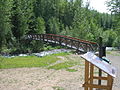
Bridge over Driftwood Creek at the start of the interpretive trail.
-
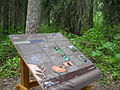
Interpretive sign on Driftwood Canyon trail.
Palaeontology
Paleontological and geological studies of these deposits go back to work carried out by George Mercer Dawson in 1890 as part of his survey of British Columbia for the Geological Survey of Canada, although significant research has occurred since the 1970s.[4] The Driftwood Canyon fossil beds are best known for the abundant and well preserved insect and fish fossils (Amia, Amyzon, and Eosalmo). The insects are particularly diverse and well preserved, and include water striders (Gerridae), aphids (Aphididae), leaf hoppers (Cicadellidae), green lacewings (Neuroptera), spittle bugs (Cercopidae), march flies (Bibionidae), scorpionflies (Mecoptera), fungus gnats (Mycetophilidae), snout beetles (Curculionidae), and ichneumon wasps. Fossils of plant remains are rare, but include up to 29 genera of plants. The most common plant fossil found is leafy shoots of the dawn redwood, Metasequoia occidentalis. Leaves of alder (Alnus sp.) are also found, as well as the leaves or needles and seeds of pines, cedars, redwood (Sequoia sp.), Ginkgo, and the floating fern Azolla. Fossil feathers are sometimes found and rare rodent bones are sometimes found in fish coprolites. Small collections of fossils are housed in the Bulkley Valley Museum in Smithers, the Royal BC Museum in Victoria BC, the Royal Ontario Museum (ROM), Canadian Museum of nature (CMN), and university collections. Unfortunately significant collections of fossils from Driftwood Canyon are in private ownership.[5]
A fossil bird complete with feathers collected from the Park in 1970 by German visitors Margret and Albrecht Klöckner, was repatriated to British Columbia and donated to the Royal British Columbia Museum/Victoria some 38 years later. This fossil of a long-legged water bird, has been tentatively identified as possibly from the order Charadriiformes.[6]
The cessation of fossil collecting at Driftwood Canyon Provincial Park is consistent with British Columbia's new Fossil Management Framework [7]which seeks to:
-
- clarify the rules governing the management and use of fossils;
- manage impacts on fossils from other activities;
- provide for the stewardship of significant fossil sites;
- raise internal and external awareness of the framework and the importance of fossils;
- build knowledge of the nature and extent of the resource in BC; and
- clarify the rights and obligations of the public, business, government and other stakeholders.
See also
- BC Parks webpage
- British Columbia Eocene fossils, Canadian Encyclopedia
- List of fossil sites (with link directory)
- List of fossil parks
- Tyhee Lake Provincial Park
References
- ^ Ludvigsen, R. 2001. The fossils at Driftwood Canyon provincial park: A management plan for BC Parks. Denman Instiute for Research on Trilobites, 339 Denman Road, Denman Island, BC V0R 1T0 http://www.bvcentre.ca/files/External/FossilMgmtPlan-Ludvigsen2001.pdf (accessed July 14, 2011)
- ^ Approved Driftwood Canyon Provincial Park Management Direction Statement http://www.env.gov.bc.ca/bcparks/planning/mgmtplns/drift_canyon/driftwood.pdf (accessed July 14, 2011)
- ^ National Trails Coalition, news and events http://www.ntc-canada.ca/news.php (accessed July 15, 2011)
- ^ Archibald, S.B., and Greenwood, D.R., 2005, Fossil biotas from the Okanagan Highlands, southern British Columbia and northeastern Washington State: climates and ecosystems across an Eocene landscape: Canadian Journal of Earth Sciences, v. 42, p. 167–185.
- ^ Ludvigsen, R. 2001. The fossils at Driftwood Canyon provincial park: A management plan for BC Parks. Denman Instiute for Research on Trilobites, 339 Denman Road, Denman Island, BC V0R 1T0 http://www.bvcentre.ca/files/External/FossilMgmtPlan-Ludvigsen2001.pdf (accessed July 14, 2011)
- ^ Information panel, public viewing area, Driftwood Canyon Provincial Park interpretive trail.
- ^ Fossil Management in British Columbia http://www.agf.gov.bc.ca/clad/strategic_land/fossil.html (accessed July 15, 2011)
Coordinates: 54°49′34″N 127°01′19″W / 54.826°N 127.022°W
Categories:- Provincial Parks of British Columbia
- Bulkley Country
- Fossils
- Paleontological sites of North America
- Canyons and gorges of British Columbia
- Regional District of Bulkley-Nechako
- British Columbia protected area stubs
-

Wikimedia Foundation. 2010.