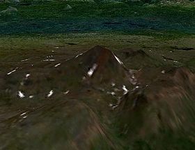
- Meszah Peak
-
Meszah Peak 
Elevation 2,166 m (7,106 ft) Prominence 1,101 m (3,612 ft) Location Location British Columbia, Canada Range Level Mountain Range, Nahlin Plateau (western Stikine Plateau) Coordinates 58°28′43.0″N 131°26′13.9″W / 58.47861°N 131.437194°WCoordinates: 58°28′43.0″N 131°26′13.9″W / 58.47861°N 131.437194°W Topo map NTS 104J/06 Geology Type Volcanic cone Volcanic arc/belt Northern Cordilleran Volcanic Province Last eruption Pleistocene Meszah Peak is a volcanic cone located 66 km (41 mi) north of Telegraph Creek and 136 km (85 mi) southwest of Zus Mountain. It is the highest mountain of the Level Mountain Range, a massive shield volcano forming the most voluminous and most persistent eruptive centre in the Northern Cordilleran Volcanic Province.
See also
- List of volcanoes in Canada
- List of Northern Cordilleran volcanoes
- Volcanism of Canada
- Volcanism of Western Canada
- Geography of Canada
- Geography of British Columbia
- Geology of the Pacific Northwest
- Heart Peaks
- Atsutla Range
References
- "Level Mountain". Global Volcanism Program, Smithsonian Institution. http://www.volcano.si.edu/world/volcano.cfm?vnum=1200-05-.
- Catalogue of Canadian volcanoes: Meszah Peak
External links
- Level Mountain in the Canadian Mountain Encyclopedia
Categories:- Volcanoes of British Columbia
- Mountains of British Columbia
- Northern Cordilleran Volcanic Province
- Cassiar Country
- Nahlin Plateau
- British Columbia Interior geography stubs
Wikimedia Foundation. 2010.
