- Dunford Bridge
-
Coordinates: 53°31′01″N 1°45′00″W / 53.517°N 1.750°W
Dunford Bridge 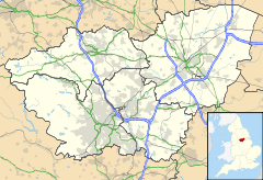
 Dunford Bridge
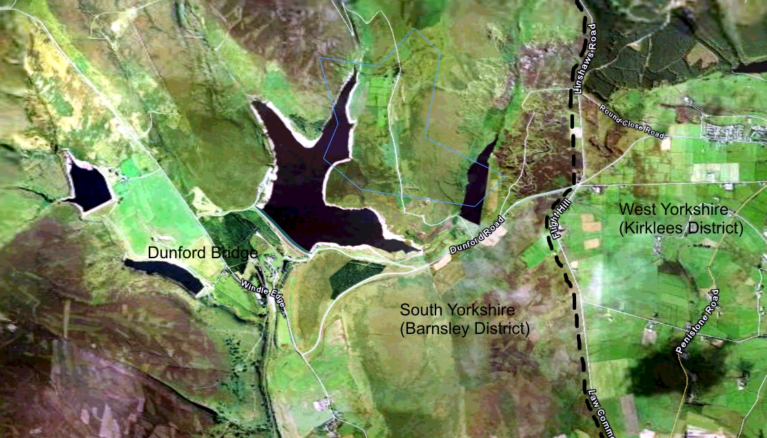
Dunford Bridge shown within South YorkshireParish Dunford Metropolitan borough Barnsley Metropolitan county South Yorkshire Region Yorkshire and the Humber Country England Sovereign state United Kingdom Post town BARNSLEY Postcode district S36 Dialling code 01226 Police South Yorkshire Fire South Yorkshire Ambulance Yorkshire EU Parliament Yorkshire and the Humber UK Parliament Penistone and Stocksbridge List of places: UK • England • Yorkshire Dunford Bridge is a remote hamlet lying northwest of Sheffield in South Yorkshire, England, 1.3 miles (2 km) from the border with West Yorkshire and 2.3 miles (4 km) from the border with Derbyshire. It lies in the Peak District, 5 miles (8 km) west of Penistone and 5 miles (8 km) south of Holmfirth, within the Metropolitan Borough of Barnsley. Before the Local Government Act 1972 the area covered by South Yorkshire was part of the West Riding of Yorkshire.
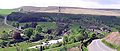
The settlement, consisting of a few houses, lies beneath the Winscar Reservoir. Water draining from the moorland around Grains Moss forms small rivers which join together to form the source of the River Don, which feeds into the reservoir. The reservoir had suffered from leakage for many years, then Yorkshire Water, the reservoir owners, employed a construction company to correct the problem, using £400,000 worth of specialist grouting and artificial membrane.[1]
The eastern end of the Woodhead Tunnel is in the centre of the hamlet. The site of the former railway station is now a parking area with the old rail line forming the route of the Trans-Pennine Trail. The only public house in the hamlet closed down in early 2000; it is now used as a theatrical and drama training workshop.
Windle Edge Road leads southwest from the hamlet to the A628 and northeast to the B6106 Holmfirth to Penistone road. The A628 gives access westwards to the M67 and Manchester and southeast to the M1 and Sheffield.
Dunford Bridge is a centre for watersports enthusiasts. It benefits from walkers exploring the Pennine moorland surrounding the hamlet, using it as a base. There is a car parking area next to the road bridge and further parking along the side of the Winscar Reservoir on Dunford Road, to the north. The reservoir is used by a local sailing club.
-
Dunford Bridge
-
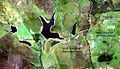
Aerial photo of Dunford Bridge and Winscar Reservoir
References
External links
Categories:- Villages in South Yorkshire
- Towns and villages of the Peak District
- Geography of Barnsley
-


Wikimedia Foundation. 2010.