- Delair Bridge
-
Delair Bridge 
The Delair Bridge from Pennsauken, NJCarries New Jersey Transit Atlantic City Line and Conrail Crosses Delaware River Locale Philadelphia, Pennsylvania and Pennsauken Township, NJ Design Steel lift bridge Total length 4,396 feet (1,340 m) Longest span 542 feet (165 m) Opened 1896 Coordinates 39°58′56″N 75°04′09″W / 39.98235°N 75.06910°WCoordinates: 39°58′56″N 75°04′09″W / 39.98235°N 75.06910°W The Delair Bridge is a lift bridge carrying the New Jersey Transit Atlantic City Line and a former Conrail line, now a shared asset between Norfolk Southern Railway and CSX Transportation. It crosses the Delaware River between Philadelphia, Pennsylvania and Pennsauken Township, New Jersey, just south of the Betsy Ross Bridge. The bridge's southern track is currently reserved for freight traffic, and the northern track is currently reserved for the Atlantic City Line. As part of the upcoming Pennsauken Transit Center project, which will involve building a station complex where the River LINE passes under the Delair Bridge's approach, a station will be constructed on the NJ approach. Since the Atlantic City Line station portion will use both tracks, both tracks will be used for passenger service in the future, with freight traffic also gaining use of both tracks. [1]
History
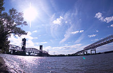 The Delair Train Bridge and the Betsy Ross Bridge from Pennsauken, NJ.
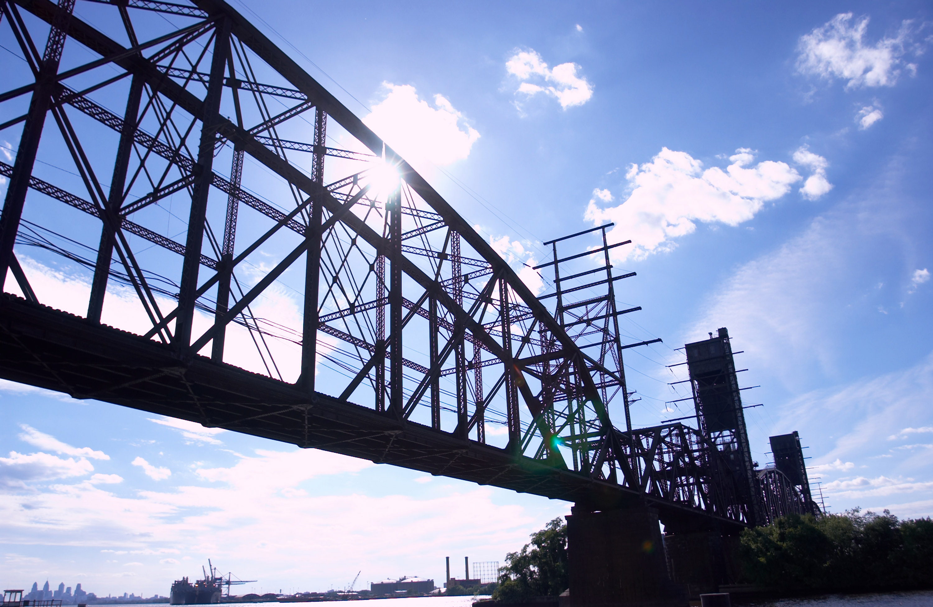
The Delair Bridge, built by the Pennsylvania Railroad (PRR) in 1895–1896, was the first bridge of any sort between Philadelphia and New Jersey. The steel span connected PRR tracks in North Philadelphia to southern New Jersey. It consisted of three fixed Pennsylvania truss spans and a through-truss swing drawbridge totaling 1,943 feet (592 m). Approach trestles of 2,129 feet (649 m) on the Pennsylvania side and 324 feet (99 m) on the New Jersey side bring its total length to 4,396 feet (1,340 m).[2]
Starting in 1958, the PRR converted the bridge into a vertical lift span to increase clearance for river traffic. The 542 feet (165 m) movable link was floated into place in one piece to facilitate installation and minimize delay.[3] Work was completed in 1960. The Delair Bridge was the longest and heaviest double-track lift bridge in the world at the time.[4]
The bridge was also electrified in the late 1930s[5], allowing freight trains hauled by electric locomotives to access the Pavonia Yard in Camden, New Jersey from the Northeast Corridor. Electrification was removed by January, 1967[6] but was restored in mid-1973. However, Conrail ceased electric freight operations in 1981 and removed the wires several years later.
Passenger traffic on the bridge ceased in 1969, but was restored in 1990. A brief shot of the bridge can be seen in the movie Transformers: Revenge of the Fallen from the defunct PECO Richmond power station on the Pennsylvania side of the river.
See also
References
- ^ "Project Scope". NJ Transit. http://www.njtransit.com/tm/tm_servlet.srv?hdnPageAction=Project099To.
- ^ Historic American Engineering Record (HAER) No. PA-545, "Pennsylvania & New Jersey Railroad, Delaware River Bridge", Prints and Photographs Division, Library of Congress, Washington, D.C.
- ^ "PRR Bridge Will Set a Record," Railway Age, vol. 145, No. 3 (21 July 1958): 18-33.
- ^ Note that the single-track Cape Cod Canal Railroad Bridge is 2 feet (0.61 m) longer; see figures in David B. Steinman, "The World’s Most Notable Bridges," Engineering News-Record, vol. 141, No. 24 (9 Dec. 1948): 92-94.
- ^ The line to Pavnoia Yard or Atlantic City is not listed in Drawing ET-1, dated June 10, 1935. Electrification was likely after this, although the Richmond Substation was installed by 1932.
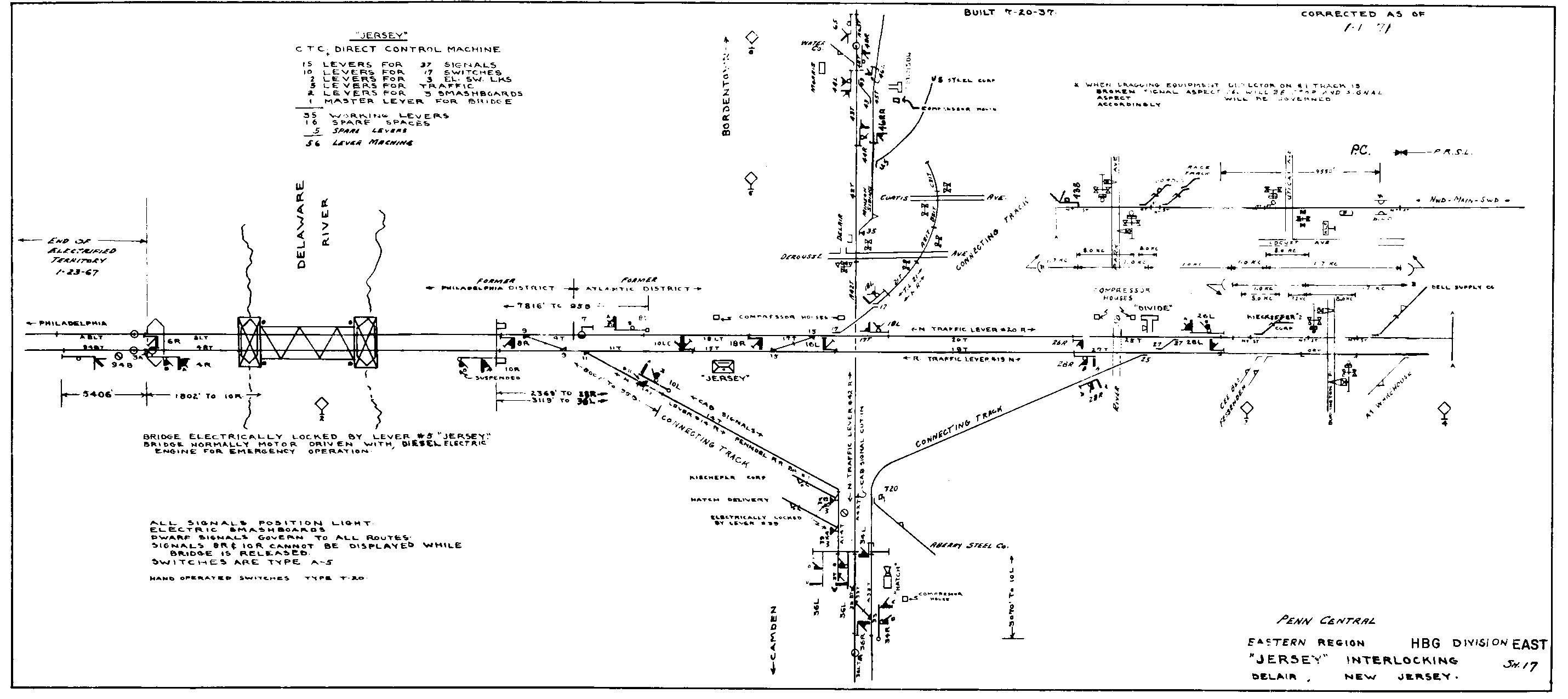
- ^ PRR Interlocking Diagram for JERSEY, dated January 1, 1971,Retrieved 12/26/2010.
Crossings of the Delaware River Upstream
Betsy Ross Bridge

Delair Bridge
Norfolk Southern/CSX
NJ TransitDownstream
Benjamin Franklin Bridge

 Categories:
- Railroad bridges in New Jersey
- Vertical lift bridges
- Bridges completed in 1896
- Railroad bridges in Pennsylvania
- Bridges in Philadelphia, Pennsylvania
- Bridges over the Delaware River
- Pennsylvania Railroad bridges and tunnels
- Transportation in Camden County, New Jersey

Wikimedia Foundation. 2010.