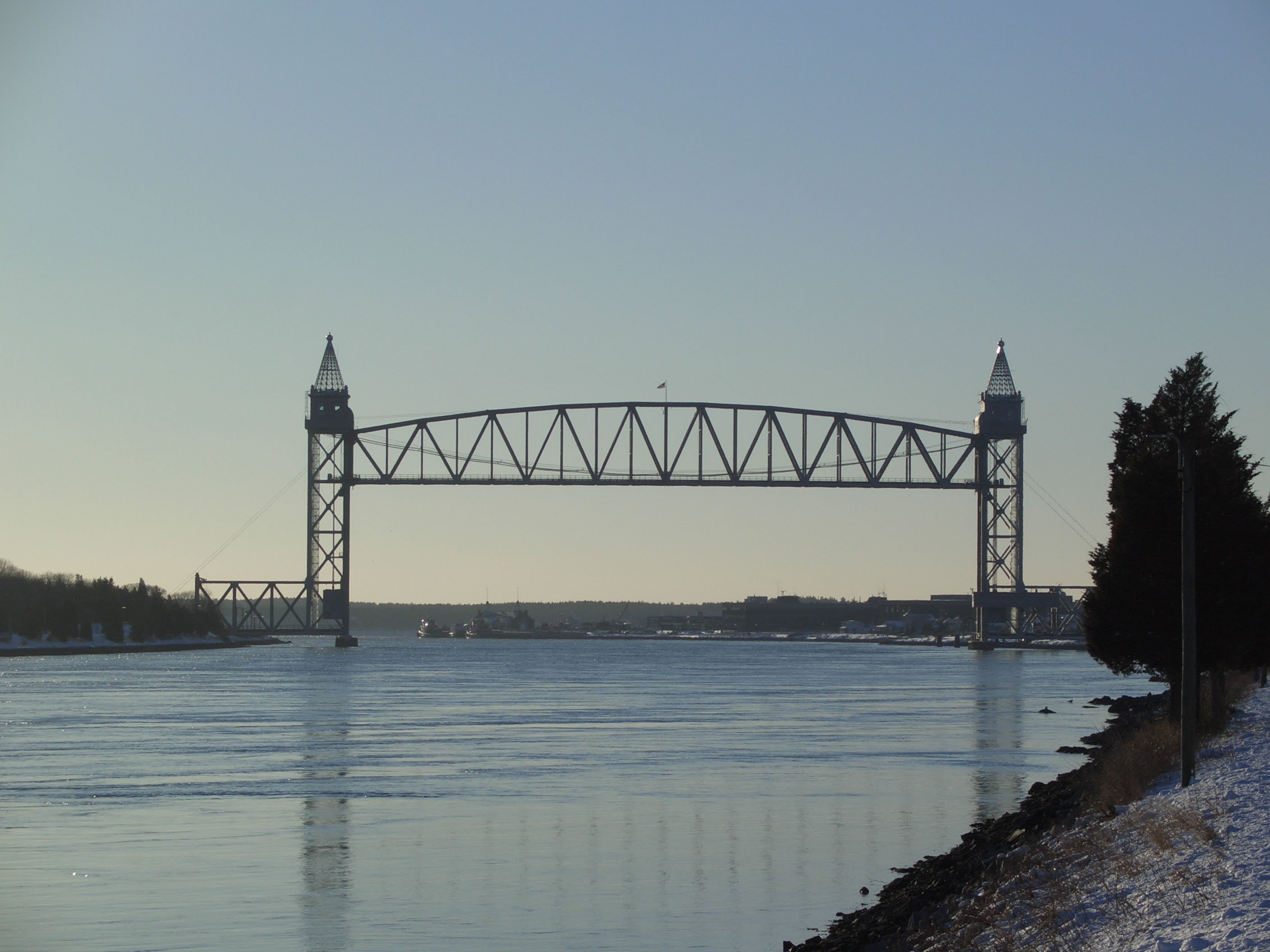
Cape Cod Canal Railroad Bridge
- Cape Cod Canal Railroad Bridge
Infobox Bridge
bridge_name=Cape Cod Canal Railroad Bridge

caption=Cape Cod Canal - Railroad Bridge
official_name=
carries=rail traffic
crosses=Cape Cod Canal
locale=Bourne, Massachusetts
maint=United States Army Corps of Engineers
id=
design=Lift bridge
mainspan=544 ft (166 m)
length=
width=
height=
load=
clearance=
below=135 ft (41 m) (raised)
traffic=
begin=1933
complete=
open=December 29, 1935
closed=
toll=
map_cue=
map_
map_text=
map_width=
coordinates= coord|41|44|31.04|N|70|36|49.44|W|display=inline,title
lat=
long=The Cape Cod Canal Railroad Bridge, a vertical lift bridge in Bourne, Massachusetts near Buzzards Bay, carries railroad traffic across the Cape Cod Canal, connecting Cape Cod with the rest of Massachusetts, USA.
The bridge was constructed beginning in 1933 by the Public Works Administration for the United States Army Corps of Engineers, which operates both the bridge and the canal. The bridge has a 544-foot (166m) main span, with a 135-foot (41m) clearance when raised, and opened on December 29, 1935.
The bridge replaced an earlier, 1910 bridge. It is the second longest lift bridge in the United States,the longest being the Arthur Kill Vertical Lift Bridge between New Jersey and Staten Island, New York.
In 2002, the Cape Cod Canal Railroad Bridge underwent a major rehabilitation at a cost of $30 million and reopened in 2003. The Bay Colony rail line on the Cape is used for a seasonal tourist train, the Cape Cod Central Railroad, and to haul trash to a waste-to-energy plant in Rochester, Massachusetts. [ [http://www.baycolonyrr.com/cape_cod_canal_bridge.htm Railroad link] ]
ee also
*Bourne Bridge
*Sagamore Bridge
References
*
External links
* http://www.esf.edu/la/people/capstones/cs2006/Fan_proposal_06.pdf
* http://www.nrao.edu/archives/Ewen/ewen_70sand80s_slides.shtml
Crossings navbox
structure = Crossings
place = Cape Cod Canal
bridge = Cape Cod Canal Railroad Bridge
bridge signs =
upstream = Bourne Bridge
upstream signs =
downstream = Buzzards Bay
downstream signs =
Wikimedia Foundation.
2010.
Look at other dictionaries:
Cape Cod Canal — Bourne Bridge, with railroad bridge in distance The Cape Cod Canal is an artificial waterway traversing the narrow neck of land that joins Cape Cod to mainland Massachusetts. Part of the Atlantic Intracoastal Waterway, the canal is roughly 17.4… … Wikipedia
Cape Cod — This article is about the area of Massachusetts. For other uses, see Cape Cod (disambiguation). For other uses, see Cod (disambiguation). Coordinates: 41°41′20″N 70°17′49″W / … Wikipedia
Portal:Cape Cod and the Islands — Wikipedia portals: Culture Geography Health History Mathematics Natural sciences People Philosophy Religion Society Technology … Wikipedia
Vertical lift bridge — BridgeTypePix image title= type name=Vertical lift bridge|sibling names=Bascule bridge, swing bridge, folding bridge, retractable bridge descendent names=Submersible bridge, table bridge ancestor names=Truss bridge, carries=Automobile,… … Wikipedia
Sagamore Bridge — Infobox Bridge bridge name=Sagamore Bridge caption=Cape Cod Canal Sagamore Bridge official name= carries= crosses=Cape Cod Canal locale=Sagamore, Massachusetts maint=United States Army Corps of Engineers id= design=arch bridge with suspended deck … Wikipedia
Bourne Bridge — Infobox Bridge bridge name=Bourne Bridge caption=Cape Cod Canal Bourne Bridge official name= carries= crosses=Cape Cod Canal locale=Bourne, Massachusetts maint=United States Army Corps of Engineers id= design=Arch bridge with suspended deck… … Wikipedia
Delair Bridge — The Delair Bridge from Pennsauken, NJ Carries New Jersey Transit Atlantic City Line and Conrail Crosses Delaware River … Wikipedia
Bay Colony Railroad — Infobox SG rail railroad name = Bay Colony Railroad logo filename = Bay Colony Railroad logo.gif logo size = system map caption = marks = BCLR locale = Massachusetts start year = 1982 end year = predecessor line = Consolidated Rail Corporation… … Wikipedia
Bourne, Massachusetts — Infobox Settlement official name = Bourne, Massachusetts nickname = motto = imagesize = image caption = Bourne Town Hall image mapsize = 250px map caption = Location in Barnstable County in Massachusetts mapsize1 = map caption1 = subdivision type … Wikipedia
List of Historic Civil Engineering Landmarks — The following is a list of Historic Civil Engineering Landmarks as designated by the American Society of Civil Engineers since it began the program in 1964. The designation is granted to projects, structures, and sites in the United States… … Wikipedia

