- Dogondoutchi
-
Dogondoutchi Location of Dogondoutchi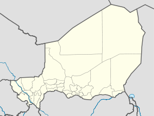
 Dogondoutchi
Coordinates: 13°38′46″N 4°01′44″E / 13.64611°N 4.02889°E Country Niger Region Dosso Department Department Dogondoutchi Department Commune Dogondoutchi Elevation 227 m (748 ft) Dogondoutchi is a city located in the east of the Dosso Region of Niger. With a population of 29,244 (2001 census), Dogondoutchi is the largest city in and administrative center of the Dogondoutchi department, the easternmost section of Dosso Region.
Contents
Situation
Sitting just north of the Niger/Nigeria border, Dogondoutchi is a majority Hausa town on the northern edge of the savanna zone, south of the Sahel. The area is dominated by small scale agriculture, mostly Millet farming, sedentary cattle raising, and seasonal grazing of longhorned cattle, mostly by nomadic Fula pastoralists and their semi-nomadic villages. The town itself is dominated by the large "Dogon Doutchi" Mesa, which looms over the eastern side of the town.
Religious culture
Dogondoutchi is best known as a cultural capital of the Arewa region, an area of rough topography that is the home of the Mawri subgroup of the Hausa people. The Mawri around Dogondoutchi are among the last Animist Hausa populations, and the region is a center for Niger's animist Hausa minority group. The town itself is majority Muslim, as is most of Niger and the Hausa ethnic group.[1] Dogondoutchi is also a center for gatherings of the Bori spirit possession ritual, which has been extensively studies by Western Anthropologists. The nearby village of Lougou was the site of the 1899 Battle of Lougou between French forces and Sarraounia, a traditional religious leader based just outside modern Dogondoutchi.
Cultural border
Dogondoutchi also is the common western border of the Nigerien Hausa population, who form a majority of the population in an arc stretching from this area towards the east all the way to Zinder. To the west of here, the Djerma people form the dominant sedentary population in Niger, while farther north, Dogondoutchi marks the rough boundary between the Wodaabe (Central-Eastern Niger) Fula people and the Dallol and Bitinkoore Fulfulde dialect speaking Fula people of the west.[2]
Trade and transport center
Dogondoutchi town is a vibrant trade center, sitting astride the intersection of routes to Nigeria less than 20km to the south, and the main Nigerien east - west highway, RN1, which connects Niamey and the west of the country with Maradi, Zinder, and Diffa in the east. After Dogodoutchi, the RN1 meets Niger's main north - south road, the RN25 heading to Tahoua, Agadez and Arlit in the north.
2005 Famine
The Dogondoutchi area was particularly hard hit during the 2005–06 Niger food crisis and drought.[3]
References
- ^ Adeline Masquelier. THE SCORPION'S STING: YOUTH, MARRIAGE AND THE STRUGGLE FOR SOCIAL MATURITY IN NIGER. Journal of the Royal Anthropological Institute Volume 11 Issue 1, (2005), pp. 59 - 83
- ^ Niger country profile: Ethnologue.
- ^ CRS begins food distribution in drought-stricken Niger, Stephen Steele, Catholic News Service, NIGER-CRS Aug-16-2005
- Samuel Decalo. Historical Dictionary of Niger (3rd ed.). Scarecrow Press, Boston & Folkestone, (1997) ISBN 0810831368
- Finn Fuglestad. A History of Niger: 1850-1960. Cambridge University Press (1983) ISBN 0521252687
- Jolijn Geels. Niger. Bradt UK/ Globe Pequot Press USA (2006) ISBN 9781841621524
- Jean-Michel Guillon, Bernard Hernandez. Dogondoutchi, petit centre urbain du Niger. Revue de géographie alpine. Volume 56, Issue 56-2, (1968) pp. 297-358.
- Adeline Masquelier, Witchcraft, Blood-Sucking Spirits, and the Demonization of Islam in Dogondoutchi, Niger, Cahiers d'études africaines, 189-190, 2008
- Adeline Masquelier. Prayer Has Spoiled Everything: Possession, Power and Identity in an Islamic Town of Niger. Duke University Press, (2001) ISBN 0822326396
- Adeline Masquelier. Behind the Dispensary's Prosperous Facade: Imagining the State in Rural Niger. Public Culture - Volume 13, Number 2, Spring 2001, pp. 267-291
- Adeline Masquelier. Lightning, Death and the Avenging Spirits: "Bori" Values in a Muslim World. Journal of Religion in Africa, Vol. 24, Fasc. 1 (Feb., 1994), pp. 2-51
External links
Coordinates: 13°39′00″N 04°02′00″E / 13.65°N 4.0333333°E
 Communes of NigerCapital: Niamey
Urban communes Abalak · Agadez · Aguie · Arlit · Bilma · Birni N'Gaoure · Birni N'Konni · Bouza · Dakoro · Diffa · Dogondoutchi · Dosso · Filingue · Gaya · Guidanroumdji · Goure · Illela · Keita · Kollo · Loga · Madaoua · Madarounfa · Magaria · Maine Soroa · Maradi I · Maradi II · Maradi III · Matamey · Mayahi · Mirriah · N'Guigmi · Commune I (Niamey) · Commune II (Niamey) · Commune III (Niamey) · Commune IV (Niamey) · Commune V (Niamey) · Ouallam · Say · Tahoua I · Tahoua II · Tanout · Tchintabaraden · Tchirozerine · Tessaoua · Téra · Tibiri · Tillaberi · Zinder I · Zinder II · Zinder III · Zinder IV · Zinder VRural communes Abala · Aderbissinat · Adjekoria · Affala · Akoubounou · Albarkaram · Alakoss · Allakaye · Allela · Anzourou · Attantane · Ayerou · Azagor · Azarori · Azeye · Babankatami · Badaguichiri · Bader Goula · Bagaroua · Bambeye · Bana · Bande · Bangui · Banibangou · Bankilare · Baoudetta · Barmou · Bazaga · Bengou · Bermo · Bibiyergou · Birni Lalle · Bitinkodji · Bosso · Boune · Chadakori · Chetimari · Dabaga · Dakoussa · Damagaram Takaya · Dan-Barto · Dan-Goulbi · Dan-Issa · Dan-Kassari · Dannet · Dantchiao · Daouche · Dargol · Deoule · Dessa · Diagourou · Diantchandou · Dingazi · Dirkou · Dioundiou · Djado · Djiratawa · Dogo · Dogo-Dogo · Dogonkiria · Doguerawa · Doumega · Doungou · Droum · Dungass · El Allassane Maireyrey · Fabidji · Fachi · Fakara · Falenko · Falmey · Falwel · Farey · Foulatari · Gabi · Gababedji · Gaffati · Galma Koudawatche · Gamou · Gangara · Gangara · Garagoumsa · Garhanga · Garankedey · Gazaoua · Golle · Goroubankassam · Gorouol · Gothèye · Gouchi · Goudoumaria · Gougaram · Gouna · Guecheme · Gueskerou · Guidan Amoumoune · Guidan Sori · Guidiguir · Guidimouni · Guilladje · Hamdallaye · Hamdara · Harikanassou · Hawandawaki · Ibrohamane · Ichirnawa · Ifernouane · Imanan · Inates · Ingall · Issawane · Kablewa · Kao · Kalfou · Kanan-Bakache · Kankandi · Kantche · Karakara · Kargiubangou · Karma · Karofane · Kelle · Kieche · Kiota · Kirtachi · Kokorou · Kolleram · Koona · Korahane · Kore Mairoua · Korgom · Kornaka · Kouré · Kourfeye · Kourni · Kourteye · Koygolo · Kwaya · Libore · Maijirgiu · Maiyara · Malawa · Malbaza · Matankari · Mehana · Moa · Mokko · N'Dounga · N'Gonga · N'Gourti · N'Guelbely · Namaro · Ollelewa · Ourafane · Ouro Gueladjo · Ourno · Roumboui · Sabon-Guida · Sabon-Machi · Sae Saboua · Safo · Sakoira · Sambera · Sanam · Sarkin Haoussa · Sarkin Yamma · Sassoumbroum · Simiri · Sinder · Sokorbe · Soucoucoutane · Tabalak · Tabelot · Tabotaki · Tagazar · Tagriss · Tajae · Takanamat · Tama · Tamaske · Tamaya · Tamou · Tanda · Tarka · Tassara · Tchadoua · Tchake · Tebaram · Tenhya · Tesker · Tessa · Tibiri (Doutchi) · Timia · Tillia · Tirmini · Tombokoirey I · Tombokoirey II · Tondikandia · Tondikiwindi · Torodi · Toumour · Tounounga · Tsaouni · Tsernaoua · Wacha · Wame · Yaouri · Yekoua · Yelou · YouriCategories:- Niger geography stubs
- Communes of Niger
- Populated places in Niger

Wikimedia Foundation. 2010.