- Newfane (village), Vermont
-
Newfane, Vermont — Village — Location within the state of Vermont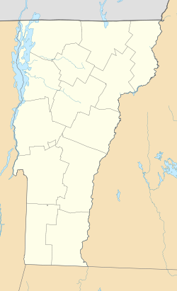
 Newfane, Vermont
Coordinates: 42°59′16″N 72°39′21″W / 42.98778°N 72.65583°WCoordinates: 42°59′16″N 72°39′21″W / 42.98778°N 72.65583°W Country United States State Vermont County Windham Area – Total 0.2 sq mi (0.5 km2) – Land 0.2 sq mi (0.5 km2) – Water 0.0 sq mi (0.0 km2) Elevation 554 ft (169 m) Population (2000) – Total 116 – Density 654.4/sq mi (252.7/km2) Time zone Eastern (EST) (UTC-5) – Summer (DST) EDT (UTC-4) ZIP code 05345 Area code(s) 802 FIPS code 50-48325[1] GNIS feature ID 1458679[2] Newfane is an incorporated village in the town of Newfane in Windham County, Vermont, United States. The population was 116 at the 2000 census.
The Newfane Village Historic District was listed on the National Register of Historic Places in 1983.[3] It is centered around the village green. It includes over 60 buildings. Greek Revival is the dominant architectural style. The Windham County Courthouse, which was built in 1825, is included in the district.[4]
Geography
According to the United States Census Bureau, the village has a total area of 0.2 square miles (0.5 km²), all land.
Demographics
As of the census[1] of 2000, there were 116 people, 61 households, and 32 families residing in the village. The population density was 654.4 people per square mile (248.8/km²). There were 68 housing units at an average density of 383.6/sq mi (145.9/km²). The racial makeup of the village was 97.41% White, 0.86% from other races, and 1.72% from two or more races. Hispanic or Latino of any race were 0.86% of the population.
There were 61 households out of which 21.3% had children under the age of 18 living with them, 45.9% were married couples living together, 6.6% had a female householder with no husband present, and 47.5% were non-families. 41.0% of all households were made up of individuals and 21.3% had someone living alone who was 65 years of age or older. The average household size was 1.90 and the average family size was 2.56.
In the village the population was spread out with 15.5% under the age of 18, 2.6% from 18 to 24, 27.6% from 25 to 44, 32.8% from 45 to 64, and 21.6% who were 65 years of age or older. The median age was 46 years. For every 100 females there were 73.1 males. For every 100 females age 18 and over, there were 71.9 males.
The median income for a household in the village was $33,250, and the median income for a family was $46,250. Males had a median income of $24,688 versus $48,000 for females. The per capita income for the village was $22,028. There were 5.9% of families and 8.2% of the population living below the poverty line, including no under eighteens and 14.7% of those over 64.
References
- ^ a b "American FactFinder". United States Census Bureau. http://factfinder.census.gov. Retrieved 2008-01-31.
- ^ "US Board on Geographic Names". United States Geological Survey. 2007-10-25. http://geonames.usgs.gov. Retrieved 2008-01-31.
- ^ Historic Districts Listed on the National Register of Historic Places, The Vermont Heritage Network, University of Vermont, accessed August 21, 2010.
- ^ Newfane Village Historic District, The Vermont Heritage Network, University of Vermont, accessed August 21, 2010.
Municipalities and communities of Windham County, Vermont Towns Athens | Brattleboro | Brookline | Dover | Dummerston | Grafton | Guilford | Halifax | Jamaica | Londonderry | Marlboro | Newfane | Putney | Rockingham | Somerset‡ | Stratton | Townshend | Vernon | Wardsboro | Westminster | Whitingham | Wilmington | Windham

Villages Bellows Falls | Jacksonville | Newfane | North Westminster | Saxtons River | Westminster
CDPs Other
communitiesFootnotes ‡ Disincorporated
Categories:- Incorporated villages in Vermont
- Newfane, Vermont
- Populated places in Windham County, Vermont


Wikimedia Foundation. 2010.