- Great Alpine Road
-
Great Alpine Road 
Formerly 

Length 303 km (188 mi) Direction Northwest-Southeast From  Old Hume Highway, Wangaratta, Victoria
via Myrtleford, Ovens, Bright, Harrietville, Mount Hotham, Dinner Plain, Omeo, Swifts Creek, Ensay, Bruthen To  Princes Highway, Bairnsdale, Victoria
Established 1998 Allocation B500 Major junctions  Hume Freeway
 Omeo Highway
The Great Alpine Road (B500)[1][2] is a country tourist road in Victoria, Australia, running from Wangaratta in the north to Bairnsdale in the east, and passing through the Australian Alps. The road was given its current name as being the mountain equivalent to Victoria's world famous Great Ocean Road in the south-west of the state[citation needed].
Contents
Route details
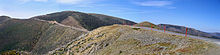
The Great Alpine Road[3] winds through mountains, valleys and forests, and past rivers, vineyards and farms. At a length of 303 kilometres, it is Australia’s highest year-round accessible sealed road. The section over Mount Hotham rises to an altitude of 1840 m,[4] is blanketed with snow during winter months and must be cleared on a daily basis. Extreme weather conditions can sometimes still result in the road being closed between Harrietville and Omeo.
The Great Alpine Road links Victoria's North East with Gippsland. It was completed with the sealing of the section between Mount Hotham and Dinner Plain and was officially opened on 4 April 1998.[citation needed] The road itself has existed since colonial times in some form, but was unsealed for much of its history, and was only given the Great Alpine Road designation after being fully sealed.[citation needed]
The current Great Alpine Road includes the former Ovens Highway from Wangaratta to Bright, and a former section of the Omeo Highway from Omeo to Bruthen,[5] along with the section of the Princes Highway from Bruthen to Bairnsdale. Attractions include the Mount Buffalo National Park, popular tourist town Bright, the Mount Hotham and Dinner Plain alpine resorts, the historic gold rush township of Omeo, the folk art sculpture Mr. Stringy, and stunning views and challenging driving along its length.
Towns and resorts
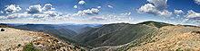 Travellers have spectacular views across the Australian Alps from the Great Alpine Road on Mt Hotham
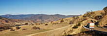
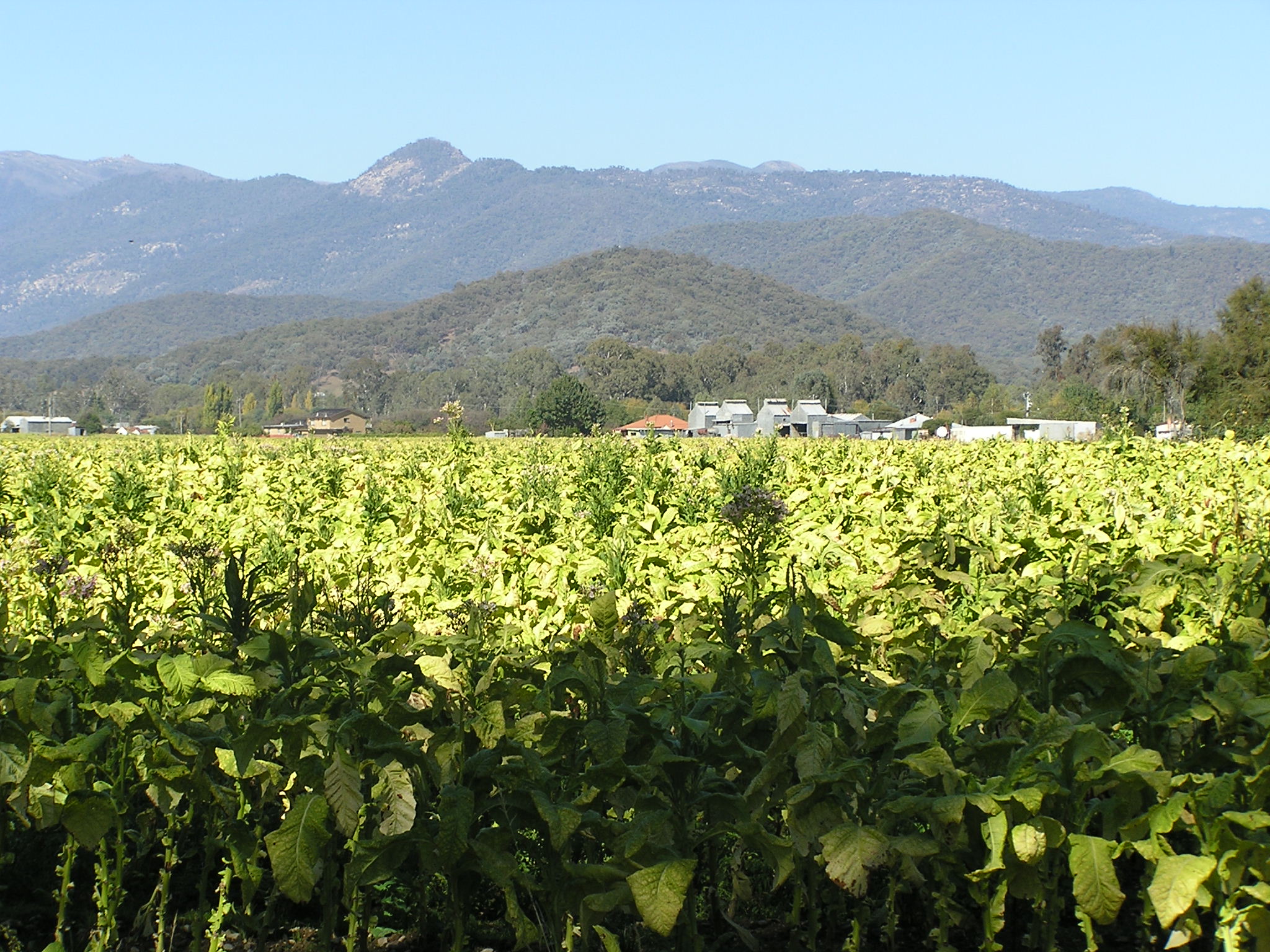
 View from Myrtleford to Mount Buffalo National Park
Location Distance from Wangaratta (km) Distance to next location (km) Distance from Bairnsdale (km) Wangaratta 0 0 303 Myrtleford 46 46 257 Ovens 53 7 250 Bright 79 26 224 Harrietville 105 26 198 Mount Hotham 133 28 170 Dinner Plain 143 10 160 Omeo 188 45 115 Swifts Creek 214 26 89 Ensay 232 18 71 Bruthen 277 45 26 Bairnsdale 303 26 0 See also
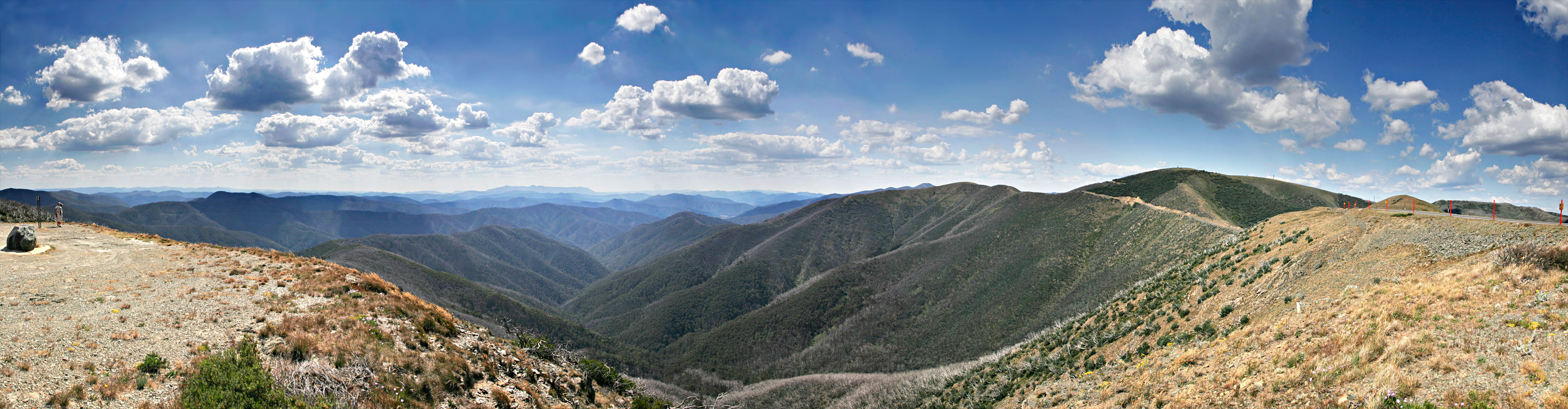
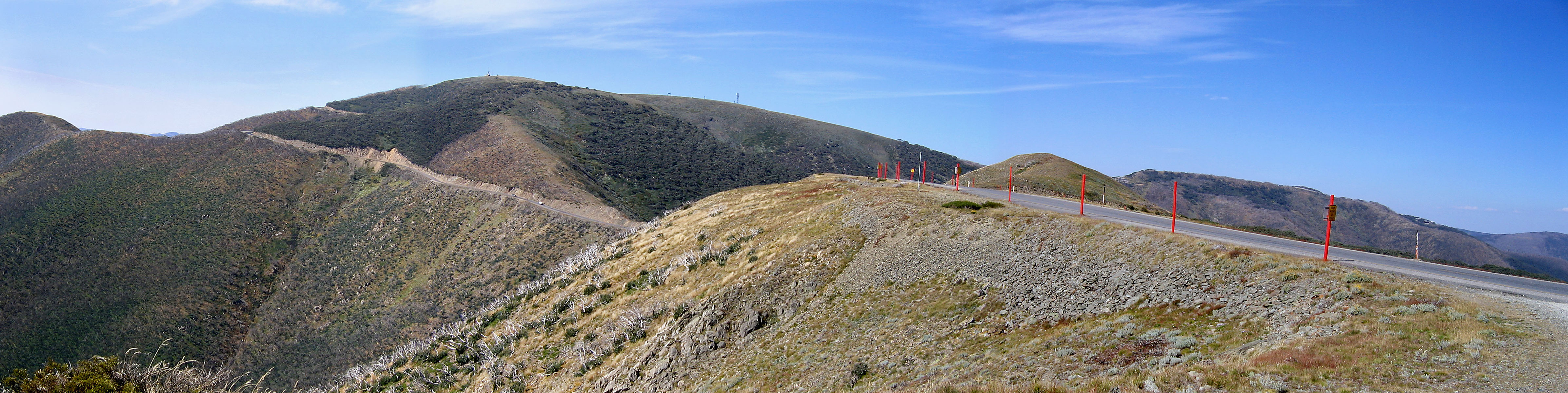
 The Great Alpine Road winds across Mount Hotham, clinging to the side and ridge of the mountain
- Highways in Australia
- Highways in Victoria
References
- ^ "Map NE Victoria". vic roads. p. p16. http://www.vicroads.vic.gov.au/NR/rdonlyres/36A4D071-9C13-4F35-95B8-B9D68C5B4ABB/0/DriverGuideA4.pdf. Retrieved 09/02/2009. size 2.4MB
- ^ "Google Maps". ©2009 Google - Map data ©2009 MapData Sciences Pty Ltd, PSMA. http://maps.google.com/maps?f=d&source=s_d&saddr=Great+Alpine+Rd&daddr=Great+Alpine+Rd+to:Great+Alpine+Rd+to:-37.818768,147.649169&hl=EN&geocode=FUFS1f0dY9-4CA%3BFUDjz_0dyOrBCA%3BFfjAzP0dUN_DCA%3B&mra=dme&mrcr=0&mrsp=3&sz=15&via=1,2&sll=-37.815107,147.653289&sspn=0.018206,0.032959&ie=UTF8&ll=-37.147182,147.002563&spn=2.351268,4.21875&z=8. Retrieved 10/02/2009.
- ^ "Great Alpine Road". Tourism Victoria. http://www.visitvictoria.com/Activities-and-attractions/Touring-routes/The-Great-Alpine-Road.aspx. Retrieved 10/02/2009.
- ^ "Mt Hotham Section". ©2009 Google - Map data ©2009 MapData Sciences Pty Ltd, PSMA. http://maps.google.com/maps?f=d&source=s_d&saddr=&daddr=&hl=EN&geocode=&mra=mr&ie=UTF8&ll=-36.977872,147.13058&spn=0.021153,0.049438&t=p&z=15. Retrieved 10/02/2009.
- ^ 8423 Omeo, Victoria, Topographic Map. National Topographic Map Series (1 ed.). Commonwealth of Australia. 1982.
External links
"Great Alpine Road - Tourism Victoria". http://www.visitvictoria.com/Activities-and-attractions/Touring-routes/The-Great-Alpine-Road.aspx. Retrieved 2011-07-21.
"Australian Traveller". http://www.australiantraveller.com/index.cfm?page_id=1693. Retrieved 10/02/2009.
"Sydney - Melbourne Touring". http://www.sydneymelbournetouring.com.au/touring-routes/gar-overview.aspx. Retrieved 10/02/2009.[dead link]
"Victoria's Alpine High Country". http://www.visitalpinevictoria.com.au/pages/the-great-alpine-road/. Retrieved 10/02/2009.
"NRMA Motoring Services". https://www.mynrma.com.au/cps/rde/xchg/mynrma/hs.xsl/Victoria_Great_Alpine_Road.htm. Retrieved 10/02/2009.
"Discover East Gippsland". http://www.discovereastgippsland.com.au/greatalpineroad.asp. Retrieved 10/02/2009.Categories:- 1998 establishments in Australia
- Australian highways
- Highways in Victoria (Australia)
- East Gippsland

Wikimedia Foundation. 2010.