- Cityplace, Dallas, Texas
-
Cityplace West Village, Mondrian and Tower at Cityplace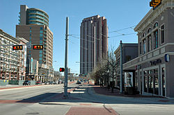
Country United States State Texas Counties Dallas City Dallas Area - Water 0 sq mi (0 km2) 0% ZIP code Area code(s) 214, 469, 972 Cityplace is a TIF District and neighborhood in the Oak Lawn area of Dallas, Texas (USA) adjacent to the intersection of Central Expressway and Haskell Avenue/Blackburn Street. East of Central Expressway, the neighborhood includes the tree-lined Haskell boulevard and travels past the 42-story Tower at Cityplace. At 42-stories, it is the tallest building in Dallas outside of downtown. The west side Cityplace includes the new-urbanist West Village and the northern end of the Uptown neighborhood.
Contents
Tallest Structures
Measuring by structural height, the tallest buildings in the Cityplace neighborhood are as follows:
- Tower at Cityplace 560 feet (171 m)
- The Mondrian
Economy
On June 8, 2009 Dean Foods announced plans to move to the Tower at Cityplace in the first quarter of 2010.[1]
Attractions
- Tower at Cityplace
- West Village
Education
Public (DISD)
High schools
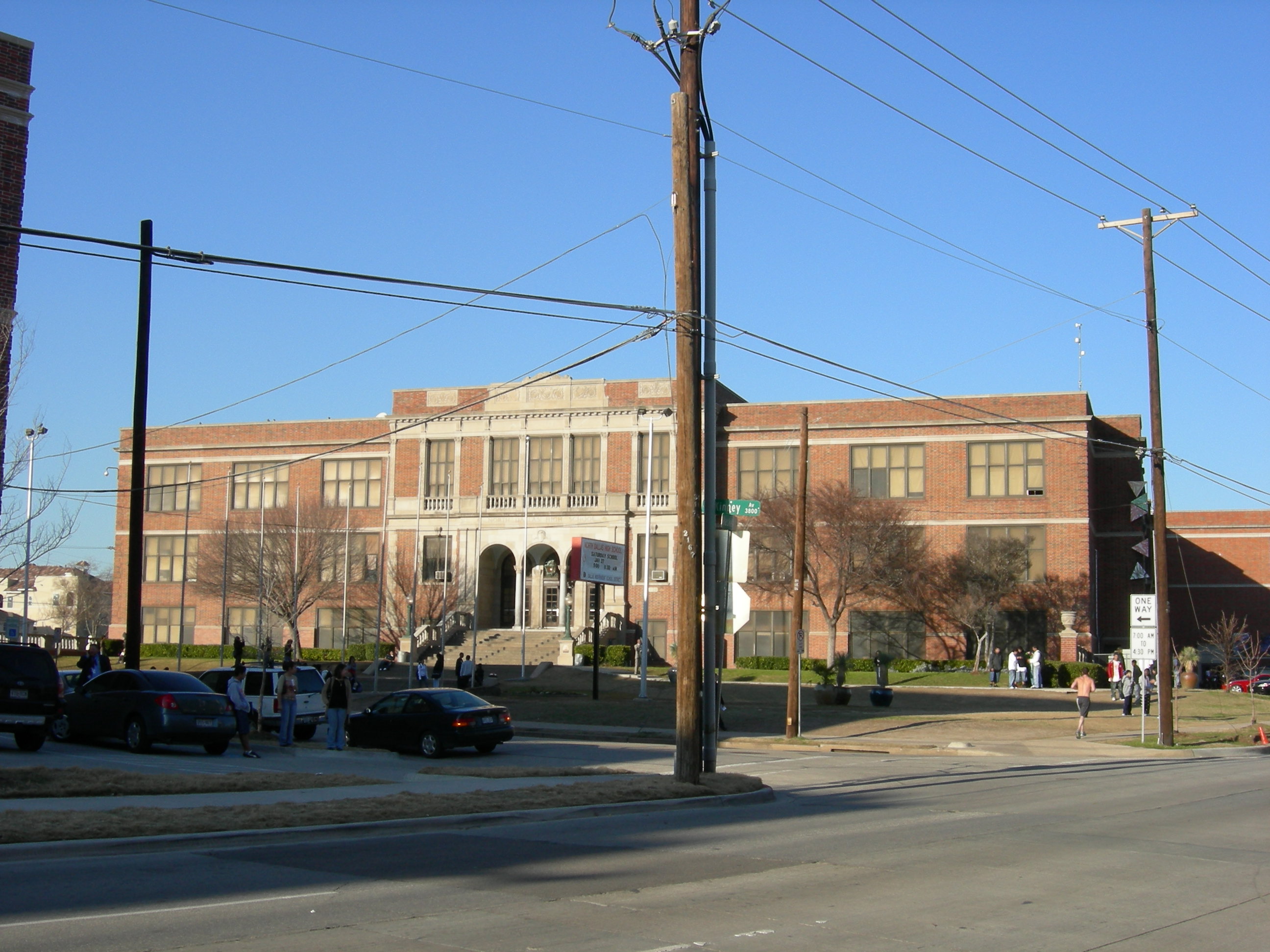
- North Dallas High School - AAAA
Middle schools
- Rusk Middle School
- Alex W. Spence Middle School
Elementary schools
- Houston Elementary School
Private Schools
Transportation
Streetcars
- McKinney Avenue Transit Authority - the M-Line
Light rail
Gallery
-
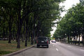
Tree-lined Haskell Avenue
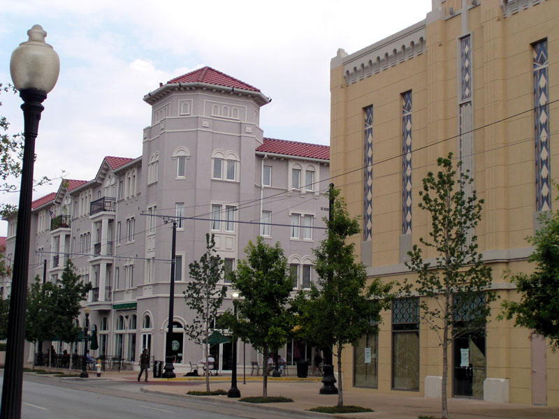
-
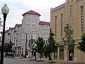
West Village
-
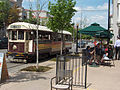
M-Line Streetcar at West Village
References
- ^ Hethcock, Bill. "Dean Foods to relocate corporate office." Dallas Business Journal. Monday June 8, 2009. Retrieved on August 2, 2009.
External links
- Cityplace TIF District
- West Village Website
- Historical maps of Cityplace neighborhood, circa 1880-1930 (includes Trolley routes)
Neighborhoods in Dallas Downtown East Dallas Belmont | Bryan Place | Casa Linda Estates | Casa View | Deep Ellum | Eastwood | Forest Hills | Greenland Hills (M Streets) | Hollywood Heights | Lake Park Estates | Lakewood | Lakewood Heights | Little Forest Hills | Lower Greenville | Lochwood | Old Lake Highlands | Parkdale Heights | Ridgewood Park | Santa Monica | Wilshire Heights
Old East Dallas: Junius Heights | Munger Place Historic District | Peak's Suburban Addition | Swiss AvenueLake Highlands Abrams Place | Alexander's Village | Boundbrook Oaks Estates | Chimney Hill | Copperfield Community | Country Forest | Forest Highlands | Forest Meadow | Glen Oaks | Hamilton Park | Highlands West | Highland Meadows | High Oaks Addition | Jackson Meadow | L Streets | Lake Highlands Estates | Lake Highlands North | Lake Highlands Square | Lake Ridge Estates | Merriman Park/University Manor | Merriman Park North | Moss Farm | Moss Meadows | Northwood Heights | Oak Highlands | Oak Tree Village | Pebble Creek | Richland Park Estates | Rolling Trails | Royal Highlands | Royal Highlands Village | Stultz Road | Town Creek | Royal Lane Village | Walnut Creek Estates | Whispering Hills | White Rock Valley | Woodbridge | Woodlands on the Creek | University Terrace | Urban ReserveNorth Dallas Bluff View | Devonshire | Greenway Parks | Melshire Estates | Northwood Hills | Platinum Corridor | Preston Center | Preston Hollow | Telecom Corridor (Richardson) | Vickery Meadow | Vickery Place
Far North Dallas: Bent Tree | Preston Highlands | Renner | TimberglenNorthwest Dallas Koreatown | Love Field | Stemmons CorridorOak Cliff Arcadia Park | Bishop Arts District | East Kessler Park | Highland Hills | Kidd Springs | Kessler Highlands | Kessler Neighbors United| Kessler Park Estates | Kessler Plaza | Kessler Square | Kings Highway Conservation District | Lake Cliff | L.O. Daniel | Redbird | Stevens Park Estates | Stevens Park Village | West Kessler | Western Park | Winnetka Heights | WynnewoodOak Lawn Cityplace | International Center | Knox Park | LoMac | Perry Heights | State Thomas | Turtle Creek | Uptown | Victory Park | West VillagePleasant Grove South Dallas West Dallas Eagle Ford | La Bajada | La L'aceate | La Loma | Lake West | Ledbetter Gardens | Los Altos | Muncie | Western Heights | Westmoreland HeightsCity of Dallas History · Government · Demographics · Economy · Transportation ·
Geology · Culture · Sports · Neighborhoods · Architecture · EducationAll Dallas articles · Dallas Portal · Texas Portal · State of Texas Categories:- Neighborhoods in Oak Lawn, Dallas, Texas


Wikimedia Foundation. 2010.